 www.geodatenkatalog.de (S2F)
Lagefestpunktfeld - Saarland
Die LFP sind Festpunkte, die in der Örtlichkeit dauerhaft vermarkt sind und deren Koordinaten, Höhen und ggfs. Schwerewerte bestimmt sind. Die Koordinaten der LFP des " Übergeordneten Festpunktfeldes " (ÜFP) sind grundsätzlich durch GPS-Messung bestimmt. Da die LFP früher durch trigonometrische Feldmessung bestimmt wurden, spricht man auch von " Trigonometrischen Punkten " (TP). Ihr Nachweis der LFP umfasst: - Punktdaten in Form von Lagekoordinaten, Höhen- und Schwerewerten - Punktbeschreibungen (Einmessungsskizzen) - Punktübersichten: Top. Karte 1: 25 000 mit eingezeichneten Punktsignaturen und -nummern
|
|
Citation proposal
. Lagefestpunktfeld - Saarland. https://gdk.gdi-de.org/geonetwork/srv/api/records/b508269f-56e0-445c-8eb8-8eba0af09ab4 |
Simple
- Alternate title
- Festpunkte
- Date ( Creation )
- 2013-11-07
- Date ( Revision )
- 2022-06-22
Point of contact
Landesamt für Vermessung, Geoinformation und Landentwicklung
-
Grundlagen (Abteilung 2)
Von der Heydt 22
Saarbrücken
Saarland
66115
Deutschland
- Maintenance and update frequency
- Continual
- Name
- sde-featureClass
- Version
- 10.0
- Keywords ( Theme )
-
- Festpunkte Höhenfestpunkt Lagefestpunkt Schwerefestpunkt
- Keywords ( Place )
-
- Saarland
- Keywords
-
- AdVMIS
- geoportal
Resource constraints
No information provided.
Resource constraints
No information provided.
Resource constraints
No information provided.
Resource constraints
No information provided.
Resource constraints
No information provided.
Resource constraints
No information provided.
Resource constraints
No information provided.
- Classification
- Unclassified
- Use limitation
- keine
- Access constraints
- Copyright
- Use constraints
- Copyright
- Spatial representation type
- Text, table
- Denominator
- 1
- Metadata language
- German
- Topic category
-
- Imagery base maps earth cover
- Version
- 6.11.2
- Distribution format
-
-
Texttabelle
(1.0 )
- Specification
-
Übersichtskarte
(1.0 )
- Specification
-
Texttabelle
(1.0 )
Distributor
Landesamt für Vermessung, Geoinformation und Landentwicklung
-
Geodatenvertrieb
Von der Heydt 22
Saarbrücken
Saarland
66115
Deutschland
- Hierarchy level
- Dataset
- Statement
- Felderfassung der Messdaten durch örtliche GPS - und Zentrieungsmessungen und Berechnung
gmd:MD_Metadata
- File identifier
- b508269f-56e0-445c-8eb8-8eba0af09ab4 XML
- Metadata language
- German
- Character set
- UTF8
- Hierarchy level
- Dataset
- Hierarchy level name
- Bilder, Basisdaten und -karten
- Date stamp
- 2025-06-25T05:17:04.268765Z
- Metadata standard name
- ISO19115/AdV
- Metadata standard version
- Erste Edition 2003-05-01/GeoInfoDok 2006
Point of contact
Landesamt für Vermessung, Geoinformation und Landentwicklung
-
Grundlagen (Abteilung 2)
Von der Heydt 22
Saarbrücken
Saarland
66115
Deutschland
- Dataset URI
- urn:sde:ldbsloracle01:5151:KBS:NOVAF.TP
Overviews
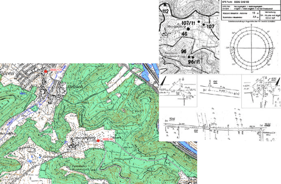
Ausschnitt Übersicht und Beschreibung
Provided by

Views
b508269f-56e0-445c-8eb8-8eba0af09ab4
Access to the portal
Read here the full details and access to the data.
Associated resources
Not available