 My GeoNetwork catalogue
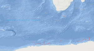
Processed seismic data of Cruise BGR96 1996
The BGR Antarctic cruise 1996 from 29th December 1995 to 6th February 1996 with M.S. AKADEMIK NEMCHINOV was designed to acquire new marine geophysical data for a better understanding of the geological processes, timing, occurrence and location of rifts of the initial break-up of southern Gondwanaland. A total of 3,836 km of multichannel seismic reflection data have been collected in the areas of the Cosmonaut Sea, the Astrid Ridge, the Lazarev Sea and the southern Agulhas Plateau in parallel with magnetic and gravity measurements. In addition magnetic and gravity measurements were carried out on transit. Major new observations of the collected MCS data include: (1) Volcanic rocks play a major part in the construction of the Astrid Ridge and also of the Agulhas Plateau. (2) The early opening of the Lazarev Sea was associated with excessive volcanism resulting in the emplacement of a voluminous volcanic body characterized by an internally divergent pattern of seaward-dipping reflectors. (3) The Astrid Fracture Zone continues in form of a sediment-filled basement depression flanked by distinct basement highs into the Lazarev Sea, and apparently swings to the west parallel to the coast of Queen Maud Land. (4) The thickness of sediments in the Cosmonaut Sea overlying oceanic crust of inferred Early Cretaceous age is in excess of 4s (twt), i.e. about 6,000 m. Three regional seismic markers of inferred Cretaceous, Late Eocene-Oligocene and Middle Miocene ages subdivide the sedimentary column.
Simple
- Alternate title
-
BGR96 1996
- Date (Creation)
- 1996-02-06
- Citation identifier
- cd0d505f-aeaf-a69c-274b-c26e54fef34e
- Status
- Completed
-
GEMET - INSPIRE themes, version 1.0
-
-
Geologie
-
geology
-
-
GEMET - Concepts, version 2.4
-
-
geophysics
-
Geophysik
-
raw material
-
Rohstoff
-
- Theme
-
-
Marine geology
-
Meeresgeologie
-
Seismics
-
Seismik
-
Two-dimensional seismic reflection
-
zweidimensionale Reflektionsseismik
-
- Place
-
-
Agulhas Plateau
-
Lazarev Sea
-
Lasarew See
-
- Access constraints
- Other restrictions
- Other constraints
- Es gelten keine Zugriffsbeschränkungen
- Use constraints
- Other restrictions
- Other constraints
-
Allgemeine Geschäftsbedingungen, siehe http://www.bgr.bund.de/AGB - General terms and conditions, see http://www.bgr.bund.de/AGB_en . Die bereitgestellten Informationen sind bei Weiterverwendung wie folgt zu zitieren: Datenquelle: BGR96 1996, (c) BGR, Hannover, 2019
- Spatial representation type
- Vector
- Language
- English
- Character set
- UTF8
- Topic category
-
- Geoscientific information
))
- Unique resource identifier
- EPSG:4326
- Distribution format
-
-
Shapefile
(
n/a
)
-
Shapefile
(
n/a
)
- Transfer size
- 2
- OnLine resource
-
BGR96 1996 (Shapefile)
BGR96 1996 im Format ESRI Shape
- OnLine resource
- Profile BGR96-001
- OnLine resource
- Profile BGR96-002
- OnLine resource
- Profile BGR96-004
- OnLine resource
- Profile BGR96-005A
- OnLine resource
- Profile BGR96-006
- OnLine resource
- Profile BGR96-007
- OnLine resource
- Profile BGR96-008
- OnLine resource
- Profile BGR96-009
- OnLine resource
- Profile BGR96-010
- OnLine resource
- Profile BGR96-011
- OnLine resource
- Profile BGR96-012
- OnLine resource
- Profile BGR96-013
- OnLine resource
- Profile BGR96-013A
- OnLine resource
- Profile BGR96-014
- OnLine resource
- Profile BGR96-015
- OnLine resource
- Profile BGR96-015A
- OnLine resource
- Profile BGR96-016
- OnLine resource
- Profile BGR96-100
- OnLine resource
- Karte im BGR-Geoviewer
- Hierarchy level
- Dataset
Conformance result
- Date (Publication)
- 2010-12-08
- Explanation
-
siehe dazu die angegebene Durchführungsbestimmung
- Statement
-
During the period from 29th December 1995 to 6th February 1996 BGR acquired seismic lines at the Agulhas Plateau and in the Lazarev Sea. The lines BGR96-002A, BGR96-003 and BGR96-005 consist of raw data. The lines BGR96-001, BGR96-002, BGR96-004, BGR96-005A, BGR96-006, BGR96-007, BGR96-008, BGR96-009, BGR96-010, BGR96-011, BGR96-012, BGR96-013, BGR96-013A, BGR96-014, BGR96-015, BGR96-015A, BGR96-016 and BGR96-100 are stacked data.
- File identifier
- b5e7177d-7cab-44cc-bb72-b4c24fcf3f5e XML
- Metadata language
- English
- Character set
- UTF8
- Parent identifier
-
Marine Seismic Survey Profiles (MSSP)
06a73c56-06a2-40d8-b806-466222b0760d
- Hierarchy level
- Dataset
- Hierarchy level name
-
Geophysik
- Date stamp
- 2023-11-14
- Metadata standard name
-
INSPIRE Metadata Implementing Rules: Technical Guidelines based on EN ISO 19115 and EN ISO 19119
- Metadata standard version
-
n/a
Overviews
Spatial extent
Provided by
