 www.geodatenkatalog.de (S1L)
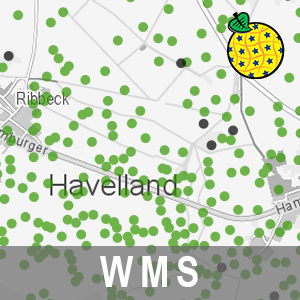
WMS Grablöcher der Bodenschätzung BB (WMS-BOGRABLOECHER)
Der Darstellungsdienst (WMS) Grablöcher der Bodenschätzung Brandenburgs stellt Daten zur FESCH - Grablöcher Bodenschätzung bereit. Diese bilden eine wesentliche Informationsgrundlage für die Bodenkartierung. Bundesweit waren bis jetzt noch keine Klassenflächen der Bodenschätzung sowie die Grablochpositionen in den Bodenschätzungskarten für Brandenburg digital vorhanden und öffentlich zugänglich. Die bereitgestellten Informationen entsprechen der Darstellung der digitalen Variante der Grablochbeschreibungen. Die Daten enthalten die Lagepunkte der Grablöcher mit Koordinatenangabe sowie eine Übersicht über Grablöcher mit und ohne Schichten.
Der WMS beinhaltet die folgenden Layer:
- Grablöcher der Bodenschätzung mit Schichten [gl_m_sch],
- Grablöcher der Bodenschätzung ohne Schichten [gl_o_sch].
|
|
Citation proposal
. WMS Grablöcher der Bodenschätzung BB (WMS-BOGRABLOECHER). Landesvermessung und Geobasisinformation Brandenburg (LGB) https://gdk.gdi-de.org/geonetwork/srv/api/records/b77b59ab-92c6-40c7-a9d4-7045cbceb043 |
INSPIRE
Identification
- File identifier
- b77b59ab-92c6-40c7-a9d4-7045cbceb043 XML
- Hierarchy level
- service Service
Online resource
Resource identifier
Encoding
Projection
Classification of data and services
Classification of data and services
- Service Type
- view
- Coupling Type
- tight Tight
Coupled resource
Coupled resource
Classification of data and services
- Service Type
- view
- Coupling Type
- tight Tight
Coupled resource
Coupled resource
Keywords
- BE/BB Schlagwortliste, Version 1.0 ( Theme )
-
- Boden
- Bodenschätzung
- Bodenschutz
Other keywords
- Keywords
-
- opendata
- Keywords ( Theme )
-
- Grabloch
- Bodenkartierung
- Bodenkunde
- Geologie
- Bodenuntersuchung
- Grablochbeschreibung
- WMS
- Bodenschicht
- sgd_Boden
Geographic coverage
))
Temporal reference
Temporal extent
Temporal extent
- Date ( Creation )
- 2017-02-15T09:55:41
Quality and validity
Conformity
Conformity
Conformity
Conformity
Conformity
Conformity
Restrictions on access and use
Restrictions on access and use
- Access constraints
- Die Daten können gemäß der „Datenlizenz Deutschland - Namensnennung - Version 2.0“ (https://www.govdata.de/dl-de/by-2-0) genutzt werden. Namensnennung: "Landesamt für Bergbau, Geologie und Rohstoffe Brandenburg (LBGR)", Beispiel: „© Landesamt für Bergbau, Geologie und Rohstoffe Brandenburg (LBGR), dl-de/by-2-0, (Daten geändert)“, (Klammer = optional)
- Access constraints
-
{
"id": "dl-by-de/2.0",
"name": "Datenlizenz Deutschland - Namensnennung - Version 2.0",
"url": "https://www.govdata.de/dl-de/by-2-0",
"quelle": "Quelle: © Landesamt für Bergbau, Geologie und Rohstoffe Brandenburg (LBGR), dl-de/by-2-0"
}
Responsible organization (s)
Contact for the resource
- Organisation name
- Landesamt für Bergbau, Geologie und Rohstoffe Brandenburg (LBGR)
- Organisation name
- Landesvermessung und Geobasisinformation Brandenburg (LGB)
Responsible organization (s)
Contact for the resource
- Organisation name
- Landesamt für Bergbau, Geologie und Rohstoffe Brandenburg (LBGR)
- Organisation name
- Landesvermessung und Geobasisinformation Brandenburg (LGB)
Metadata information
Contact for the metadata
- Organisation name
- Landesvermessung und Geobasisinformation Brandenburg (LGB)
- Date stamp
- 2025-09-02T10:10:10
- Metadata language
- ger German
SDS
Conformance class 1: invocable
Access Point URL
Endpoint URL
Technical specification
Conformance class 2: interoperable
Coordinate reference system
Quality of Service
Access constraints
- Access constraints
- Other restrictions
Limitation
Use constraints
Limitation
- string
- Die Daten können gemäß der „Datenlizenz Deutschland - Namensnennung - Version 2.0“ (https://www.govdata.de/dl-de/by-2-0) genutzt werden. Namensnennung: "Landesamt für Bergbau, Geologie und Rohstoffe Brandenburg (LBGR)", Beispiel: „© Landesamt für Bergbau, Geologie und Rohstoffe Brandenburg (LBGR), dl-de/by-2-0, (Daten geändert)“, (Klammer = optional)
- string
-
{
"id": "dl-by-de/2.0",
"name": "Datenlizenz Deutschland - Namensnennung - Version 2.0",
"url": "https://www.govdata.de/dl-de/by-2-0",
"quelle": "Quelle: © Landesamt für Bergbau, Geologie und Rohstoffe Brandenburg (LBGR), dl-de/by-2-0"
}
Responsible custodian
Contact for the resource
Conformance class 3: harmonized
Contains Operations
- Operation Name
- GetCapabilities
- Distributed Computing Platforms
- Web services
Contains Operations
- Operation Name
- GetMap
- Distributed Computing Platforms
- Web services
Contains Operations
- Operation Name
- GetFeatureInfo
- Distributed Computing Platforms
- Web services
Contains Operations
- Operation Name
- GetLegendGraphic
- Distributed Computing Platforms
- Web services
Overviews
Provided by
