 www.geodatenkatalog.de (S1L)
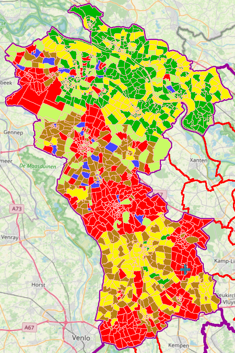
ABK-Erfassungstand Kreis Kleve
Dieser Datensatz beinhaltet den aktuellen Erfassungsstand der ABK aus ALKIS ( Amtliches Liegenschaftskatasterinformationssystem) mit allen Attributen.
Die Thematische Darstellung ist Flur genau und tagesaktuell.
|
|
Citation proposal
(2025) . ABK-Erfassungstand Kreis Kleve. Kreis Kleve - Der Landrat https://gdk.gdi-de.org/geonetwork/srv/api/records/b7fbd91c-1002-488c-a223-29c0846cea07 |
- Identification
- Distribution
- Quality
- Spatial rep.
- Ref. system
- Content
- Portrayal
- Metadata
- Md. constraints
- Md. maintenance
- Schema info
Identification
Data identification
Citation
- Alternate title
- ABK-Erfassungstand
- Date ( Publication )
- 2025-05-19T00:00:00.000+02:00
Publisher
Point of contact
Kreis Kleve - Abt. Kataster- und Vermessung - Produktbereich GeoInformation (GIS)
Nassauerallee 15-23
Kleve
Nordrhein-Westfalen
47533
DEU
Maintenance information
- Maintenance and update frequency
- As needed
- Update scope
- Dataset
- Keywords
-
- Kreis Kleve
- Bedburg-Hau
- Emmerich am Rhein
- Emmerich
- Geldern
- Goch
- Issum
- Kalkar
- Kerken
- Wallfahrtsstadt Kevelaer
- Kevelaer
- Kranenburg
- Kleve
- Rees
- Rheurdt
- Straelen
- Uedem
- Wachtendonk
- Weeze
- NW
- NRW
- Nordrhein-Westfalen
- 05154
- ABK
- Amtliche Basiskarte
- Aktuell
- Erfassungstand
Legal constraints
- Use constraints
- Other restrictions
- Other constraints
- Datenlizenz Deutschland - Zero - Version 2.0 [https://www.govdata.de/dl-de/zero-2-0]
- Other constraints
- {"id":"dl-zero-de/2.0","name":"Datenlizenz Deutschland – Zero – Version 2.0","url":"https://www.govdata.de/dl-de/zero-2-0","quelle":""}
Legal constraints
- Access constraints
- otherRestrictions Other restrictions
- Metadata language
- German
- Topic category
-
- Planning cadastre
Extent
Bounding Polygon
- Extent type code
- true
Geographic description
- Extent type code
- true
- Geographic identifier
- Kleve, Kreis (05154)
N
S
E
W
))
Quality
Data quality
- Hierarchy level
- Dataset
- Statement
- Das Amtliche Liegenschaftskataster-Informationssystem (ALKIS) weist die Liegenschaften und sonstige Basisinformationen des Liegenschaftskatasters mit objektstrukturierten Geometrie- und Sachdaten nach. ALKIS liegt die von der Arbeitsgemeinschaft der Vermessungsverwaltungen der Länder der Bundesrepublik Deutschland (AdV) entwickelte und in der Dokumentation zur Modellierung der Geoinformationen des amtlichen Vermessungswesens (GeoInfoDok) enthaltene Konzeption des Amtlichen Liegenschaftskataster-Informationssystem zu Grunde.
Metadata
Metadata
- File identifier
- b7fbd91c-1002-488c-a223-29c0846cea07 XML
- Metadata language
- German
- Character set
- UTF8
- Hierarchy level
- dataset Dataset
- Date stamp
- 2025-07-18
- Metadata standard name
- ISO19115
- Metadata standard version
- 2003/Cor.1:2006
Point of contact
Kreis Kleve - Abt. Kataster- und Vermessung - Produktbereich GeoInformation (GIS)
Nassauerallee 15-23
Kleve
Nordrhein-Westfalen
47533
DEU
Overviews
ABK-Erfassungstand Kreis Kleve
Provided by

Views
b7fbd91c-1002-488c-a223-29c0846cea07
Access to the portal
Read here the full details and access to the data.
Associated resources
Not available