 www.geodatenkatalog.de (S2L)
Geotope
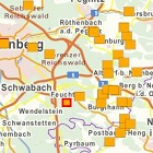
Geotope sind erdgeschichtliche Bildungen der unbelebten Natur, die Erkenntnisse über die Entwicklung der Erde und des Lebens vermitteln. Sie umfassen Aufschlüsse von Gesteinen, Böden, Mineralien und Fossilien sowie einzelne Naturschöpfungen und natürliche Landschaftsteile. Geotope werden in Bayern seit 1985 systematisch erfasst und im Geotopkataster des Landesamts für Umwelt registriert. Der Layer „Geotope“ zeigt die Lage der Geotope Bayerns. Als Attribute angehängt sind neben Name und Nummer des Geotopes im Geotopkataster die Position als Gauß-Krüger- Koordinate (Rechts- und Hochwert) und die Geologische Raumeinheit zu der das Objekt gehört. Zusätzlich ist ein beschreibender Steckbrief mit allen wichtigen Eckdaten verknüpft und gegebenenfalls die Nummer in der Serie „Bayerns 100 schönste Geotope“ angegeben. Bitte beachten: Dieser Datensatz ist nicht tagesaktuell und zudem unvollständig, da manche Geotope vom Landesamt für Umwelt nicht allgemein veröffentlicht werden (Gründe: Privatgrund, Betriebsgelände, besonders empfindliche und gefährdete Objekte).
|
|
Citation proposal
. Geotope. https://gdk.gdi-de.org/geonetwork/srv/api/records/b8df6dfd-7012-4e82-a801-bbbe01d26117 |
INSPIRE
Identification
- File identifier
- b8df6dfd-7012-4e82-a801-bbbe01d26117 XML
- Hierarchy level
- dataset Dataset
Online resource
Resource identifier
- Metadata language
- ger German
- Spatial representation type
- vector Vector
Encoding
- Format
- ArcGIS Geodatabase Feature Class
- Version
- 10.1
- Format
- Oracle Spatial Tabelle
- Version
- 11.x
Projection
Classification of data and services
- Topic category
-
- Geoscientific information
- Environment
Classification of data and services
Coupled resource
Coupled resource
Classification of data and services
Coupled resource
Coupled resource
Keywords
- Spatial scope
-
- Regional
Other keywords
- Keywords ( Theme )
-
- Geologie
- Geotope
- Keywords
-
- opendata
- gdiby
Geographic coverage
N
S
E
W
))
Temporal reference
Temporal extent
Temporal extent
- Date ( Revision )
- 2017-09-27
Quality and validity
- Lineage
- Geländekartierungen durch Bayerisches Landesamt für Umwelt (Abt.10 Geologischer Dienst), nach Karten- und Literaturrecherche, Hinweise von Behörden und Ortskennern
Conformity
Conformity
Conformity
Conformity
Conformity
Conformity
Restrictions on access and use
- Use limitation
- keine Einschränkungen
- Access constraints
- Der Datensatz/Dienst steht unter der Lizenz: Creative Commons Namensnennung 4.0 International (CC BY 4.0). Die Namensnennung des Bayerischen Landesamtes für Umwelt als Rechteinhaber hat in folgender Weise zu erfolgen: "Datenquelle: Bayerisches Landesamt für Umwelt, www.lfu.bayern.de". Die Nutzung von Daten über Dienste ist geldleistungsfrei. Bei Bezug von Daten über die Datenstelle des LfU (nur Daten, die nicht über Dienste verfügbar sind) wird eine Bereitstellungsgebühr erhoben, die sich an der Umweltgebührenordnung orientiert.
- Access constraints
- { "id": "cc-by", "name": "Creative Commons Namensnennung (CC BY)", "quelle": "Datenquelle: Bayerisches Landesamt für Umwelt, www.lfu.bayern.de", "url": "http://creativecommons.org/licenses/by/3.0/deed.de" }
Restrictions on access and use
Responsible organization (s)
Contact for the resource
- Organisation name
- Bayerisches Landesamt für Umwelt
Responsible organization (s)
Contact for the resource
- Organisation name
- Bayerisches Landesamt für Umwelt
Metadata information
Contact for the metadata
- Organisation name
- Bayerisches Landesamt für Umwelt
- Date stamp
- 2022-10-26T06:58:25+01:00
- Metadata language
- ger German
- Character set
- utf8 UTF8
SDS
Conformance class 1: invocable
Access Point URL
Endpoint URL
Technical specification
Conformance class 2: interoperable
Coordinate reference system
Quality of Service
Access constraints
Limitation
Use constraints
Limitation
Responsible custodian
Contact for the resource
Conformance class 3: harmonized
Overviews
Provided by

Views
b8df6dfd-7012-4e82-a801-bbbe01d26117
Access to the portal
Read here the full details and access to the data.
Associated resources
Not available