 www.geodatenkatalog.de (S1L)
Bodenrichtwerte - Bodenrichtwerte
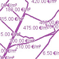
Bodenrichtwerte Mainz 2012, Der Bodenrichtwert ist ein durchschnittlicher Lagewert des Bodens in €/m² für eine Mehrheit von Grundstücken (Bodenrichtwertzone), für die im Wesentlichen gleiche Nutzungs- und Wertverhältnisse vorliegen. Er bezieht sich auf baureife und beitragsfreie Grundstücke. Abweichungen einzelner Grundstücke in wertbestimmenden Eigenschaften wie z. B. spezielle Lage, Art und Maß der Nutzung, Bodenbeschaffenheit etc. bewirken entsprechende Abweichungen ihrer Bodenwerte vom Bodenrichtwert.:Bodenrichtwerte Mainz 2012, Der Bodenrichtwert ist ein durchschnittlicher Lagewert des Bodens in €/m² für eine Mehrheit von Grundstücken (Bodenrichtwertzone), für die im Wesentlichen gleiche Nutzungs- und Wertverhältnisse vorliegen. Er bezieht sich auf baureife und beitragsfreie Grundstücke. Abweichungen einzelner Grundstücke in wertbestimmenden Eigenschaften wie z. B. spezielle Lage, Art und Maß der Nutzung, Bodenbeschaffenheit etc. bewirken entsprechende Abweichungen ihrer Bodenwerte vom Bodenrichtwert.
|
|
Citation proposal
. Bodenrichtwerte - Bodenrichtwerte. 60-Bauamt, Abt. Bodenmanagement und Geoinformation https://gdk.gdi-de.org/geonetwork/srv/api/records/bbaea8d4-3a91-43d4-58cb-e6da4029abc3 |
INSPIRE
Identification
- File identifier
- bbaea8d4-3a91-43d4-58cb-e6da4029abc3 XML
- Hierarchy level
- service Service
Online resource
- Protocol
- OGC:WMS-1.1.1-http-get-map
Resource identifier
Encoding
Projection
Classification of data and services
Classification of data and services
- Service Type
- view
- Coupling Type
- Loose
Coupled resource
Coupled resource
Classification of data and services
- Service Type
- view
- Coupling Type
- Loose
Coupled resource
Coupled resource
Keywords
- mapbender.2.registryId
-
- 2f23ed6e-0186-4c2b-8380-748389036509
Other keywords
- Keywords
-
- Rheinland-Pfalz
- Landeshauptstadt
- Mainz
- Übersichtskarte
- Strassen
- infoMapAccessService
Geographic coverage
N
S
E
W
))
Temporal reference
Temporal extent
Temporal extent
- Date ( Revision )
- 2023-11-28
Quality and validity
Conformity
Conformity
Conformity
Conformity
Conformity
Conformity
- Explanation
- No explanation available
- Explanation
- No explanation available
- Explanation
- No explanation available
- Explanation
- No explanation available
- Explanation
- No explanation available
- Explanation
- No explanation available
- Explanation
- No explanation available
- Explanation
- No explanation available
Restrictions on access and use
Restrictions on access and use
Responsible organization (s)
Contact for the resource
- Organisation name
- 60-Bauamt, Abt. Bodenmanagement und Geoinformation
Responsible organization (s)
Contact for the resource
- Organisation name
- 60-Bauamt, Abt. Bodenmanagement und Geoinformation
Metadata information
Contact for the metadata
- Organisation name
- Stadt Mainz
- Date stamp
- 2025-06-08
- Metadata language
- Deutsch German
SDS
Conformance class 1: invocable
- Pass
- true
- Pass
- true
- Pass
- true
- Pass
- true
- Pass
- true
- Pass
- true
- Pass
- true
- Pass
- true
Access Point URL
Endpoint URL
Technical specification
- Date
- Explanation
- No explanation available
- Date
- Explanation
- No explanation available
- Date
- Explanation
- No explanation available
- Date
- Explanation
- No explanation available
- Date
- Explanation
- No explanation available
- Date
- Explanation
- No explanation available
- Date
- Explanation
- No explanation available
- Date
- Explanation
- No explanation available
Conformance class 2: interoperable
Coordinate reference system
Quality of Service
Access constraints
- Access constraints
- Other restrictions
Limitation
Use constraints
- Use constraints
- Other restrictions
Limitation
Responsible custodian
Contact for the resource
Conformance class 3: harmonized
Contains Operations
- Operation Name
- GetCapabilities
- Distributed Computing Platforms
- Web services
Overviews
Thumbnail
Provided by

Views
bbaea8d4-3a91-43d4-58cb-e6da4029abc3
Access to the portal
Read here the full details and access to the data.
Associated resources
Not available