 www.geodatenkatalog.de (S3L)
Förderkulisse Zukunftsinitiative Stadtteil II; ZIS II 2014-2020
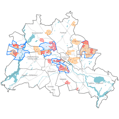
Berliner Fördergebiete der 'Zukunftsinitiative Stadtteil II' (ZIS II) in der europäischen Strukturfonds-Förderperiode 2014-2020; integrierte Strategien zur Aufwertung von Quartieren werden gefördert aus Mitteln des Landes, des Bundes und der Europäischen Union. Bestandteil dieser Förderkulisse sind Stadtumbaugebiete, Quartiersmanagementgebiete und Aktionsräume.
|
|
Citation proposal
. Förderkulisse Zukunftsinitiative Stadtteil II; ZIS II 2014-2020. https://gdk.gdi-de.org/geonetwork/srv/api/records/bf39728b-4685-3ae9-bc4f-c684097f1e3d |
- Identification
- Distribution
- Quality
- Spatial rep.
- Ref. system
- Content
- Portrayal
- Metadata
- Md. constraints
- Md. maintenance
- Schema info
Identification
Data identification
Citation
- Date ( Creation )
- 2014-11-28
- Date ( Revision )
- 2017-09-13
Point of contact
Point of contact
- Maintenance and update frequency
- As needed
- Keywords ( Theme )
-
- open data
- opendata
- Karten
- Sachdaten
- Geodaten
- Berlin
- EFRE
- ZIS
- ZIS II
- Förderkulisse
- Strukturfonds
- Zukunftsinitiative
- Stadtteil
- Räumlicher Anwendungsbereich ( Theme )
Legal constraints
- Access constraints
- Other restrictions
Legal constraints
- Use constraints
- Other restrictions
- Other constraints
- Für die Nutzung der Daten ist die Datenlizenz Deutschland - Zero - Version 2.0 anzuwenden. Die Lizenz ist über https://www.govdata.de/dl-de/zero-2-0 abrufbar.
- Other constraints
- {"id":"dl-zero-de/2.0","name":"Datenlizenz Deutschland - Zero - Version 2.0","url":"https://www.govdata.de/dl-de/zero-2-0"}
- Spatial representation type
- Vector
- Denominator
- 1000
- Metadata language
- German
- Character set
- UTF8
- Topic category
-
- Planning cadastre
Extent
N
S
E
W
))
Geographic description
- Extent type code
- true
- Geographic identifier
- 110000000000
Distribution
Distribution
- Distribution format
-
-
Text/HTML
(4.01 )
- Specification
- Keine Angabe
-
Text/HTML
(4.01 )
- OnLine resource
-
Darstellungsdienst - Förderkulisse Zukunftsinitiative Stadtteil II; ZIS II 2014-2020 (WMS)
Darstellungsdienst - Förderkulisse Zukunftsinitiative Stadtteil II; ZIS II 2014-2020 (WMS)
- OnLine resource
-
Downloaddienst - Förderkulisse Zukunftsinitiative Stadtteil II; ZIS II 2014-2020 (WFS)
Downloaddienst - Förderkulisse Zukunftsinitiative Stadtteil II; ZIS II 2014-2020 (WFS)
- OnLine resource
-
Inhaltliche Beschreibung
Inhaltliche Beschreibung
- OnLine resource
-
Technische Beschreibung
Technische Beschreibung
Quality
Data quality
- Hierarchy level
- Dataset
Lineage
- Statement
- Daten aus der Berliner Verwaltung
- Description
- Daten aus der Berliner Verwaltung
Ref. system
- Reference system identifier
- http://www.opengis.net/def/crs/EPSG/0/25833
Metadata
Metadata
- File identifier
- bf39728b-4685-3ae9-bc4f-c684097f1e3d XML
- Metadata language
- German
- Character set
- UTF8
- Hierarchy level
- Dataset
- Date stamp
- 2025-11-19T00:00:00Z
- Metadata standard name
- ISO 19115/19119 - BE
- Metadata standard version
- 1.0.0
Point of contact
Overviews
Vorschaubild
Provided by

Views
bf39728b-4685-3ae9-bc4f-c684097f1e3d
Access to the portal
Read here the full details and access to the data.
Associated resources
Not available