 www.geodatenkatalog.de (S2L)
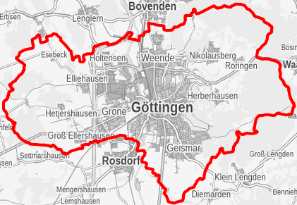
Landschaftsschutzgebiete der Stadt Göttingen
Gebiete in denen besonders die Landschaft oder Teile davon einschließlich der darin ablaufenden natürlichen Prozesse und Nutzungen geschützt sind. Dabei geht es insbesondere um den Erhalt des Landschaftscharakters
|
|
Citation proposal
. Landschaftsschutzgebiete der Stadt Göttingen. https://gdk.gdi-de.org/geonetwork/srv/api/records/c400fcf0-ba33-467a-87f4-9f7acc3d724e |
- Identification
- Distribution
- Quality
- Spatial rep.
- Ref. system
- Content
- Portrayal
- Metadata
- Md. constraints
- Md. maintenance
- Schema info
Identification
Data identification
Citation
- Alternate title
- Landschaftsschutzgebiete
- Date ( Creation )
- 2010-01-01
Point of contact
Stadt Göttingen
-
Mitarbeiter/innen Fachdienst "Umwelt"
(Sachbearbeitung )
Hiroshimaplatz 1-4
Göttingen
Niedersachsen
37083
Deutschland
- Maintenance and update frequency
- As needed
- GEMET - INSPIRE themes, version 1.0 ( Theme )
-
- Landschaftsschutzgebiet
- Landschaftsschutz
- Umweltschutz
- Gewässerschutz
- Schutzgebiete
Resource constraints
No information provided.
Resource constraints
No information provided.
Resource constraints
No information provided.
Resource constraints
No information provided.
- Classification
- Unclassified
- Use limitation
- Nutzungsvereinbarung
Legal constraints
- Access constraints
- Other restrictions
- Other constraints
- Nutzungsvereinbarung
Legal constraints
- Use constraints
- Other restrictions
- Other constraints
- Nutzungsvereinbarung
- Spatial representation type
- Vector
- Metadata language
- German
- Character set
- UTF8
- Topic category
-
- Environment
N
S
E
W
))
Distribution
Distribution
- Distribution format
-
- Papier, PDF, Shapefile (10.2 )
Point of contact
Stadt Göttingen
-
Mitarbeiter/innen Fachdienst "Umwelt"
(Sachbearbeitung )
Hiroshimaplatz 1-4
Göttingen
Niedersachsen
37083
Deutschland
Quality
Data quality
Scope
- Hierarchy level
- Dataset
Conformance result
Citation
- Date ( Publication )
- 2015-08-26
- Explanation
- Die Daten sind konform.
- Pass
- true
- Statement
- Die Daten wurden im Jahr ???? erfastt und bei Bedarf aktualisiert.???
Ref. system
Identifier
- Version
- 6.11.2
Metadata
Metadata
- File identifier
- c400fcf0-ba33-467a-87f4-9f7acc3d724e XML
- Metadata language
- German
- Character set
- UTF8
- Hierarchy level
- Dataset
- Date stamp
- 2023-01-12
Point of contact
Stadt Göttingen
-
Mitarbeiter/innen Fachdienst "Geoservice und Grundstücke"
Hiroshimaplatz 1-4
Göttingen
Niedersachsen
37083
Deutschland
Overviews
Provided by

Views
c400fcf0-ba33-467a-87f4-9f7acc3d724e
Access to the portal
Read here the full details and access to the data.
Associated resources
Not available