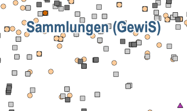
Map of the BGR Geoscientific Collections based on GewiS
The map of the BGR geoscientific collections displays the localities of the collection‘s objects. Two different types of positions are presented: localities based on available coordinates (´Fundort erfasst´) and subsequently generated coordinates based on descriptions (´Position ermittelt´). The BGR-Geoviewer provides a link directly to the GewiS application (https://gewis.bgr.de) and thus to the description of the collection objects.
|
|
Citation proposal
(2020) . Map of the BGR Geoscientific Collections based on GewiS. https://gdk.gdi-de.org/geonetwork/srv/api/records/c504be09-add7-418f-bc7b-ee6c59ba7188 |
Simple
- Alternate title
- Geowiss. Sammlungen (GewiS)
- Date ( Publication )
- 2020-09-07
- Date ( Revision )
- 2022-07-14
- Identifier
- c69d413d-d391-d26a-2ef2-117ea6c5fd4c
- Status
- onGoing On going
Point of contact
- GEMET - INSPIRE themes, version 1.0 ( Theme )
-
- Geologie
- Geology
- Keywords ( Theme )
-
- GewiS
- geowissenschaftliche Sammlung
- Fossil
- Gestein
- Mineral
- Bohrung
- Bohrprobe
- Fundorte
- Lokalität
- Sammlungsstück
- GIS
- GeolDG
- Keywords ( Place )
-
- weltweit
- Access constraints
- Other restrictions
- Use constraints
- Other restrictions
- Other constraints
- Allgemeine Geschäftsbedingungen, siehe https://www.bgr.bund.de/AGB - General terms and conditions, see https://www.bgr.bund.de/AGB_en. Die bereitgestellten Informationen sind bei Weiterverwendung wie folgt zu zitieren: Datenquelle: Sammlung (GewiS), BGR, Hannover, 2022
- Spatial representation type
- Vector
- Metadata language
- ger German
- Character set
- utf8 UTF8
- Topic category
-
- Geoscientific information
N
S
E
W
))
- Distribution format
-
- WMS (OGC:WMS 1.3.0 )
- OnLine resource
-
Webanwendung Gewis - Geowissenschaftliche Sammlungen online
Webanwendung Gewis - Geowissenschaftliche Sammlungen online
- OnLine resource
-
Karte im BGR-Geoviewer
Karte im BGR-Geoviewer
- OnLine resource
-
StoryMap zu GewiS
StoryMap zur Anwendung GewiS
- Hierarchy level
- Dataset
Conformance result
- Date ( Publication )
- 2010-12-08
- Explanation
- siehe dazu die angegebene Durchführungsbestimmung
- Statement
- Basierend auf den Datenbanken der Geowissenschaftlichen Sammlungen werden die Fundorte der Sammlungsobjekte in einem WMS (web mapping service) dargestellt. Wenn in der Datenbank keine Informationen zu den Koordinaten vorliegen, werden die Fundorte basierend auf den vorhandenen Beschreibungen geokodiert. Fundorte innerhalb Deutschlands werden auf Grundlage vorhandener Geobasisdaten einer Qualitätsprüfung unterzogen.
gmd:MD_Metadata
- File identifier
- c504be09-add7-418f-bc7b-ee6c59ba7188 XML
- Metadata language
- German
- Character set
- utf8 UTF8
- Hierarchy level
- dataset Dataset
- Hierarchy level name
- Geologie
- Hierarchy level name
- GeolDG
- Date stamp
- 2024-11-28
- Metadata standard name
- INSPIRE Metadata Implementing Rules: Technical Guidelines based on EN ISO 19115 and EN ISO 19119
- Metadata standard version
- n/a
Point of contact
Overviews

Provided by

Views
c504be09-add7-418f-bc7b-ee6c59ba7188
Access to the portal
Read here the full details and access to the data.
Associated resources
Not available
 www.geodatenkatalog.de (S1L)