 My GeoNetwork catalogue
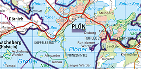
Kreise Segeberg, Stormarn und Herzogtum Lauenburg
Bei dieser Kreiskarte handelt es sich um die Karte "Kreise Segeberg,Stormarn und Herzogtum Lauenburg" im Maßstab 1:100.000. Herausgegeben wird dieses Kartenblatt durch das Bundesland Schleswig-Holstein. Der Karteninhalt erstreckt sich von der Darstellung der Siedlungen, Bodenbewachsung, Gewässer formen, des Verkehrsnetzes bis zur farblichen Betonung der Bundes-, Landes- und Kreisstraßen. In Violett sind Bundes-, Landes-, Kreis-, Amts- und Gemeindegrenzen dargestellt. Die Karte hat das Format 108 x 86 cm .
INSPIRE
Identification
- File identifier
- c5b181d1-e52b-498c-9373-41eaf72af25d XML
- Hierarchy level
- Tile
Online resource
Resource identifier
- Metadata language
- Deutsch
- Spatial representation type
- Grid
Encoding
- Format
-
HINWEIS: Die Abgabe der analogen (plano oder gefaltet) Daten ist kostenpflichtig.
- Version
-
keine Angabe
Projection
- code
- 25832
Classification of data and services
- Topic category
-
- Imagery base maps earth cover
Classification of data and services
Coupled resource
Coupled resource
Classification of data and services
Coupled resource
Coupled resource
Keywords
Other keywords
- Keywords
-
-
Kreiskarte
-
- Keywords
-
-
Schleswig-Flensburg
-
- Keywords
-
-
Kreisgrenzen
-
- Keywords
-
-
Gemeindegrenzen
-
- Keywords
-
-
Topographische Gebietskarten
-
- Keywords
-
-
Schleswig-Holstein
-
- Keywords
-
-
SH
-
- Keywords
-
-
KKN
-
- Keywords
-
-
1:100000
-
- Keywords
-
-
KK
-
- Keywords
-
-
analoge Karte
-
Geographic coverage
))
Temporal reference
Temporal extent
Temporal extent
- Date (Creation)
- 2013-02-01
- Date (Revision)
- 2023-09-26
Quality and validity
- Lineage
-
Topographische Karte 1:100.000 (TK100); Verwaltungsgrenzen, gemäß der Vorgabe durch das Land Schleswig-Holstein; Erstherstellung: Scannen der Kartengrundlage; Aktualisierung und Ergänzung: Auf Grundlage der Originalrasterdaten werden mittels spezieller EDV-Verfahren alle Veränderungen bearbeitet.
Conformity
Conformity
Conformity
Conformity
Conformity
Conformity
Restrictions on access and use
- Access constraints
-
Es gelten keine Zugriffsbeschränkungen
- Access constraints
-
Nutzungsbedingungen: Geobasisdaten (analog und digital) sind gesetzlich geschützt. Unbefugte Vervielfältigung oder Verbreitung verstößt gegen das Urheberrechtsgesetz (UrhG) und das Schleswig-Holsteinische Vermessungs- und Katastergesetz (VermKatG). Als Vervielfältigungen gelten zum Beispiel Nachdruck, Fotokopie, Microverfilmung, Digitalisieren, Scannen sowie Speicherung auf Datenträger.
Responsible organization (s)
Contact for the resource
- Organisation name
-
Landesamt für Vermessung und Geoinformation Schleswig-Holstein
Responsible organization (s)
Contact for the resource
- Organisation name
-
Landesamt für Vermessung und Geoinformation Schleswig-Holstein
Metadata information
Contact for the metadata
- Organisation name
-
Landesamt für Vermessung und Geoinformation Schleswig-Holstein
- Date stamp
- 2024-01-09
- Metadata language
- Deutsch
- Character set
- UTF8
SDS
Conformance class 1: invocable
Access Point URL
Endpoint URL
Technical specification
Conformance class 2: interoperable
Access constraints
Limitation
Use constraints
Limitation
Responsible custodian
Contact for the resource
Overviews
Spatial extent
Provided by
