 www.geodatenkatalog.de (S3L)
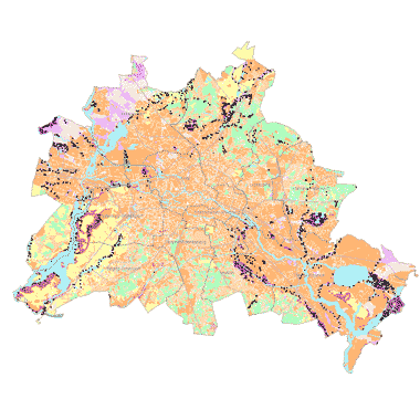
Bodengesellschaften und Bodenarten 2010 (Umweltatlas)
Bodengesellschaften und Bodenarten unversiegelter Böden, Konzeptkarte ermittelt aus Bodenuntersuchungen und Nutzungsarten auf Grundlage der Blockkarte 1 : 5.000 (ISU5, Raumbezug Umweltatlas 2010), Bearbeitungsstand November 2012.
|
|
Citation proposal
(2016) . Bodengesellschaften und Bodenarten 2010 (Umweltatlas). https://gdk.gdi-de.org/geonetwork/srv/api/records/c5f49c12-58de-3af3-9e7b-0a67fdd10fd5 |
- Identification
- Distribution
- Quality
- Spatial rep.
- Ref. system
- Content
- Portrayal
- Metadata
- Md. constraints
- Md. maintenance
- Schema info
Identification
Data identification
Citation
- Date ( Creation )
- 2016-03-15
- Date ( Publication )
- 2016-04-01
Point of contact
- Keywords ( Theme )
-
- opendata
- open data
- Geodaten
- Berlin
- Umweltatlas
- Bodengesellschaften
- Bodenarten
- Bodentypen
- Bodenkartierung
- Böden
- Spatial scope
Legal constraints
- Access constraints
- Other restrictions
Legal constraints
- Use constraints
- Other restrictions
- Other constraints
- Für die Nutzung der Daten ist die Datenlizenz Deutschland - Zero - Version 2.0 anzuwenden. Die Lizenz ist über https://www.govdata.de/dl-de/zero-2-0 abrufbar.
- Other constraints
- { "id": "dl-zero-de/2.0" , "name": "Datenlizenz Deutschland - Zero - Version 2.0", "url": "https://www.govdata.de/dl-de/zero-2-0" }
- Spatial representation type
- Vector
- Denominator
- 50000
- Metadata language
- German
- Character set
- UTF8
- Topic category
-
- Geoscientific information
Extent
N
S
E
W
))
Geographic description
- Extent type code
- true
- Geographic identifier
- 110000000000
Distribution
Distribution
- Distribution format
-
- Text/HTML (4.01 )
Digital transfer options
- OnLine resource
-
Darstellungsdienst - Bodenarten 2010 (Umweltatlas) (WMS)
Darstellungsdienst - Bodenarten 2010 (Umweltatlas) (WMS)
- OnLine resource
-
Darstellungsdienst - Bodengesellschaften 2010 (Umweltatlas) (WMS)
Darstellungsdienst - Bodengesellschaften 2010 (Umweltatlas) (WMS)
- OnLine resource
-
Downloaddienst - Bodengesellschaften und Bodenarten 2010 (Umweltatlas) (WFS)
Downloaddienst - Bodengesellschaften und Bodenarten 2010 (Umweltatlas) (WFS)
Quality
Data quality
- Hierarchy level
- Dataset
- Statement
- Daten aus der Berliner Verwaltung
Ref. system
- Reference system identifier
- http://www.opengis.net/def/crs/EPSG/0/25833
Metadata
Metadata
- File identifier
- c5f49c12-58de-3af3-9e7b-0a67fdd10fd5 XML
- Metadata language
- German
- Character set
- UTF8
- Hierarchy level
- Dataset
- Date stamp
- 2025-03-06T12:33:47
- Metadata standard name
- ISO 19115/19119 ? BE
- Metadata standard version
- 1.0.0
Overviews
Provided by

Views
c5f49c12-58de-3af3-9e7b-0a67fdd10fd5
Access to the portal
Read here the full details and access to the data.
Associated resources
Not available