 My GeoNetwork catalogue
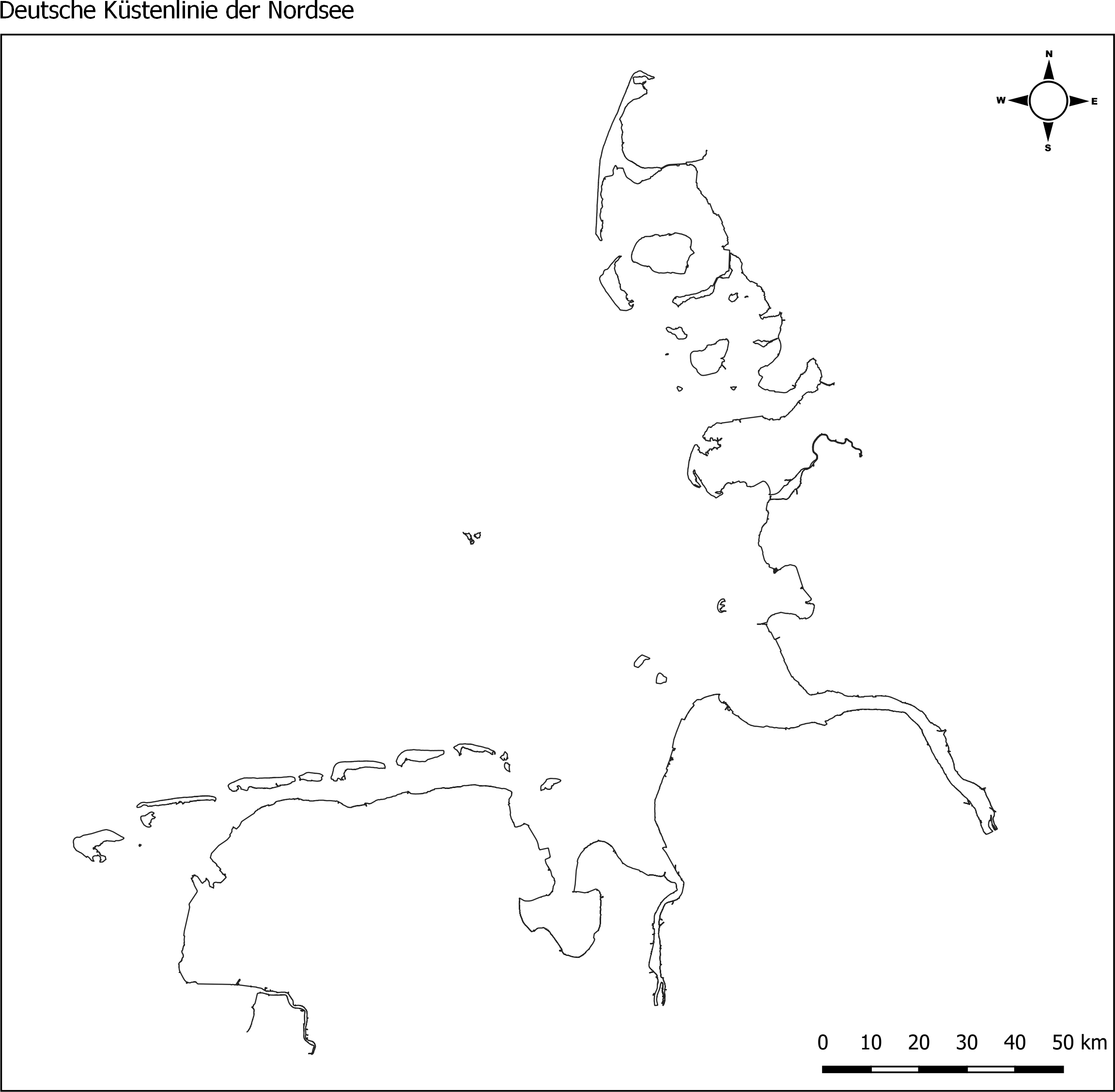
Küstenlinie deutsche Nordsee für WRRL/MSRL von 2017/2018
Die Küstenlinie der deutschen Nordseeküste, erstellt vom Landesamt für Umwelt (LfU) von Schleswig Holstein. Grundlage dafür waren MSRL- und WRRL-Shapefiles der Küsten- Übergangsgewässer. Der Dienst stellt Shapefiles der Küstenlinien für die Nordsee (ANS-DE) und die Ostsee (BAL-DE) aus den abgestimmten und an die EU gemeldeten Berichtsgeometrien für die gesamte deutsche Küste bereit. Hierfür wurden Shapes der MSRL und der WRRL (Küsten- und Übergangsgewässer) genutzt. Die Daten wurden im Dezember 2017 (Ostsee) / bzw. im Januar 2018 (Nordsee) erstellt.
- Identification
- Distribution
- Quality
- Spatial rep.
- Ref. system
- Content
- Portrayal
- Metadata
- Md. constraints
- Md. maintenance
- Schema info
Identification
Data identification
Citation
- Alternate title
-
Die Küstenlinie der deutschen Nordsee
- Date (Creation)
- 2018-01-02T00:00:00.000+01:00
- Date (Publication)
- 2018-01-03T00:00:00.000+01:00
- Citation identifier
- https://mdi-de-dienste.org#ac5dd631-ed63-4e57-b2ff-c39fc10c8d8d
- Status
- Completed
- Hours of service
-
9 - 15:30 Uhr
Maintenance information
- Maintenance and update frequency
- As needed
- Update scope
- Dataset
-
GEMET - INSPIRE themes, version 1.0
-
-
Verwaltungseinheiten
-
- Keywords
-
-
Basisdienste
-
Meeresregionen
-
Hydrography
-
Gewässernetz
-
Sea regions
-
coastline
-
Küstenlinine
-
North Sea
-
German Bight
-
MDI-DE_Basisdaten
-
- Keywords
-
-
inspireidentifiziert
-
- Keywords
-
-
opendata
-
- Theme
-
-
ENVI
-
- Keywords
-
-
Deutsche Bucht
-
Nordsee
-
Küste
-
- Use limitation
-
Für die Lehre und Forschung zu verwenden, nicht tauglich für Navigation.
Legal constraints
- Use constraints
- Other restrictions
- Other constraints
-
Creative Commons Namensnennung 4.0 International
- Other constraints
-
Quellenvermerk: Marine Dateninfrastruktur <Jahr des Datenbezugs>
- Other constraints
-
{"id":"CC BY 4.0","name":"Creative Commons Namensnennung 4.0 International","url":" https://creativecommons.org/licenses/by/4.0/deed.de","quelle":"Marine Dateninfrastruktur <Jahr des Datenbezugs>"}
Legal constraints
- Access constraints
- Other restrictions
- Other constraints
- Es gelten keine Zugriffsbeschränkungen
- Spatial representation type
- Vector
- Language
- Deutsch
- Character set
- UTF8
- Topic category
-
- Boundaries
Extent
Geographic description
- Extent type code
- Yes
- Geographic identifier
- Raumbezug des Datensatzes
))
Geographic description
- Extent type code
- Yes
- Geographic identifier
- Nordsee
))
Distribution
Distribution
- Distribution format
-
-
Shapefiles
(
1.0
)
-
GML
(
1.0
)
-
Shapefiles
(
1.0
)
- OnLine resource
-
OGC WMS
Adresse: https://mdi-de-dienste.org/geoserver/Basisdaten/wms
- OnLine resource
-
OGC WFS
Adresse: https://mdi-de-dienste.org/geoserver/Basisdaten/wfs
Quality
Data quality
- Hierarchy level
- Dataset
Conformance result
Citation
- Date (Publication)
- 2010-12-08
- Explanation
-
see the referenced specification
- Pass
- Yes
- Statement
-
Datensatz wurde aus mehreren vorhandenen Shapfiles zusammen gesetzt. Zugrunde liegende Datensätze beruhen auf MSRL und WRRL.
Spatial rep.
Vector spatial representation
- Topology level
- Geometry only
- Geometric object type
- Curve
Ref. system
- Unique resource identifier
- EPSG 25832: ETRS89 / UTM Zone 32N
Metadata
Metadata
- File identifier
- c7d748c9-e12f-4038-a556-b1698eb4033e XML
- Metadata language
- Deutsch
- Character set
- UTF8
- Hierarchy level
- Dataset
- Date stamp
- 2025-05-26
- Metadata standard name
-
ISO19115:2003; GDI-NOKIS
- Metadata standard version
-
2003(E)/Cor.1:2006(E);1.0:2019
Overviews
Spatial extent
Provided by
