 www.geodatenkatalog.de (S3L)
GK 50 A - Geologische Karte von Nordrhein-Westfalen 1:50.000 (analog)
Das Kartenwerk ist ein Produkt der Integrierten Geologischen Landesaufnahme (IGL) von Nordrhein-Westfalen und stellt geologische Fachdaten über Alter, Beschaffenheit und Verbreitung der Gesteine im Blattschnitt zur Verfügung. Es besteht aus folgenden Kartenthemen: geologische Detaildarstellung, Lithologie, Höhenlinien der Quartär-Basis, präquartärer Untergrund, geologische Schnitte. Die Kartenblätter liegen gescannt und georeferenziert vor.
|
|
Citation proposal
(2019) . GK 50 A - Geologische Karte von Nordrhein-Westfalen 1:50.000 (analog). https://gdk.gdi-de.org/geonetwork/srv/api/records/ce284aa1-805a-45e0-b113-5e0a95cc3986 |
INSPIRE
Identification
- File identifier
- ce284aa1-805a-45e0-b113-5e0a95cc3986 XML
- Hierarchy level
- series Series
Online resource
Resource identifier
- Metadata language
- German
- Spatial representation type
- Grid
Encoding
- Format
- JPEG
- Version
- n.a.
- Format
- Version
- 1.6
Projection
Classification of data and services
- Topic category
-
- Geoscientific information
Classification of data and services
Coupled resource
Coupled resource
Classification of data and services
Coupled resource
Coupled resource
Keywords
- UMTHES-Thesaurus ( Theme )
-
- Tektonik
- Stratigraphie
- Geologie
- Thematische Karte
- Geologische Kartierung
- OGDD-Kategorien
-
- geo
Other keywords
- Keywords
-
- opendata
- Keywords
-
- Integrierte Geologische Landesaufnahme
- IGL
Geographic coverage
N
S
E
W
))
Temporal reference
Temporal extent
Temporal extent
- Date ( Creation )
- 2013-12-31
- Date ( Publication )
- 2019-11-14
Quality and validity
- Lineage
- Integrierte Geologische Landesaufnahme
- Denominator
- 50000
Conformity
Conformity
Conformity
Conformity
Conformity
Conformity
Restrictions on access and use
- Access constraints
- {"id": "dl-by-de/2.0","name": "Datenlizenz Deutschland Namensnennung 2.0","url": "https://www.govdata.de/dl-de/by-2-0","quelle": "GK 50 A (Ausgabejahr) @ Geologischer Dienst NRW, Jahr des Abrufs"}
Restrictions on access and use
Responsible organization (s)
Contact for the resource
- Organisation name
- Geologischer Dienst NRW
- geodaten@gd.nrw.de
Responsible organization (s)
Contact for the resource
- Organisation name
- Geologischer Dienst NRW
- geodaten@gd.nrw.de
Metadata information
Contact for the metadata
- Organisation name
- Geologischer Dienst NRW
- metadaten@gd.nrw.de
- Date stamp
- 2024-11-28
- Metadata language
- ger German
- Character set
- UTF8
SDS
Conformance class 1: invocable
Access Point URL
Endpoint URL
Technical specification
Conformance class 2: interoperable
Coordinate reference system
Quality of Service
Access constraints
Limitation
Use constraints
Limitation
Responsible custodian
Contact for the resource
Conformance class 3: harmonized
Overviews
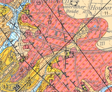
Vorschaugrafik GK 50
Provided by

Views
ce284aa1-805a-45e0-b113-5e0a95cc3986
Access to the portal
Read here the full details and access to the data.
Associated resources
Not available