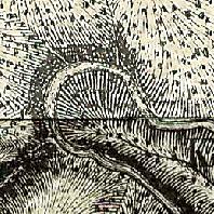
Preußische Generalstabskarte 1:86400 Ausgabe 1816-1847
Preußische Generalstabskarte 1:86400 Ausgabe 1816-1847
|
|
Citation proposal
(2018) . Preußische Generalstabskarte 1:86400 Ausgabe 1816-1847. https://gdk.gdi-de.org/geonetwork/srv/api/records/cf7d4d15-b35a-4b5c-8ee0-f6e95f27b612 |
- Identification
- Distribution
- Quality
- Spatial rep.
- Ref. system
- Content
- Portrayal
- Metadata
- Md. constraints
- Md. maintenance
- Schema info
Identification
Data identification
Citation
- Alternate title
- Preußische_Generalstabskarte
- Date ( Publication )
- 2018-06-13
Point of contact
Landesamt für Vermessung, Geoinformation und Landentwicklung
-
Abt.2 Grundlagen, Geotopographie, Kartographie, Fernerkundung
Von der Heydt 22
Saarbrücken
Saarland
66115
Deutschland
- Maintenance and update frequency
- Not planned
Format
- Name
- sde-rasterDataset
- Version
- 10.0
- Keywords
-
- opendata
- Keywords ( Place )
-
- Saarland
- Keywords
-
- Geoportal
- Classification
- Unclassified
Legal constraints
- Use limitation
- Keine Einschränkung
- Use limitation
- No limitation
Legal constraints
- Access constraints
- License
- Access constraints
- Other restrictions
Legal constraints
- Use constraints
- Other restrictions
- Other constraints
- Lizenz: dl-de-by-2.0 - Datenlizenz Deutschland Namensnennung 2.0 - https://www.govdata.de/dl-de/by-2-0 - Quellenvermerk: © GeoBasis DE/LVGL-SL (Jahr)
- Other constraints
- {"id":"dl-de-by-2.0","name":"Datenlizenz Deutschland Namensnennung 2.0","url":"https://www.govdata.de/dl-de/by-2-0","quelle":"© GeoBasis DE/LVGL-SL (Jahr)"}
- Spatial representation type
- Grid
- Denominator
- 86400
- Metadata language
- German
- Character set
- UTF8
- Topic category
-
- Imagery base maps earth cover
- Location
- Geographic identifier
- Saarland
Extent
N
S
E
W
))
- Supplemental Information
- layer_id_1301
Distribution
Distribution
Distributor
Landesamt für Vermessung, Geoinformation und Landentwicklung
-
Sachgebiet 4.3 Vertrieb, Gebühren, Reproduktion
Von der Heydt 22
Saarbrücken
Saarland
66115
Deutschland
- OnLine resource
- Preußische Generalstabskarte
Quality
Data quality
- Hierarchy level
- Dataset
- Statement
- K.A.
Ref. system
- Reference system identifier
- urn:ogc:def:crs:EPSG / 31466 / 6.11.2
Metadata
Metadata
- File identifier
- cf7d4d15-b35a-4b5c-8ee0-f6e95f27b612 XML
- Metadata language
- German
- Character set
- UTF8
- Hierarchy level
- Dataset
- Hierarchy level name
- basisdaten
- Hierarchy level name
- lvgl_abt2
- Date stamp
- 2025-01-31T14:34:57
- Metadata standard name
- ISO19115
- Metadata standard version
- 2003/Cor.1:2006
Point of contact
Landesamt für Vermessung, Geoinformation und Landentwicklung
-
Sachgebiet 3.1 Geoinformationssysteme, E-Government
Von der Heydt 22
Saarbrücken
Saarland
66115
Deutschland
Overviews

Preuß. Generalstabskarte
Provided by

Views
cf7d4d15-b35a-4b5c-8ee0-f6e95f27b612
Access to the portal
Read here the full details and access to the data.
Associated resources
Not available
 www.geodatenkatalog.de (S3F)