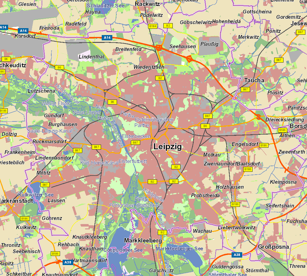
WFS Digitales Landschaftsmodell 1:250 000
Dieser Downloaddienst stellt das Digitale Landschaftsmodell 1:250 000 (DLM250) für das Gebiet der Bundesrepublik Deutschland zu Verfügung. Das DLM250 beschreibt die topographischen Objekte der Landschaft und das Relief der Erdoberfläche im Vektorformat. Die Objekte werden einer bestimmten Objektart zugeordnet und durch ihre räumliche Lage, ihren geometrischen Typ, beschreibende Attribute und Beziehungen zu anderen Objekten (Relationen) definiert. Der Datenbestand umfasst Objektarten, wie z.B. Straßen, Eisenbahnen, Gewässer, Siedlungen, Vegetation und Verwaltungsgrenzen (bis zur Kreisebene) Ebenso wird das Relief durch Höhenlinien und weiteren Oberflächenformen dargestellt. Welche Objektarten das DLM250 im Detail beinhaltet und wie die Objekte gebildet werden, ist im ATKIS®-Objektartenkatalog (ATKIS®-OK250) festgelegt. Maßstab: 1:250000
|
|
Citation proposal
. WFS Digitales Landschaftsmodell 1:250 000. https://gdk.gdi-de.org/geonetwork/srv/api/records/d6d50b87-b896-4696-9efb-66d1adc62337 |
INSPIRE
Identification
- File identifier
- d6d50b87-b896-4696-9efb-66d1adc62337 XML
- Hierarchy level
- service Service
Online resource
Resource identifier
Encoding
- Format
- GML
- Version
- 3.1.1
Projection
Classification of data and services
Classification of data and services
- Service Type
- download
- Coupling Type
- Tight
Coupled resource
Coupled resource
Classification of data and services
- Service Type
- download
- Coupling Type
- Tight
Coupled resource
Coupled resource
Keywords
- GEMET - INSPIRE themes, version 1.0 ( Theme )
-
- Gebäude
- GEMET - Concepts, version 3.1 ( Theme )
-
- inland water
- environment
- station
- wood
- forest
- tunnel
- swamp
- sluice
- excavation side
- sea
- road
- railway
- opencast mining
- national park
- national boundary
- motorway
- bog
- moss
- monument
- river
- island
- heathland
- glacier
- ditch
- dam
- dyke
- natural park
- church
- brook
- bridge
- border
- distribution area
- airport
- Infrastructure for spatial information in Europe
- Service Classification, version 1.0 ( Theme )
-
- infoFeatureAccessService
Other keywords
- Keywords
-
- DLM250
- Landschaftsmodell
- Verkehrswesen
- Ortsangaben
- Grenzen
- Weg
- Unterführung
- Turm
- Watt
- Ried
- Haltepunkt
- Haltestelle
- Landesgrenze
- Vollspurige
- Bahn
- Stadion
- Sonderkultur
- Schiffshebewerk
- Kliff
- Sprungschanze
- Schiffahrtslinie
- Fährverkehr
- Raststätte
- Sandbank
- Seilbahn
- Schienenbahn
- Teich
- Stausee
- Freileitung
- Schmalspurige
- Stollenmundloch
- Autobahnkreuz
- Autobahndreieck
- Denkstein
- Standbild
- Bergbaubetrieb
- Truppenübungsplatz
- Standortübungsplatz
- Leuchtturm
- Strom
- Binnensee
- Grenzübergang
- Zollanlage
- Burg
- Talsperre
- Wehr
- Wall
- Höhenlinie
- Tiefenlinie
- Zahnradbahn
- Stadtbahn
- Schloß
- Kanal
- Ortslage
- Überführung
- Regierungsbezirksgrenze
- Kreisgrenze
- Vegetationslose
- Uferbefestigung
- Flugplatz
- Landeplatz
- Verwaltungseinheit
- WFS
- DownloadService
- INSPIRE:DownloadService
- infoFeatureAccessService
- BKG
- Bundesamt für Kartographie und Geodäsie
- Deutschland
- Digitales Landschaftsmodell 1:250 000
- DLM
- Keywords
-
- AdVMIS
Geographic coverage
N
S
E
W
))
Temporal reference
Temporal extent
Temporal extent
- Date ( Creation )
- 2008-11-21T00:00:00.000+01:00
Quality and validity
Conformity
Conformity
Conformity
Conformity
Conformity
Conformity
- Explanation
- see the referenced specification
- Explanation
- see the referenced specification
Restrictions on access and use
Restrictions on access and use
- Access constraints
- Die Daten sind urheberrechtlich geschützt. Die Daten werden geldleistungsfrei gemäß der Datenlizenz Deutschland Namensnennung 2.0 (https://www.govdata.de/dl-de/by-2-0) zur Verfügung gestellt. Die Verwendung des Datensatzes für die Pflege und Erweiterung der Daten des OpenStreetMap Projektes wird unter Einhaltung der im Ergänzungstext beschriebenen Angaben zur Namensnennung ausdrücklich erlaubt, siehe https://sgx.geodatenzentrum.de/web_public/gdz/lizenz/deu/datenlizenz_deutschland_ergaenzungstext_namensnennung.pdf. Der Quellenvermerk ist zu beachten.
- Access constraints
- Quellenvermerk: © GeoBasis-DE / BKG (Jahr des letzten Datenbezugs) dl-de/by-2-0
Responsible organization (s)
Contact for the resource
- Organisation name
- Bundesamt für Kartographie und Geodäsie (BKG)
- dlz@bkg.bund.de
- Organisation name
- Bundesamt für Kartographie und Geodäsie (BKG)
- mailbox@bkg.bund.de
Responsible organization (s)
Contact for the resource
- Organisation name
- Bundesamt für Kartographie und Geodäsie (BKG)
- dlz@bkg.bund.de
- Organisation name
- Bundesamt für Kartographie und Geodäsie (BKG)
- mailbox@bkg.bund.de
Metadata information
Contact for the metadata
- Organisation name
- Bundesamt für Kartographie und Geodäsie (BKG)
- dlz@bkg.bund.de
- Date stamp
- 2025-06-03
- Metadata language
- German
SDS
Conformance class 1: invocable
- Pass
- true
- Pass
- true
Access Point URL
Endpoint URL
Technical specification
- Date
- Explanation
- see the referenced specification
- Date
- Explanation
- see the referenced specification
Conformance class 2: interoperable
Coordinate reference system
Quality of Service
Access constraints
- Access constraints
- otherRestrictions Other restrictions
Limitation
Use constraints
Limitation
- string
- Die Daten sind urheberrechtlich geschützt. Die Daten werden geldleistungsfrei gemäß der Datenlizenz Deutschland Namensnennung 2.0 (https://www.govdata.de/dl-de/by-2-0) zur Verfügung gestellt. Die Verwendung des Datensatzes für die Pflege und Erweiterung der Daten des OpenStreetMap Projektes wird unter Einhaltung der im Ergänzungstext beschriebenen Angaben zur Namensnennung ausdrücklich erlaubt, siehe https://sgx.geodatenzentrum.de/web_public/gdz/lizenz/deu/datenlizenz_deutschland_ergaenzungstext_namensnennung.pdf. Der Quellenvermerk ist zu beachten.
- string
- Quellenvermerk: © GeoBasis-DE / BKG (Jahr des letzten Datenbezugs) dl-de/by-2-0
Responsible custodian
Contact for the resource
Conformance class 3: harmonized
Contains Operations
- Operation Name
- GetCapabilities
- Distributed Computing Platforms
- HTTPGet
- Invocation Name
- GetCapabilities
Parameter
- Name
- REQUEST=GetCapabilities
- Description
- Name of request
- Optionality
- 0
- Repeatability
- false
- Name
Parameter
- Name
- VERSION=2.0.0
- Description
- Request version
- Optionality
- 1
- Repeatability
- false
- Name
Parameter
- Name
- UPDATESEQUENCE=string
- Description
- Sequence number or string for cache control
- Optionality
- 1
- Repeatability
- false
- Name
Parameter
- Name
- SERVICE=WFS
- Description
- Service type
- Optionality
- 0
- Repeatability
- false
- Name
- Connect Point
- https://sgx.geodatenzentrum.de/wfs_dlm250?
Overviews

Provided by

Views
d6d50b87-b896-4696-9efb-66d1adc62337
Access to the portal
Read here the full details and access to the data.
Associated resources
Not available
 www.geodatenkatalog.de (S3L)