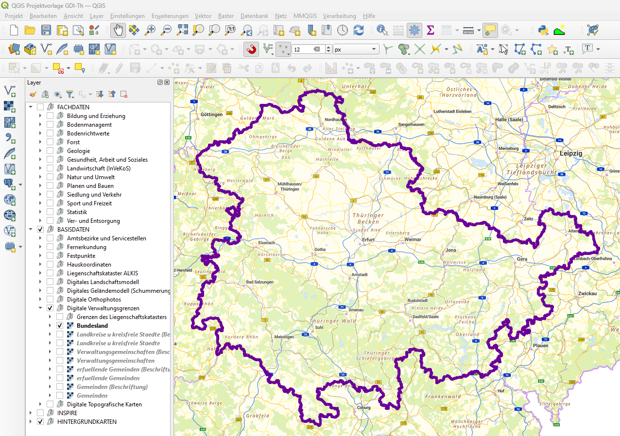
QGIS-WMS-Projektvorlage
Die Geodateninfrastruktur Thüringen (GDI-Th) enthält eine Vielzahl von Darstellungsdiensten (WMS-Services), die unter anderem in QGIS zur Visualisierung der thüringischen Geodaten eingebunden werden können. Die hier bereitgestellte QGIS-WMS-Projektvorlage vereinfacht die Nutzung dieser Dienste, da bereits alle relevanten Themen in der bereitgestellten Projektdatei eingeladen sind. Damit entfällt die sonst notwendige Recherche und der Einbindungsprozess von Dienst-URL´s. Der Aufbau des Layerbaumes orientiert sich stark an der Struktur der Themen im Thüringen Viewer.
Zur schnellen Anfertigung von PDF-Ausgaben oder zum Drucken von Karten enthält die Layout-Verwaltung einige vorgefertigte Print-Vorlagen. Es stehen die Formate DIN A4 und DIN A3 im Hoch- und Querformat zur Verfügung. Weiterhin wird zwischen fixierten und verschiebbaren Layouts unterschieden. Die Nutzung von fixierten Layouts wird besonders Einsteigern empfohlen, denn ein versehentliches Verschieben von Layoutelementen wird hier verhindert.
|
|
Citation proposal
(2024) . QGIS-WMS-Projektvorlage. https://gdk.gdi-de.org/geonetwork/srv/api/records/d7c93270-8113-4bcc-b1f5-403d59a9bec9 |
INSPIRE
Identification
- File identifier
- d7c93270-8113-4bcc-b1f5-403d59a9bec9 XML
- Hierarchy level
- Software
Online resource
- Protocol
- WWW:LINK-1.0-http--link
- Protocol
- WWW:DOWNLOAD-1.0-http--download
- Protocol
- WWW:DOWNLOAD-1.0-http--download
- Protocol
- WWW:DOWNLOAD-1.0-http--download
- Protocol
- WWW:DOWNLOAD-1.0-http--download
- Protocol
- WWW:DOWNLOAD-1.0-http--download
- Protocol
- WWW:DOWNLOAD-1.0-http--download
- Protocol
- WWW:DOWNLOAD-1.0-http--download
Resource identifier
- Metadata language
- German
Encoding
- Format
- QGIS-Projektdatei (QGZ) / QGIS-Layer-Definitionsdatei
- Version
Projection
Classification of data and services
- Topic category
-
- Planning cadastre
- Imagery base maps earth cover
- Elevation
- Health
- Environment
- Economy
- Boundaries
- Biota
- Farming
Classification of data and services
Coupled resource
Coupled resource
Classification of data and services
Coupled resource
Coupled resource
Keywords
- GDI-Th Schlüsselwörter ( Theme )
-
- opendata
Other keywords
- Keywords
-
- Thüringen
- Geodatendienste
- Geodaten
- QGIS
- Projektvorlage
- WMS-Dienste
- WMS
Geographic coverage
))
Temporal reference
Temporal extent
Temporal extent
- Date ( Creation )
- 2024-02-26
- Date ( Publication )
- 2024-02-26
- Date ( Revision )
- 2024-09-04
Quality and validity
- Lineage
- Zusammenfassung von WMS-Diensten der GDI-Th.
- Distance
- 1 m
Conformity
Conformity
Conformity
Conformity
Conformity
Conformity
- Explanation
- Originäre Daten
Restrictions on access and use
- Access constraints
- Nutzungsbedingungen: Datenlizenz Deutschland-Namensnennung 2.0 in JSON Syntax
- Access constraints
- {"id": "dl-by-de/2.0", "name": "Datenlizenz Deutschland Namensnennung 2.0", "url": "https://www.govdata.de/dl-de/by-2-0 ", "quelle": "© GDI-Th"}
Restrictions on access and use
Responsible organization (s)
Contact for the resource
- Organisation name
- Thüringer Landesamt für Bodenmanagement und Geoinformation
Responsible organization (s)
Contact for the resource
- Organisation name
- Thüringer Landesamt für Bodenmanagement und Geoinformation
Metadata information
Contact for the metadata
- Organisation name
- Thüringer Landesamt für Bodenmanagement und Geoinformation
- Date stamp
- 2024-09-23T14:32:47
- Metadata language
- German
- Character set
- UTF8
SDS
Conformance class 1: invocable
Access Point URL
Endpoint URL
Technical specification
Conformance class 2: interoperable
Coordinate reference system
Quality of Service
Access constraints
Limitation
Use constraints
Limitation
Responsible custodian
Contact for the resource
Conformance class 3: harmonized
Overviews

Provided by

 www.geodatenkatalog.de (S2L)