 www.geodatenkatalog.de (S3L)
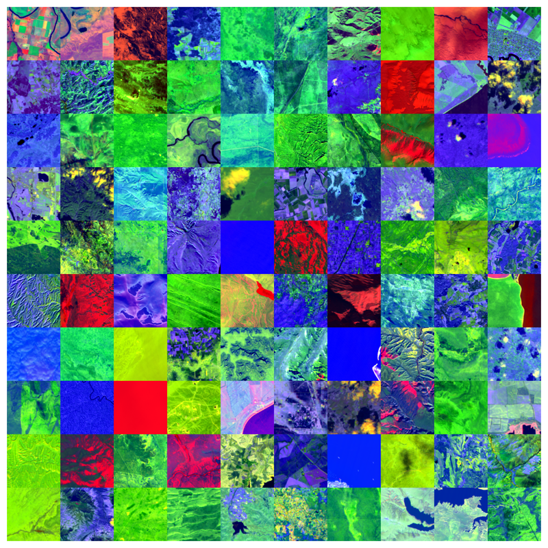
EnMAP HSI – SpectralEarth, non-georeferenced – Global
The Environmental Mapping and Analysis Program (EnMAP) is a German hyperspectral satellite mission to monitoring and characterise Earth’s environment on a global scale. EnMAP measures and models key dynamic processes of Earth’s ecosystems by extracting geochemical, biochemical and biophysical parameters that provide information on the status and evolution of various terrestrial and aquatic ecosystems. The mission’s main objective is to study and decipher coupled environmental processes and to assist and promote the sustainable management of Earth’s resources.
This collection includes Level 0 quicklook images of the mission. For more information, please see the mission website: https://www.enmap.org/mission/
|
|
Citation proposal
German Aerospace Center (DLR). EnMAP HSI – SpectralEarth, non-georeferenced – Global. https://gdk.gdi-de.org/geonetwork/srv/api/records/d98099fd-b2c2-4749-9a05-d00ef0a0df49 |
INSPIRE
Identification
- File identifier
- d98099fd-b2c2-4749-9a05-d00ef0a0df49 XML
- Hierarchy level
- Series
Online resource
- Protocol
- WWW:LINK-1.0-http--link
Resource identifier
- Metadata language
- English English
- Spatial representation type
- Grid
Encoding
- Format
- GeoTIFF
Projection
Classification of data and services
- Topic category
-
- Imagery base maps earth cover
Classification of data and services
Coupled resource
Coupled resource
Classification of data and services
Coupled resource
Coupled resource
Keywords
- GEMET - INSPIRE themes, version 1.0 ( Theme )
-
- Orthoimagery
- Spatial scope ( Place )
Other keywords
- Keywords
-
- DLR
- EOC
- ENMAP
- HSI
- Global
- hyperspectral
- geospatial foundation models
- land cover classification
- unsupervised change detection
Geographic coverage
))
Temporal reference
Temporal extent
Temporal extent
- Date ( Creation )
- 2024-08-15T00:00:00
Quality and validity
- Lineage
- SpectralEarth is derived from DLR EnMAP L2A data. Downstream task data have been collected from CORINE landcover, CDL, and NLCD.
- Denominator
- 60000
Conformity
Conformity
Conformity
Conformity
Conformity
Conformity
- Explanation
- See the referenced specification.
Restrictions on access and use
- Access constraints
- Nutzungsbedingungen: Lizenz, https://www.enmap.org/data_access/ Terms of use: https://www.enmap.org/data_access/
Restrictions on access and use
Responsible organization (s)
Contact for the resource
- Organisation name
- German Aerospace Center (DLR)
- geoservice@dlr.de
- Organisation name
- German Aerospace Center (DLR)
Responsible organization (s)
Contact for the resource
- Organisation name
- German Aerospace Center (DLR)
- geoservice@dlr.de
- Organisation name
- German Aerospace Center (DLR)
Metadata information
Contact for the metadata
- Organisation name
- German Aerospace Center (DLR)
- geoservice@dlr.de
- Date stamp
- 2024-09-17T09:14:28
- Metadata language
- English English
- Character set
- UTF8
SDS
Conformance class 1: invocable
Access Point URL
Endpoint URL
Technical specification
Conformance class 2: interoperable
Coordinate reference system
Quality of Service
Access constraints
Limitation
Use constraints
Limitation
Responsible custodian
Contact for the resource
Conformance class 3: harmonized
Overviews

Provided by
