 www.geodatenkatalog.de (S3L)
Streckennetz DB Netz AG
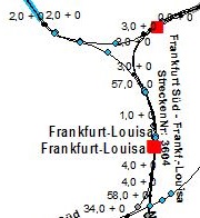
Das Streckennetz der DB Netz AG mit Strecken, Betriebsstellen, Brücken, Tunnel, Bahnübergängen, Straßenüberführungen, Kilometerpunkten, Kilometrierungssprünge, Schutzwände und Schutzwandtüren.
|
|
Citation proposal
. Streckennetz DB Netz AG. https://gdk.gdi-de.org/geonetwork/srv/api/records/d9ed1b3a-30a6-11e7-93ae-92361f002671 |
INSPIRE
Identification
- File identifier
- d9ed1b3a-30a6-11e7-93ae-92361f002671 XML
- Hierarchy level
- dataset Dataset
Online resource
Resource identifier
- Metadata language
- German
- Spatial representation type
- Vector
Encoding
- Format
- Shapefiles
- Version
- 1.0
Projection
Classification of data and services
- Topic category
-
- Transportation
Classification of data and services
Coupled resource
Coupled resource
Classification of data and services
Coupled resource
Coupled resource
Keywords
- GEMET - Concepts, version 3.1 ( Theme )
Other keywords
- Keywords
-
- Streckennetz
- Straßenüberführung
- Bahnübergang
- Deutsche Bahn
- DB Netz
- Betriebstelle
- Kilometerpunkt
- Schutzwandtür
- Schutzwand
- Haltepunkt
Geographic coverage
N
S
E
W
))
Temporal reference
Temporal extent
Temporal extent
- Date ( Creation )
- 2016-11-01T00:00:00.000+01:00
- Date ( Revision )
- 2019-10-01T00:00:00.000+02:00
Quality and validity
- Lineage
- Daten werden von der DB Netz AG geliefert
- Denominator
- 25000
Conformity
Conformity
Conformity
Conformity
Conformity
Conformity
- Explanation
- see the referenced specification
Restrictions on access and use
- Access constraints
- Es gelten Zugriffsbeschränkungen. Für den Erwerb von Nutzungsrechten wenden Sie sich deshalb bitte an die Zentrale Stelle Geotopographie der AdV (ZSGT) / Dienstleistungszentrum (DLZ) des Bundesamtes für Kartographie und Geodäsie: https://www.bkg.bund.de/DE/Service/Kontakt/kontakt.html.
- Access constraints
- Die Daten sind urheberrechtlich geschützt. Auf Grundlage des Vertrages mit dem Datenanbieter werden die Daten je nach vertraglicher Ausgestaltung allen oder ausgewählten Bundesbehörden und weiteren Nutzungsberechtigten im Sinne des § 4 V GeoBund geldleistungsfrei zur Verfügung gestellt. Der Quellenvermerk ist zu beachten.
Restrictions on access and use
Responsible organization (s)
Contact for the resource
- Organisation name
- Bundesamt für Kartographie und Geodäsie (BKG)
- dlz@bkg.bund.de
- Organisation name
- Bundesamt für Kartographie und Geodäsie (BKG)
- dlz@bkg.bund.de
- Organisation name
- Bundesamt für Kartographie und Geodäsie (BKG)
- mailbox@bkg.bund.de
Metadata information
Contact for the metadata
- Organisation name
- Bundesamt für Kartographie und Geodäsie (BKG)
- dlz@bkg.bund.de
- Date stamp
- 2025-04-10
- Metadata language
- German
- Character set
- UTF8
SDS
Conformance class 1: invocable
Access Point URL
Endpoint URL
Technical specification
Conformance class 2: interoperable
Coordinate reference system
Quality of Service
Access constraints
Limitation
Use constraints
Limitation
Responsible custodian
Contact for the resource
Conformance class 3: harmonized
Overviews
Provided by

Views
d9ed1b3a-30a6-11e7-93ae-92361f002671
Access to the portal
Read here the full details and access to the data.
Associated resources
Not available