 www.geodatenkatalog.de (S1L)
Postleitzahlen Land Brandenburg
Das PLZ-Shape des Landes Brandenburg enthält hausgenaue Geometriedaten der Postleitzahlengebiete als Grenzpolygone und die Postleitzahlen als Text. Die Grundlage der Grenzdarstellung ist das Basis-DLM. Die postalischen Informationen wurden anhand des Postleitzahlenbuches vom Oktober 2005 erstellt und werden seitdem entsprechend den offiziellen Informationen, die quartalsweise von der Deutschen Post AG herausgegeben werden, aktualisiert. Die Daten werden über automatisierte Verfahren oder durch Selbstentnahme kostenfrei bereitgestellt. Bei Nutzung der Daten sind die Lizenzbedingungen zu beachten.
|
|
Citation proposal
(2024) . Postleitzahlen Land Brandenburg. Landesvermessung und Geobasisinformation Brandenburg (LGB) https://gdk.gdi-de.org/geonetwork/srv/api/records/dc69bf4a-9fc7-42e8-8332-57d30ff6b993 |
INSPIRE
Identification
- File identifier
- dc69bf4a-9fc7-42e8-8332-57d30ff6b993 XML
- Hierarchy level
- dataset Dataset
Online resource
Resource identifier
- Metadata language
- ger German
- Spatial representation type
- vector Vector
Encoding
Projection
Classification of data and services
- Topic category
-
- Boundaries
Classification of data and services
Coupled resource
Coupled resource
Classification of data and services
Coupled resource
Coupled resource
Keywords
- BE/BB Schlagwortliste, Version 1.0 ( Theme )
-
- Vermessung
Other keywords
- Keywords
-
- opendata
- Keywords ( Theme )
-
- Vektordaten
- Statistik
- Sachdaten
- Verwaltung
- bboxbebb
- Planung
- bodenbedeckung
- Gemeinden
Geographic coverage
N
S
E
W
))
Temporal reference
Temporal extent
Temporal extent
- Date ( Publication )
- 2024-03-26T00:00:00
- Date ( Revision )
- 2024-04-01T00:00:00
- Date ( Creation )
- 2006-03-31T00:00:00
Quality and validity
- Lineage
- Eine Auskunft über die Herkunft der Daten erhalten Sie per Anfrage an die E-Mail kundenservice@geobasis-bb.de.
- Denominator
- 25000
Conformity
Conformity
Conformity
Conformity
Conformity
Conformity
Restrictions on access and use
- Access constraints
- Die Daten können gemäß der „Datenlizenz Deutschland - Namensnennung - Version 2.0“ (https://www.govdata.de/dl-de/by-2-0) genutzt werden. Namensnennung: "GeoBasis-DE/LGB", Beispiel: „© GeoBasis-DE/LGB, dl-de/by-2-0, (Daten geändert)“, (Klammer = optional)
- Access constraints
- {"id":"dl-by-de/2.0","name":"Datenlizenz Deutschland - Namensnennung - Version 2.0","url":"https://www.govdata.de/dl-de/by-2-0","quelle":"Quelle: © GeoBasis-DE/LGB, dl-de/by-2-0"}
Restrictions on access and use
Responsible organization (s)
Contact for the resource
- Organisation name
- Landesvermessung und Geobasisinformation Brandenburg (LGB)
Responsible organization (s)
Contact for the resource
- Organisation name
- Landesvermessung und Geobasisinformation Brandenburg (LGB)
Metadata information
Contact for the metadata
- Organisation name
- Landesvermessung und Geobasisinformation Brandenburg (LGB)
- Date stamp
- 2024-03-26T09:48:38
- Metadata language
- ger German
- Character set
- utf8 UTF8
SDS
Conformance class 1: invocable
Access Point URL
Endpoint URL
Technical specification
Conformance class 2: interoperable
Coordinate reference system
Quality of Service
Access constraints
Limitation
Use constraints
Limitation
Responsible custodian
Contact for the resource
Conformance class 3: harmonized
Overviews
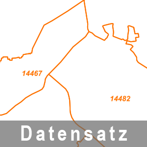
Ausschnitt aus dem Datenbestand Postleitzahlen
Provided by

Views
dc69bf4a-9fc7-42e8-8332-57d30ff6b993
Access to the portal
Read here the full details and access to the data.
Associated resources
Not available