 www.geodatenkatalog.de (S3L)
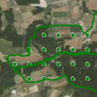
Landschaftsschutzgebiete
Landschaftsschutzgebiete dienen in erster Linie dem Schutz des Naturhaushalts und seiner Funktionsfähigkeit. (Aktualisierung am 01.05. und 01.12. jährlich)
|
|
Citation proposal
. Landschaftsschutzgebiete. https://gdk.gdi-de.org/geonetwork/srv/api/records/e0d3ec70-007a-11e0-be74-0000779eba3a |
INSPIRE
Identification
- File identifier
- e0d3ec70-007a-11e0-be74-0000779eba3a XML
- Hierarchy level
- dataset Dataset
Online resource
Resource identifier
- Metadata language
- German
- Spatial representation type
- Vector
Encoding
- Format
- Shapefile
- Format
- Datenbank
Projection
Classification of data and services
- Topic category
-
- Environment
Classification of data and services
Coupled resource
Coupled resource
Classification of data and services
Coupled resource
Coupled resource
Keywords
- GEMET - INSPIRE themes, version 1.0 ( Theme )
-
- Schutzgebiete
- Spatial scope
- High-value dataset categories ( Theme )
Other keywords
- Keywords
-
- UmweltAtlas
- gdiby
- Landschaftsschutzgebiet
- Schutzgebiet
- Umweltschutz
- Naturschutz
- Landschaftsschutz
- Landschaft
- Naturhaushalt
- nachhaltige Nutzung
- umweltverträgliche Landnutzung
- HVD
- opendata
- Keywords ( Theme )
-
- ENVI
- Keywords
-
- inspireidentifiziert
Geographic coverage
N
S
E
W
))
Temporal reference
Temporal extent
Temporal extent
- Date ( Creation )
- 2020-05-01T00:00:00.000+02:00
Quality and validity
- Lineage
- Digitale Erfassung von Flächen der Landschaftsschutzgebiete im Bundesland Bayern im Maßstabsbereich 1:1000 bis 1:25000
- Denominator
- 25000
Conformity
Conformity
Conformity
Conformity
Conformity
Conformity
- Explanation
- see the referenced specification
- Explanation
- see the referenced specification
Restrictions on access and use
- Access constraints
- Creative Commons Namensnennung 4.0 International (CC BY 4.0); Datenquelle: Bayerisches Landesamt für Umwelt, www.lfu.bayern.de; Die Nutzung von Daten über Dienste ist geldleistungsfrei. Bei Bezug von Daten über die Datenstelle des LfU (nur Daten, die nicht über Dienste verfügbar sind) wird eine Bereitstellungsgebühr erhoben, die sich an der Umweltgebührenordnung orientiert.
- Access constraints
- {"id":"cc-by/4.0","name":"Creative Commons Namensnennung 4.0 International (CC BY 4.0)","url":"https://creativecommons.org/licenses/by/4.0/deed.de","quelle":"Bayerisches Landesamt für Umwelt, www.lfu.bayern.de"}
Restrictions on access and use
Responsible organization (s)
Contact for the resource
- Organisation name
- Bayerisches Landesamt für Umwelt
Responsible organization (s)
Contact for the resource
- Organisation name
- Bayerisches Landesamt für Umwelt
Metadata information
Contact for the metadata
- Organisation name
- Bayerisches Landesamt für Umwelt
- Date stamp
- 2024-06-28
- Metadata language
- German
- Character set
- UTF8
SDS
Conformance class 1: invocable
Access Point URL
Endpoint URL
Technical specification
Conformance class 2: interoperable
Coordinate reference system
Quality of Service
Access constraints
Limitation
Use constraints
Limitation
Responsible custodian
Contact for the resource
Conformance class 3: harmonized
Overviews
Provided by

Views
e0d3ec70-007a-11e0-be74-0000779eba3a
Access to the portal
Read here the full details and access to the data.
Associated resources
Not available