 www.geodatenkatalog.de (S1F)
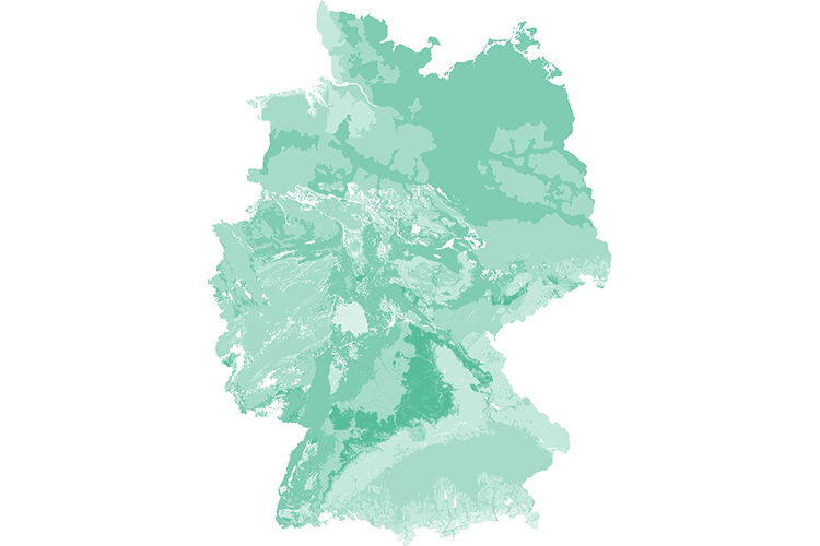
Groundwater Background Values of Germany (HGW)
The spatial distribution of geogenic groundwater background values for hydrogeochemical and physicochemical parameters of the near-surface groundwater bodies is represented based on the HÜK200. Background values are used to describe the nature of the groundwater bodies and provide a basis for decisions on the differentiation between geogenic and conspicuous data. The representation of background values is a contribution of SGD and BGR to describe groundwater bodies and thus serves to implement the European Water Framework Directive (WFD).
|
|
Citation proposal
. Groundwater Background Values of Germany (HGW). https://gdk.gdi-de.org/geonetwork/srv/api/records/e174a14a-0b86-4341-886f-019c6d267714 |
INSPIRE
Identification
- File identifier
- e174a14a-0b86-4341-886f-019c6d267714 XML
- Hierarchy level
- Dataset
Online resource
Resource identifier
- code
- 72eb271d-0649-489e-9789-34b5d21a54e5
- Metadata language
- German
- Spatial representation type
- Vector
Encoding
- Format
- Shapefile
- Version
- n/a
Projection
Classification of data and services
- Topic category
-
- Geoscientific information
Classification of data and services
Coupled resource
Coupled resource
Classification of data and services
Coupled resource
Coupled resource
Keywords
- GEMET - INSPIRE themes, version 1.0 ( Theme )
-
- Geologie
- geology
- GEMET - Concepts, version 2.4 ( Theme )
-
- Grundwasser
- Grundwassergefährdung
- Grundwasserschutz
- Hydrogeologie
- Hydrogeologische Großräume
- Hydrogeologische Räume
- Hydrogeologische Regionen
- Hydrogeologische Teilräume
- Karte
- Wasser
Other keywords
- Keywords ( Theme )
-
- Deckschicht
- Geodaten
- Geogene Hintergrundwerte
- Geoinformationssystem
- GIS
- Grundwasserbeschaffenheit
- Grundwasserüberdeckung
- HGW
- hgw
- HUEK 200
- HUEK200
- HÜK 200
- HÜK200
- Hydrochemie
- Hydrogeochemie
- Kartenanwendung
- Messstellen
- Oberer Grundwasserleiter
- Schutzpotential
- Vektordaten
- Keywords ( Place )
-
- Deutschland
Geographic coverage
N
S
E
W
))
Temporal reference
Temporal extent
Temporal extent
- Date ( Revision )
- 2014-10-06
Quality and validity
- Lineage
- Messwerte der Staatlichen Geologischen Dienste, Hydrogeologische Einheiten der HÜK200, Hydrogeologische Räume
- Denominator
- 200000
Conformity
Conformity
Conformity
Conformity
Conformity
Conformity
- Explanation
- siehe dazu die angegebene Durchführungsbestimmung
Restrictions on access and use
- Access constraints
- Allgemeine Geschäftsbedingungen, siehe https://www.bgr.bund.de/AGB - General terms and conditions, see https://www.bgr.bund.de/AGB_en. Die bereitgestellten Informationen sind bei Weiterverwendung wie folgt zu zitieren: Datenquelle: HGW v2.9.2, (c) BGR & SGD 2014
Restrictions on access and use
Responsible organization (s)
Contact for the resource
- Organisation name
- Bundesanstalt für Geowissenschaften und Rohstoffe (BGR)
- fis.hy@bgr.de
Responsible organization (s)
Contact for the resource
- Organisation name
- Bundesanstalt für Geowissenschaften und Rohstoffe (BGR)
- fis.hy@bgr.de
Metadata information
Contact for the metadata
- Organisation name
- Bundesanstalt für Geowissenschaften und Rohstoffe (BGR)
- Date stamp
- 2025-04-07
- Metadata language
- German
- Character set
- UTF8
SDS
Conformance class 1: invocable
Access Point URL
Endpoint URL
Technical specification
Conformance class 2: interoperable
Coordinate reference system
Quality of Service
Access constraints
Limitation
Use constraints
Limitation
Responsible custodian
Contact for the resource
Conformance class 3: harmonized
Overviews
Provided by

Views
e174a14a-0b86-4341-886f-019c6d267714
Access to the portal
Read here the full details and access to the data.
Associated resources
Not available