 www.geodatenkatalog.de (S3F)
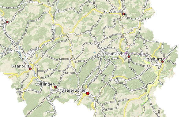
Flächennutzung HQ100 Saarland
Die Hochwasserrisikokarte HQ100 stellt die Landnutzung der überschwemmten Flächen bei Ereignisse dar, die im statistischen Mittel alle 100 Jahre auftreten können. Folgende Nutzungsklassen wurden unterschieden: Klasse 1: Wohnbauflächen, Flächen gemischter Nutzung (rot); Klasse 2: landwirtschaftlich genutzte Flächen, Wald, Forst (gelb); Klasse 3: sonstige Vegetations- und Freiflächen (grün); Klasse 4: Industrie- und Gewerbeflächen, Fl. mit funktionaler Prägung (magenta); Klasse 5: Verkehrsflächen (grau); Klasse 6: Gewässerflächen (blau); Bei Deichgeschützten Gebieten wurde im Feld Schutz die Zahl 10 eingetragen und diese aufaddiert, so dass sich entsprechend der obigen Reigenfolge, die Klassen 11 bis 16 für die geschützen Bereiche ergibt. Diese werden mit der gleichen Farbe, jedoch nicht flächig, sondern schraffiert dargestellt. Die Klassifizierung erfolgte durch Zusammenfassungen aus den ATKIS Typen nach Art der wirtschaftlichen Tätigkeit entsprechend der Vorgabe aus dem LAWA Entwurf vom 25./26.03.2010 Dresden " Empfehlungen zur Aufstellung von Hochwassergefahrenkarten und Hochwasserrisikokarten. Attribute: NUTZUNG: Beschreibung der Nutzungsklasse SCHUTZ: Schutzstatus (0 = nein; 10 = ja) KLASSE: Risikoklasse GEWAESSER: Gewässername GEWKZ: Gewässerkennziffer
|
|
Citation proposal
(2010) . Flächennutzung HQ100 Saarland. https://gdk.gdi-de.org/geonetwork/srv/api/records/e20302b0-0338-449e-9c0e-11378779a129 |
- Identification
- Distribution
- Quality
- Spatial rep.
- Ref. system
- Content
- Portrayal
- Metadata
- Md. constraints
- Md. maintenance
- Schema info
Identification
Data identification
Citation
- Date ( Creation )
- 2010-12-15
- Date ( Publication )
- 2010-12-15
- Date ( Revision )
- 2018-11-08
Point of contact
Landesamt für Umwelt- und Arbeitsschutz
-
Fachbereich 2.4 Gewässerentwicklung und Hochwasserschutz
Don-Bosco-Straße 1
Saarbrücken
Saarland
66119
Deutschland
Format
- Name
- filegdb-featureClass
- Version
- 10.0
- GEMET - INSPIRE themes, version 1.0 ( Theme )
-
- Gebiete mit naturbedingten Risiken
- GEMET - Concepts, version 2.4 ( Theme )
-
- Geowissenschaften
- Keywords
-
- geoportal
- mapbender.2.inspireWholeArea
-
- 2500
- mapbender.2.inspireActualCoverage
-
- 2500
- Keywords ( Place )
-
- Saarland
- Spatial scope
-
- Regional
Resource constraints
No information provided.
Resource constraints
No information provided.
Resource constraints
No information provided.
Resource constraints
No information provided.
Resource constraints
No information provided.
Resource constraints
No information provided.
Resource constraints
No information provided.
Resource constraints
No information provided.
Resource constraints
No information provided.
Resource constraints
No information provided.
Resource constraints
No information provided.
Resource constraints
No information provided.
Resource constraints
No information provided.
Resource constraints
No information provided.
Resource constraints
No information provided.
- Classification
- Unclassified
- Use limitation
- Maßstabsbeschränkung im Geoportal. Die Nutzungsbedingungen sind mit der zuständigen Stelle individuell abzuklären.
Legal constraints
- Access constraints
- Other restrictions
Legal constraints
- Use constraints
- Other restrictions
- Other constraints
- Die Nutzungsbedingungen sind mit der zuständigen Stelle individuell abzuklären.
- Spatial representation type
- Vector
- Denominator
- 5000
- Metadata language
- German
- Character set
- UTF8
- Topic category
-
- Geoscientific information
N
S
E
W
))
- Geographic identifier
- Saarland
- Geographic identifier
- 100000000000
Distribution
Distribution
- Distribution format
-
- Esri Shape (1.0 )
Distributor
Ministerium für Umwelt, Klima, Mobilität, Agrar und Verbraucherschutz
-
Referat E/6 Geodatenzentrum
Von der Heydt 22
Saarbrücken
Saarland
66115
Deutschland
- OnLine resource
-
Geoportal SL
Geoportal SL
- OnLine resource
-
Geoportal SL
Geoportal SL
- OnLine resource
-
Shape Download
Shape Download
Quality
Data quality
Scope
- Hierarchy level
- Dataset
Conformance result
Citation
- Date ( Publication )
- 2010-12-08
- Explanation
- Getestet mit GDI - DE Testsuite und INSPIRE new Geoportal validator
- Pass
- false
- Statement
- Die Daten wurden 2010 aus den ATKIS Daten des LVGL abgeleitet. Projektbearbeitung: Firma eepi, Luxembourg und Fa. NetGIS (Blies) Verschneidungsergebnis der Nutzungsklassen aus ATKIS mit der Wasserspiegellage des HQ100 Ereignisses.
Metadata
Metadata
- File identifier
- e20302b0-0338-449e-9c0e-11378779a129 XML
- Metadata language
- German
- Character set
- UTF8
- Hierarchy level
- Dataset
- Date stamp
- 2023-07-26
- Metadata standard name
- ISO19115
- Metadata standard version
- 2003/Cor.1:2006
Point of contact
Ministerium für Umwelt, Klima, Mobilität, Agrar und Verbraucherschutz
-
Referat E/6 Geodatenzentrum
Von der Heydt 22
Saarbrücken
Saarland
66115
Deutschland
- Dataset URI
- M:\suis\SUIS_GDB.gdb?ResourceName=Nutzung_100
Overviews
Flächennutzung HQ100
Provided by

Views
e20302b0-0338-449e-9c0e-11378779a129
Access to the portal
Read here the full details and access to the data.
Associated resources
Not available