 www.geodatenkatalog.de (S3F)
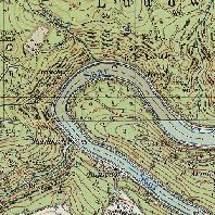
Top. Karte 1:25000 Ausgaben 1957-1965
Top. Karte 1:25000 Ausgaben 1957-1965
|
|
Citation proposal
(2018) . Top. Karte 1:25000 Ausgaben 1957-1965. https://gdk.gdi-de.org/geonetwork/srv/api/records/e27f7e8f-df63-46f4-b350-d7163736d544 |
INSPIRE
Identification
- File identifier
- e27f7e8f-df63-46f4-b350-d7163736d544 XML
- Hierarchy level
- Dataset
Online resource
Resource identifier
- Metadata language
- German
- Spatial representation type
- Grid
Encoding
Projection
Classification of data and services
- Topic category
-
- Imagery base maps earth cover
- Location
Classification of data and services
Coupled resource
Coupled resource
Classification of data and services
Coupled resource
Coupled resource
Keywords
Other keywords
- Keywords
-
- opendata
- Keywords ( Place )
-
- Saarland
- Keywords
-
- Geoportal
Geographic coverage
N
S
E
W
))
Temporal reference
Temporal extent
Temporal extent
- Date ( Publication )
- 2018-06-13
Quality and validity
- Lineage
- K.A.
- Denominator
- 25000
Conformity
Conformity
Conformity
Conformity
Conformity
Conformity
Restrictions on access and use
- Access constraints
- Lizenz: dl-de/by-2-0 - Datenlizenz Deutschland Namensnennung 2.0 - https://www.govdata.de/dl-de/by-2-0 - Quellenvermerk: © GeoBasis DE/LVGL-SL (Jahr)
- Access constraints
- {"id":"dl-by-de/2.0","name":"Datenlizenz Deutschland Namensnennung 2.0","url":"https://www.govdata.de/dl-de/by-2-0","quelle":"© GeoBasis DE/LVGL-SL (Jahr)"}
Restrictions on access and use
Responsible organization (s)
Contact for the resource
- Organisation name
- Landesamt für Vermessung, Geoinformation und Landentwicklung
Responsible organization (s)
Contact for the resource
- Organisation name
- Landesamt für Vermessung, Geoinformation und Landentwicklung
Metadata information
Contact for the metadata
- Organisation name
- Landesamt für Vermessung, Geoinformation und Landentwicklung
- Date stamp
- 2025-06-03T06:12:57.42596Z
- Metadata language
- German
- Character set
- UTF8
SDS
Conformance class 1: invocable
Access Point URL
Endpoint URL
Technical specification
Conformance class 2: interoperable
Coordinate reference system
Quality of Service
Access constraints
Limitation
Use constraints
Limitation
Responsible custodian
Contact for the resource
Conformance class 3: harmonized
Overviews
Provided by

Views
e27f7e8f-df63-46f4-b350-d7163736d544
Access to the portal
Read here the full details and access to the data.
Associated resources
Not available