 www.geodatenkatalog.de (S2L)
IS HK 50 WMS - Informationssystem Hydrogeologische Karte von Nordrhein-Westfalen 1:50.000 - Darstellungsdienst
Dieser WMS stellt das Informationssystem Hydrogeologische Karte von Nordrhein-Westfalen 1:50.000 [IS HK 50] dar. Das Kartenwerk basiert auf den Ergebnissen der Integrierten Geologischen Landesaufnahme (IGL), geologischen Untergrundmodellen sowie Grundwasserdaten des Landesamtes für Natur, Umwelt und Klima Nordrhein-Westfalen (LANUK NRW). Der Datensatz ist im Aufbau und nicht flächendeckend. Dargestellte Kartenthemen: Grundlagen, Hydrogeologischer Bau, Hydrogeologische Schnitte, Risiko von Stoffeinträgen in das Grundwasser sowie Transmissivität.
|
|
Citation proposal
(2025) . IS HK 50 WMS - Informationssystem Hydrogeologische Karte von Nordrhein-Westfalen 1:50.000 - Darstellungsdienst. https://gdk.gdi-de.org/geonetwork/srv/api/records/e64346a0-7f4d-4e66-b921-2aae22339c85 |
INSPIRE
Identification
- File identifier
- e64346a0-7f4d-4e66-b921-2aae22339c85 XML
- Hierarchy level
- Service
Online resource
Resource identifier
Encoding
Projection
Classification of data and services
Classification of data and services
- Service Type
- WMS
- Coupling Type
- Tight
Coupled resource
Coupled resource
Classification of data and services
- Service Type
- WMS
- Coupling Type
- Tight
Coupled resource
Coupled resource
Keywords
- UMTHES Thesaurus ( Discipline )
-
- Grundwasser
- Hydrogeologie
- Hydrologie
- Hydrogeologische Karte
- Geowissenschaft
- Service Classification, version 1.0
-
- infoMapAccessService
Other keywords
- Keywords ( Theme )
-
- ISHK50
- HK50
- Hydrogeologische Einheiten
- Durchlässigkeit
Geographic coverage
N
S
E
W
))
Temporal reference
Temporal extent
Temporal extent
- Date ( Creation )
- 2024-08-06
- Date ( Publication )
- 2025-04-14
Quality and validity
Conformity
Conformity
Conformity
Conformity
Conformity
Conformity
Restrictions on access and use
Restrictions on access and use
Responsible organization (s)
Contact for the resource
- Organisation name
- Geologischer Dienst NRW
- geodaten@gd.nrw.de
Responsible organization (s)
Contact for the resource
- Organisation name
- Geologischer Dienst NRW
- geodaten@gd.nrw.de
Metadata information
Contact for the metadata
- Organisation name
- Geologischer Dienst NRW
- metadaten@gd.nrw.de
- Date stamp
- 2025-05-15
- Metadata language
- German
SDS
Conformance class 1: invocable
Access Point URL
Endpoint URL
Technical specification
Conformance class 2: interoperable
Coordinate reference system
Quality of Service
Access constraints
- Access constraints
- Other restrictions
Limitation
Use constraints
- Use constraints
- Other restrictions
Limitation
Responsible custodian
Contact for the resource
Conformance class 3: harmonized
Contains Operations
- Operation Name
- GetCapabilities
- Distributed Computing Platforms
- Web services
- Connect Point
- https://www.wms.nrw.de/gd/hk50?
Overviews
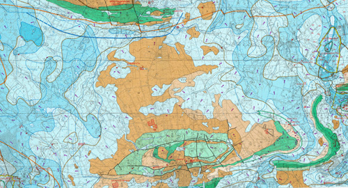
Vorschaubild HK 50 WMS
Provided by

Views
e64346a0-7f4d-4e66-b921-2aae22339c85
Access to the portal
Read here the full details and access to the data.
Associated resources
Not available