 www.geodatenkatalog.de (S1F)
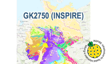
INSPIRE: Geological Map of Germany 1:2,750,000 (GK2750)
The GK2750 Geology (INSPIRE) represents the surface geology of Germany and adjacent areas on a scale of 1:2,750,000. According to the Data Specification on Geology (D2.8.II.4_v3.0) the content of the geological map is stored in three INSPIRE-compliant GML files: GK2750_GeologicUnit.gml contains the geologic units, GK2750_GeologicStructure.gml comprises the faults and GK2750_NaturalGeomorphologicFeature.gml represents the marginal position of the ice shield and the impact crater Nördlinger Ries. The GML files together with a Readme.txt file are provided in ZIP format (GK2750-INSPIRE.zip). The Readme.text file (German/English) contains detailed information on the GML files content. Data transformation was proceeded by using the INSPIRE Solution Pack for FME according to the INSPIRE requirements.
|
|
Citation proposal
(2020) . INSPIRE: Geological Map of Germany 1:2,750,000 (GK2750). https://gdk.gdi-de.org/geonetwork/srv/api/records/ea100b2f-dae9-4e40-9f5c-a0f07b777b68 |
- Identification
- Distribution
- Quality
- Spatial rep.
- Ref. system
- Content
- Portrayal
- Metadata
- Md. constraints
- Md. maintenance
- Schema info
Identification
Data identification
Citation
- Alternate title
- GK2750 (INSPIRE)
- Date ( Publication )
- 2020-07-02
- Date ( Revision )
- 2025-03-18
- Status
- completed Completed
Point of contact
- GEMET - INSPIRE themes, version 1.0 ( Theme )
-
- Geologie
- Geology
- Keywords ( Theme )
-
- Genese
- genesis
- inspireidentifiziert
- Petrographie
- petrography
- Stratigraphie
- stratigraphy
- Tektonik
- tectonics
- opendata
- Keywords ( Place )
-
- Deutschland
- Germany
- Spatial scope
-
- National
- High-value dataset categories
-
- Erdbeobachtung und Umwelt
Legal constraints
- Access constraints
- Other restrictions
Legal constraints
- Use constraints
- Other restrictions
- Other constraints
- General Terms and Conditions, s. https://www.bgr.bund.de/agb_en
- Other constraints
- Dieser Datensatz kann gemäß der "Nutzungsbestimmungen für die Bereitstellung von Geodaten des Bundes" (https://sg.geodatenzentrum.de/web_public/gdz/lizenz/geonutzv.pdf) genutzt werden.
- Other constraints
- {"id": "geonutz/20130319", "name": "Nutzungsbestimmungen für die Bereitstellung von Geodaten des Bundes", "url": "https://sg.geodatenzentrum.de/web_public/gdz/lizenz/geonutzv.pdf", "quelle": "Quelle: Bundesanstalt für Geowissenschaften und Rohstoffe (BGR)"}
- Spatial representation type
- Vector
- Denominator
- 2750000
- Metadata language
- eng English
- Character set
- utf8 UTF8
- Topic category
-
- Geoscientific information
N
S
E
W
))
- Geographic identifier
- Regionalschlüssel / 000000000000
Distribution
Distribution
- Distribution format
-
- INSPIRE-GML (n/a )
Digital transfer options
- Transfer size
- 3
- OnLine resource
-
GK2750 (INSPIRE) (INSPIRE-GML)
GK2750 (INSPIRE) im Format INSPIRE-GML
- OnLine resource
-
Karte im BGR-Geoviewer
Karte im BGR-Geoviewer
Quality
Data quality
Scope
- Hierarchy level
- Dataset
Conformance result
Citation
- Date ( Publication )
- 2013-12-10
- Explanation
- See the referenced specification
- Pass
- true
Conformance result
Citation
- Date ( Publication )
- 2010-12-08
- Explanation
- See the referenced specification
- Statement
- The GK2750 Geology (INSPIRE) GML files based on the spatial dataset of the Geological Map of Germany 1:2,750,000 - Geology (GK2750 Geology) transformed according to INSPIRE.
Metadata
Metadata
- File identifier
- ea100b2f-dae9-4e40-9f5c-a0f07b777b68 XML
- Metadata language
- English
- Character set
- utf8 UTF8
- Hierarchy level
- dataset Dataset
- Hierarchy level name
- Geologie
- Hierarchy level name
- INSPIRE
- Date stamp
- 2025-03-18
- Metadata standard name
- INSPIRE Metadata Implementing Rules: Technical Guidelines based on EN ISO 19115 and EN ISO 19119
- Metadata standard version
- n/a
Point of contact
Overviews
Provided by

Views
ea100b2f-dae9-4e40-9f5c-a0f07b777b68
Access to the portal
Read here the full details and access to the data.
Associated resources
Not available