 www.geodatenkatalog.de (S3L)
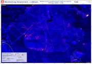
Mecklenburg-Vorpommern - Lübtheen - P03 - Thermales Luftbild - Waldbrand Situation am 02. Juli 2019 zwischen 16:50 und 17:20 UTC
Luftbildkarte der Waldbrandsituation bei Lübtheen, Mecklenburg-Vorpommern auf Basis von thermalen Luftbildaufnahmen vom 02. Juli 2019, zwischen 16:50 und 17:20 UTC.
|
|
Citation proposal
. Mecklenburg-Vorpommern - Lübtheen - P03 - Thermales Luftbild - Waldbrand Situation am 02. Juli 2019 zwischen 16:50 und 17:20 UTC. https://gdk.gdi-de.org/geonetwork/srv/api/records/f05bbcfe-97dd-5333-90f7-50b891096fa3 |
INSPIRE
Identification
- File identifier
- f05bbcfe-97dd-5333-90f7-50b891096fa3 XML
- Hierarchy level
- Dataset
Online resource
- Protocol
- WWW:DOWNLOAD-1.0-http--download
- Protocol
- WWW:DOWNLOAD-1.0-http--download
- Protocol
- WWW:DOWNLOAD-1.0-http--download
Resource identifier
- Metadata language
- German
Encoding
Projection
Classification of data and services
- Topic category
-
- Geoscientific information
Classification of data and services
Coupled resource
Coupled resource
Classification of data and services
Coupled resource
Coupled resource
Keywords
- GEMET - INSPIRE themes, version 1.0 ( Theme )
-
- Gesundheit und Sicherheit
- ZKI Standardportfolio ( Theme )
-
- Feuer
- Satelliten- und Luftbildinformation
- GEMET - Concepts, version 2.4
-
- Brand
- Waldbrand
- Monitoring
Other keywords
- Keywords ( Place )
-
- Deutschland
- Mecklenburg-Vorpommern
- Lübtheen
- Keywords
-
- DLR
- EOC
- ZKI
- Kriseninformation
Geographic coverage
N
S
E
W
))
Temporal reference
Temporal extent
Temporal extent
- Date ( Creation )
- 2019-07-03
- Date ( Revision )
- 2019-07-05
Quality and validity
- Lineage
- KONFORMITÄTSERKLÄRUNG: Das vorliegende Produkt wurde im Rahmen der internen Qualitätskontrolle gemäß der ZKI-DE Qualitätskontrollcheckliste für Rapid Mapping Produkte unterzogen und erfüllt die Anforderungen des ZKI-DE Portfolios.Der genutzte Analyseansatz wurde unter vergleichbaren Rahmenbedingungen validiert. Die thematische Genauigkeit dieses Produktes wird als hoch eingeschätzt. Bereiche mit reduzierter Genauigkeit sind im Kartenprodukt gekennzeichnet. Datenquellen: Luftbild (1m) © DLR 2019, Vektordaten © GeoBasis-DE / BKG bearbeitet durch DLR
- Denominator
- 6000
- Distance
- 1 m
Conformity
Conformity
Conformity
Conformity
Conformity
Conformity
Restrictions on access and use
- Use limitation
- Dieses Produkt ist für eine Darstellung in DIN A1 optimiert.
- Use limitation
- Die Karte wurde nach dem aktuellen Stand der Technik erstellt. Alle geografischen Informationen unterliegen Einschränkungen hinsichtlich des Maßstabes, der Auflösung, des Aufnahmedatums und der Interpretation der Ausgangsdaten.
- Access constraints
- Zu beachtende Lizenzen, Nutzungsbeschränkungen und Zitierhinweise für ZKI-Produkte gemäß den Kartenrandinformationen
- Access constraints
- keine Zugriffsbeschränkungen
Restrictions on access and use
Responsible organization (s)
Contact for the resource
- Organisation name
- Deutsches Zentrum für Luft- und Raumfahrt (DLR)
- zki-am@dlr.de
Responsible organization (s)
Contact for the resource
- Organisation name
- Deutsches Zentrum für Luft- und Raumfahrt (DLR)
- zki-am@dlr.de
Metadata information
Contact for the metadata
- Organisation name
- Deutsches Zentrum für Luft- und Raumfahrt (DLR)
- zki-am@dlr.de
- Date stamp
- 2024-06-20T13:12:51
- Metadata language
- German
- Character set
- UTF8
SDS
Conformance class 1: invocable
Access Point URL
Endpoint URL
Technical specification
Conformance class 2: interoperable
Coordinate reference system
Quality of Service
Access constraints
Limitation
Use constraints
Limitation
Responsible custodian
Contact for the resource
Conformance class 3: harmonized
Overviews
thumbnail

large_thumbnail
Provided by

Views
f05bbcfe-97dd-5333-90f7-50b891096fa3
Access to the portal
Read here the full details and access to the data.
Associated resources
Not available