 www.geodatenkatalog.de (S3L)
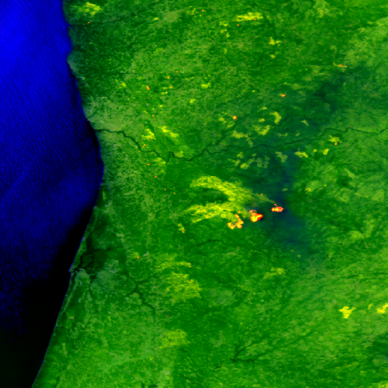
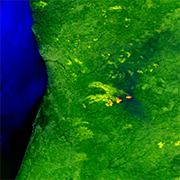
Firebird MSC - Level 0 Multispectral Images
The FireBIRD mission consists of two small satellites, TET-1 and BIROS. Together, the two satellites are on an Earth observation mission that aims to detect forest fires, or high-temperature events, from space. The new infrared system provides high-quality data that is capable of measuring the spread of the fire and the amount of heat generated with great accuracy very early on - almost in real time - meaning that FireBIRD can serve as an early warning system. The data acquired from this Earth observation mission can also be used as a basis for scientific climate research. In addition to the main payload of the cameras, further experiments have been planned for developing the technology on board the small satellites. Further information can be found on the following website:
http://www.dlr.de/firebird/en/
and in the FireBIRD brochure available at: http://www.dlr.de/firebird/en/Portaldata/79/Resources/dokumente/FireBIRD_Broschuere_HighRes_v3_english.pdf
|
|
Citation proposal
. Firebird MSC - Level 0 Multispectral Images. German Aerospace Center (DLR) https://gdk.gdi-de.org/geonetwork/srv/api/records/f920473c-15a2-490c-8b24-b48f9b8a0226 |
INSPIRE
Identification
- File identifier
- f920473c-15a2-490c-8b24-b48f9b8a0226 XML
- Hierarchy level
- Series
Online resource
- Protocol
- WWW:LINK-1.0-http--related
Resource identifier
- Metadata language
- eng
- Spatial representation type
- Grid
Encoding
- Format
- Version
Projection
- code
- WGS 84 (EPSG:4326)
Classification of data and services
- Topic category
-
- Imagery base maps earth cover
Classification of data and services
Coupled resource
Coupled resource
Classification of data and services
Coupled resource
Coupled resource
Keywords
- GEMET - INSPIRE themes, version 1.0 ( Theme )
-
- Orthoimagery
Other keywords
- Keywords
-
- Satellite
- Earth Observation
- FireBIRD
- BIROS
- TET-1
- FireBIRD Multi-Spectral Camera
- MSC
- Optical
- Thermal Infrared
- Natural Hazards
- Wildfire
- High Temperature Events
- Volcanoes
- FBI.MSC.L0
- FEDEO
Geographic coverage
N
S
E
W
))
Temporal reference
Temporal extent
Temporal extent
- Date ( Creation )
- 2017-07-03T08:12:00
Quality and validity
- Lineage
- Input data sets: Raw data from the TET-1 and BIROS satellites
- Denominator
- 80000
Conformity
Conformity
Conformity
Conformity
Conformity
Conformity
- Explanation
- See the referenced specification
Restrictions on access and use
- Access constraints
- Nutzungsbedingungen: https://geoservice.dlr.de/resources/licenses/firebird/FireBird_Image_Data_Policy.pdf / Terms of Use: https://geoservice.dlr.de/resources/licenses/firebird/FireBird_Image_Data_Policy.pdf
- Access constraints
- Restricted - Data available upon request (science-firebird@dlr.de )
Restrictions on access and use
Responsible organization (s)
Contact for the resource
- Organisation name
- German Aerospace Center (DLR)
- science-firebird@dlr.de
- Organisation name
- German Aerospace Center (DLR)
- geoservice@dlr.de
Responsible organization (s)
Contact for the resource
- Organisation name
- German Aerospace Center (DLR)
- science-firebird@dlr.de
- Organisation name
- German Aerospace Center (DLR)
- geoservice@dlr.de
Metadata information
Contact for the metadata
- Organisation name
- German Aerospace Center (DLR)
- geoservice@dlr.de
- Date stamp
- 2024-06-20T14:12:24
- Metadata language
- English
- Character set
- UTF8
SDS
Conformance class 1: invocable
Access Point URL
Endpoint URL
Technical specification
Conformance class 2: interoperable
Coordinate reference system
Quality of Service
Access constraints
Limitation
Use constraints
Limitation
Responsible custodian
Contact for the resource
Conformance class 3: harmonized
Overviews
large_thumbnail
thumbnail
Provided by

Views
f920473c-15a2-490c-8b24-b48f9b8a0226
Access to the portal
Read here the full details and access to the data.
Associated resources
Not available