 www.geodatenkatalog.de (S3L)
Höhenfestpunktfeld - Saarland
Die HFP sind in der Örtlichkeit dauerhaft durch Marken aus Metall ( Höhenbolzen ) i.d.R. an Bauwerken, im Fels oder an besonderen Punktträgern vermarkt. Grundsätzlich sind deren Höhen und ggfs. die Koordinaten und Schwerewerte bestimmt. Z. Zt. werden die HFP noch ausschließlich durch geometrisches Nivellement, in Form eines geschlossenen Nivellementweges (Schleife), der auch aus mehreren netzbildenden Linien bestehen kann, bestimmt. Deshalb spricht man auch von Nivellementpunkten (NivP). Der Nachweis der HFP umfasst: - Punktdaten in Form von Höhen-, Schwerewerte und Lagekoordinaten - Punktbeschreibungen (Einmessungsskizzen) - Punktübersichten auf der Grundlage der Topographischen Karte 1:25000 (TK 25) mit Punktsignaturen und -nummern
|
|
Citation proposal
. Höhenfestpunktfeld - Saarland. https://gdk.gdi-de.org/geonetwork/srv/api/records/fc469d3d-b187-44c4-87e3-c7fefbda3934 |
INSPIRE
Identification
- File identifier
- fc469d3d-b187-44c4-87e3-c7fefbda3934 XML
- Hierarchy level
- Dataset
Online resource
Resource identifier
- Metadata language
- German
- Spatial representation type
- Text, table
Encoding
Projection
Classification of data and services
- Topic category
-
- Elevation
Classification of data and services
Coupled resource
Coupled resource
Classification of data and services
Coupled resource
Coupled resource
Keywords
Other keywords
- Keywords
-
- Festpunkte Höhenfestpunkt Lagefestpunkt Schwerefestpunkt
- Keywords
-
- AdVMIS
- geoportal
Geographic coverage
Temporal reference
Temporal extent
Temporal extent
- Date ( Creation )
- 2010-01-01
- Date ( Revision )
- 2022-06-22
Quality and validity
- Lineage
- örtliche Feinnivellements Felderfassung der Messdaten und Berechnung
Conformity
Conformity
Conformity
Conformity
Conformity
Conformity
Restrictions on access and use
Restrictions on access and use
Responsible organization (s)
Contact for the resource
- Organisation name
- Landesamt für Vermessung, Geoinformation und Landentwicklung
Responsible organization (s)
Contact for the resource
- Organisation name
- Landesamt für Vermessung, Geoinformation und Landentwicklung
Metadata information
Contact for the metadata
- Organisation name
- Landesamt für Vermessung, Geoinformation und Landentwicklung
- Date stamp
- 2025-06-25T05:17:38.018374Z
- Character set
- UTF8
SDS
Conformance class 1: invocable
Access Point URL
Endpoint URL
Technical specification
Conformance class 2: interoperable
Coordinate reference system
Quality of Service
Access constraints
Limitation
Use constraints
Limitation
Responsible custodian
Contact for the resource
Conformance class 3: harmonized
Overviews
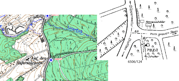
Ausschnitt Übersicht und Beschreibung
Provided by

Views
fc469d3d-b187-44c4-87e3-c7fefbda3934
Access to the portal
Read here the full details and access to the data.
Associated resources
Not available