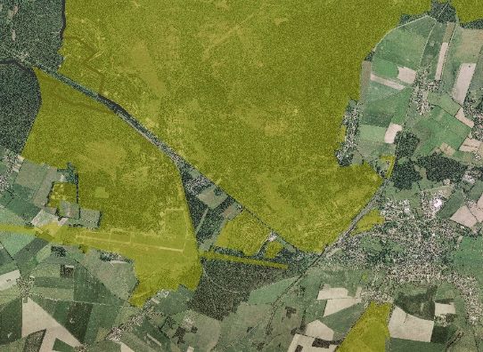
ehemalige Militärflächen im Landkreis Teltow-Fläming
ehemalig militärisch genutzte Flächen im Landkreis Teltow-Fläming (GUS und NVA)
|
|
Citation proposal
. ehemalige Militärflächen im Landkreis Teltow-Fläming. https://gdk.gdi-de.org/geonetwork/srv/api/records/fd68b539-fdee-47f6-bc34-a7d608fa38c8 |
Simple
- Date ( Creation )
- 2000-07-13
- Date ( Revision )
- 2007-11-13
Point of contact
Landkreis Teltow-Fläming
-
Frau Blazy
(SB Militärflächen/ Altlasten/ Schadstoffe im Boden )
Am Nuthefließ 2
Luckenwalde
Brandenburg
14943
Deutschland
- Name
- sde-featureClass
- Version
- 1
- BE/BB Schlagwortliste, Version 1.0 ( Discipline )
-
- Bodenschutz
- Umweltverschmutzung
- GEMET - INSPIRE themes, version 1.0 ( Discipline )
-
- Umweltüberwachung
- Use limitation
- keine
- Access constraints
- Copyright
- Denominator
- 25000
- Metadata language
- German
- Character set
- UTF8
- Topic category
-
- Environment
N
S
E
W
))
- Reference system identifier
- urn:ogc:def:crs:EPSG / 25833 / 6.11.2
- Hierarchy level
- Dataset
- Statement
- Abgrenzung der Liegenschaften durch IABG-Berichte und durch die Untere Abfallwirtschafts- und Bodenschutzbehörde. Aktualisierung bei Bedarf.
gmd:MD_Metadata
- File identifier
- fd68b539-fdee-47f6-bc34-a7d608fa38c8 XML
- Metadata language
- German
- Character set
- UTF8
- Hierarchy level
- Dataset
- Hierarchy level name
- Umwelt/Abfall und Altlasten
- Date stamp
- 2020-12-02
- Metadata standard name
- ISO 19115:2003/Cor 1:2006, 19119:2005/Amd 1:2008 (BE/BB)
- Metadata standard version
- 2.1.0
Point of contact
Landkreis Teltow-Fläming
-
Frau Braune
(SB Geoinformationssystem (GIS) Wasser, Boden, Abfall )
Am Nuthefließ 2
Luckenwalde
Brandenburg
14943
Deutschland
- Dataset URI
- urn:sde:gisdb.lktf.dom:5151:gisdb:UMWELT.Altlasten_EHEM_MILIT_FLAECH
Overviews

ehemalig militärisch genutzte Flächen im Landkreis Teltow-Fläming
Provided by

Views
fd68b539-fdee-47f6-bc34-a7d608fa38c8
Access to the portal
Read here the full details and access to the data.
Associated resources
Not available
 www.geodatenkatalog.de (S1L)