 www.geodatenkatalog.de (S3L)
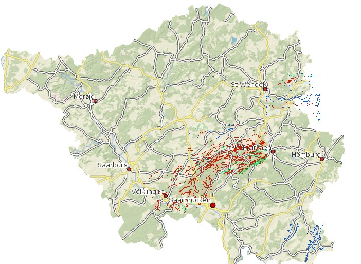
Geologische Karte Bänke Saarland 1:25.000
In dem Datensatz Bänke wird, wegen der geringen Mächtigkeit der Horizonte, der Verlauf besonderer Gesteinsausbildungen (Tuffe, Karbonate, Kohle usw.) als Linie dargestellt. Diese Bänke (Member) bilden häufig die Grenze zwischen lithostratigraphischen Einheiten oder besitzen eine für die Kartierung wichtige Funktion als Leithorizont. Geologische Karte 1:25 000 Bänke ist in Bearbeitung und noch nicht flächendeckend vorhanden. Die Daten wurden ins GDZ importiert und dort als Werte der Multifeatureklasse Wert Geologie modelliert, die sich zusammensetzt aus der flächenhaften Featureklasse GDZ2010.A_ghgeowt (enthält die Gk100, die GK25, und die Rohstoffflächen) der linienhaften Featureklasse GDZ2010.L_ghgeowt (enthält die GK15_Bänke, die GK25_Tektonik und die GK100_Tektonik) , der punkthaften Featureklasse GDZ2010.P_ghgeowt (enthält die Geotope) und der dazugehörigen Businessklasse GDZ2010.ghgeowt. Anschließend wurden die Werte für die Objektart = gk25 und Parameter Langtext = Bänke exportiert in die Filegeodatabase GDZ_GDB. Folgende Attribute sind relevant: NR (Nummer der Bänke) BEZEICHNUNG; STRATIGRAPHIE; PETROGRAPHIE.
|
|
Citation proposal
. Geologische Karte Bänke Saarland 1:25.000. https://gdk.gdi-de.org/geonetwork/srv/api/records/ffb3bd26-e1cc-46aa-8821-ad70260501a9 |
- Identification
- Distribution
- Quality
- Spatial rep.
- Ref. system
- Content
- Portrayal
- Metadata
- Md. constraints
- Md. maintenance
- Schema info
Identification
Data identification
Citation
- Date ( Creation )
- 2003-03-18T00:00:00.000+01:00
- Date ( Revision )
- 2011-03-01T00:00:00.000+01:00
Point of contact
Fachbereich 2.1 Gebiets- und anlagenbezogener Grundwasserschutz
Don-Bosco-Straße 1
Saarbrücken
Saarland
66119
DEU
- GEMET - INSPIRE themes, version 1.0 ( Theme )
-
- Geologie
- Keywords
-
- Geowissenschaften
- geoportal
- Geo
- HVD
- Saarland
- opendata
- Spatial scope
- Keywords ( Theme )
-
- REGI
- ENVI
- Keywords
-
- inspireidentifiziert
- High-value dataset categories ( Theme )
- Use limitation
- Es gelten keine Bedingungen.
Legal constraints
- Use constraints
- Other restrictions
- Other constraints
- Creative Commons Namensnennung – 4.0 International (CC BY 4.0)
- Other constraints
- Quellenvermerk: © GDI-SL (Jahr)
Legal constraints
- Access constraints
- otherRestrictions Other restrictions
- Spatial representation type
- Vector
- Metadata language
- German
- Character set
- UTF8
- Topic category
-
- Geoscientific information
Extent
Geographic description
- Extent type code
- true
- Geographic identifier
- Saarland, Deutschland (administrative) (10)
N
S
E
W
))
Distribution
Distribution
- Distribution format
-
- Esri Shape (1.0 )
Distributor
Distributor
- OnLine resource
-
Geologische Karte Bänke Saarland 1:25.000
Geoportal SL
- OnLine resource
-
Geologische Karte Bänke Saarland 1:25.000
Geoportal SL
Quality
Data quality
- Hierarchy level
- Dataset
Conformance result
Citation
- Date ( Publication )
- 2010-12-08
- Explanation
- Die Daten wurden mit dem EU-Validator überprüft.
- Pass
- false
- Statement
- Erstellt von Hubert Thum (LUA). Geologische Karte 1:25 000 Bänke ist in Bearbeitung und noch nicht flächendeckend vorhanden.
Spatial rep.
Vector spatial representation
- Geometric object type
- Curve
Metadata
Metadata
- File identifier
- ffb3bd26-e1cc-46aa-8821-ad70260501a9 XML
- Metadata language
- German
- Character set
- UTF8
- Hierarchy level
- dataset Dataset
- Date stamp
- 2025-09-04
- Metadata standard name
- ISO19115
- Metadata standard version
- 2003/Cor.1:2006
Point of contact
Overviews
Geologische Karte Bänke Saarland 1:25.000
Provided by

Views
ffb3bd26-e1cc-46aa-8821-ad70260501a9
Access to the portal
Read here the full details and access to the data.
Associated resources
Not available