 My GeoNetwork catalogue
Satellite
Provided by
Type of resources
Available actions
Topics
Keywords
Contact for the resource
Update frequencies
-
This collection contains radar image products of the German national TerraSAR-X mission acquired in Spotlight mode. Spotlight imaging allows for a spatial resolution of up to 2 m at a scene size of 10 km (across swath) x 10 km (in orbit direction). TerraSAR-X is a sun-synchronous polar-orbiting, all-weather, day-and-night X-band radar earth observation mission realized in the frame of a public-private partnership between the German Aerospace Center (DLR) and Airbus Defence and Space. For more information concerning the TerraSAR-X mission, the reader is referred to: https://www.dlr.de/content/de/missionen/terrasar-x.html
-
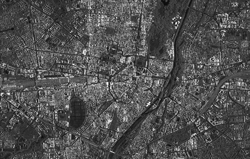
This collection contains radar image products of the German national TerraSAR-X mission acquired in High Resolution Spotlight mode. High Resolution Spotlight imaging allows for a spatial resolution of up to 1 m at a scene size of 10 km (across swath) x 5 km (in orbit direction). TerraSAR-X is a sun-synchronous polar-orbiting, all-weather, day-and-night X-band radar earth observation mission realized in the frame of a public-private partnership between the German Aerospace Center (DLR) and Airbus Defence and Space. For more information concerning the TerraSAR-X mission, the reader is referred to: https://www.dlr.de/content/de/missionen/terrasar-x.html
-

This collection contains synthesized Sentinel-2 Level 3A surface reflectances for Germany on a monthly basis computed by the WASP processor (which utilizes L2A products derived from the MAJA processor). During the Level 3A processing, atmospherically corrected data from a predefined time interval are collected, weighted based on temporal distance and integrated to a new data set with the aim of removing clouds. Thereby, monthly Sentinel-2 Level 3A composites are provided for whole Germany. Please see https://logiciels.cnes.fr/en/content/maja for additional information on the MAJA product. Further Sentinel-2 Level 3A data computed using MAJA are available on the following website: https://theia.cnes.fr
-
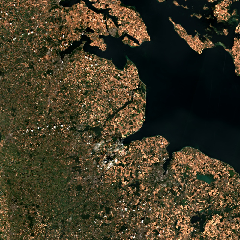
This collection contains Sentinel-2 Level 2A surface reflectances, which are computed for the country of Germany using the time-series based MAJA processor. During the Level 2A processing, the data are corrected for atmospheric effects and clouds and their shadows are detected. The MAJA L2A product is available online for the last 12 months. Further data are kept in the archive and are available upon request. Please see https://logiciels.cnes.fr/en/content/maja for additional information on the MAJA product. The MAJA product offers an alternative to the official ESA L2A product and has been processed with consideration of the characteristics of the Sentinel-2 mission (fast collection of time series, constant sensor perspective, and global coverage). Assumptions about the temporal constancy of the ground cover are taken into account for a robust detection of clouds and a more flexible determination of aerosol properties. As a result, an improved determination of the reflectance of sunlight at the earth's surface (pixel values of the multispectral image) is derived. Further Sentinel-2 Level 2A data computed using MAJA are available on the following website: https://theia.cnes.fr
-
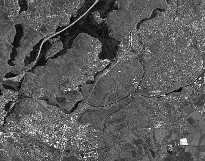
This collection contains radar image products of the German national TerraSAR-X mission acquired in Staring Spotlight mode. Staring Spotlight imaging allows for a spatial resolution of up to 25 cm. The scene size varies depending on the incidence angle. As an example, 4 km (across swath) x 3.7 km (in orbit direction) can be achieved at 60°. TerraSAR-X is a sun-synchronous polar-orbiting, all-weather, day-and-night X-band radar earth observation mission realized in the frame of a public-private partnership between the German Aerospace Center (DLR) and Airbus Defence and Space. For more information concerning the TerraSAR-X mission, the reader is referred to: https://www.dlr.de/content/de/missionen/terrasar-x.html
-
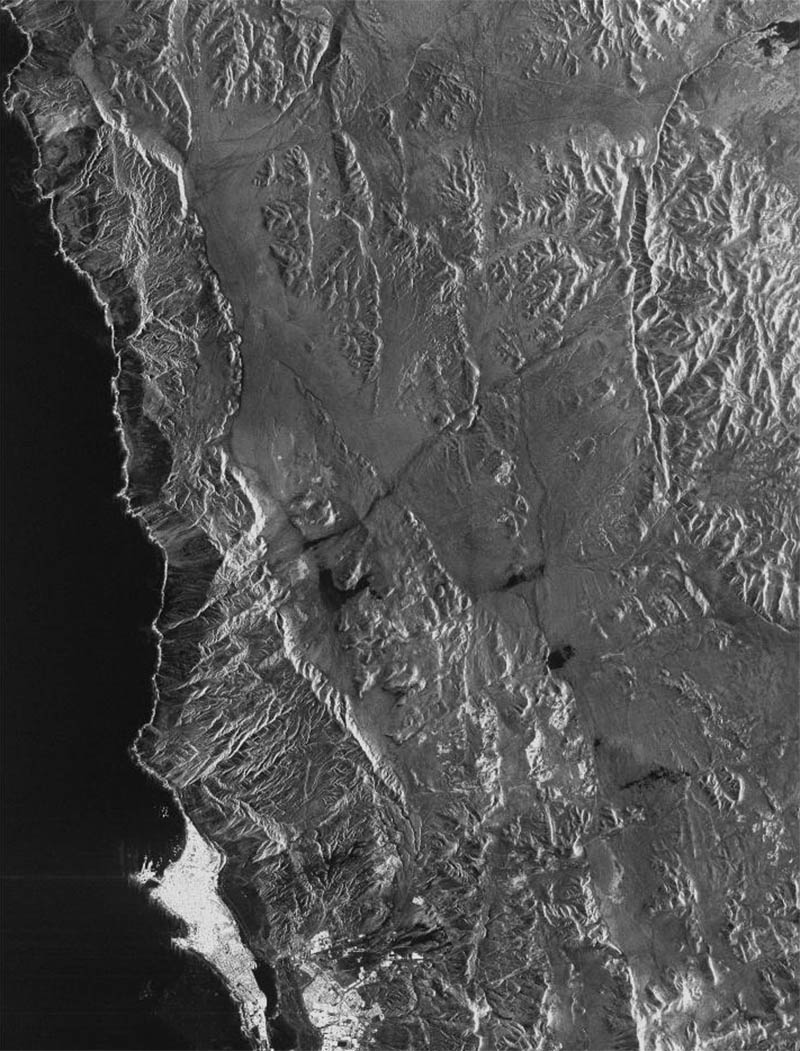
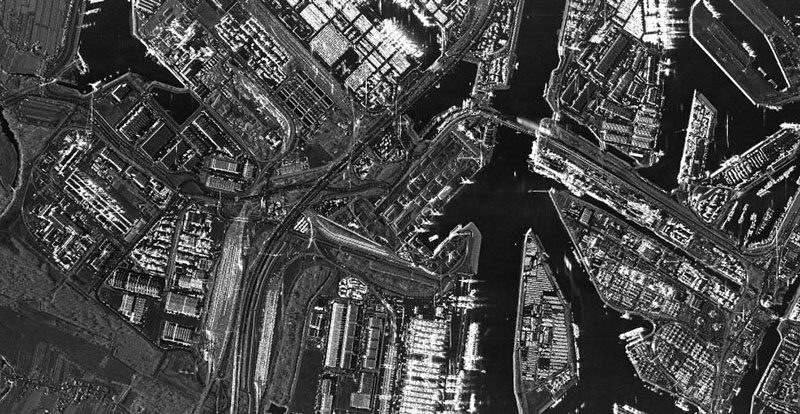
This collection contains radar image products of the German national TerraSAR-X mission acquired in StripMap mode. StripMap imaging allows for a spatial resolution of up to 3 m at a scene size of 30 km (across swath) x 50-1650 km (in orbit direction). TerraSAR-X is a sun-synchronous polar-orbiting, all-weather, day-and-night X-band radar earth observation mission realized in the frame of a public-private partnership between the German Aerospace Center (DLR) and Airbus Defence and Space. For more information concerning the TerraSAR-X mission, the reader is referred to: https://www.dlr.de/content/de/missionen/terrasar-x.html
-

This collection contains radar image products of the German national TerraSAR-X mission acquired in ScanSAR mode. ScanSAR imaging allows for a spatial resolution of up to 18.5 m at a scene size of 100 km (across swath) x 150-1650 km (in orbit direction) in regular ScanSAR mode (4 beams) and up to 270 km (across swath) x 200-1500 km (in orbit direction) in Wide ScanSAR mode (6 beams). TerraSAR-X is a sun-synchronous polar-orbiting, all-weather, day-and-night X-band radar earth observation mission realized in the frame of a public-private partnership between the German Aerospace Center (DLR) and Airbus Defence and Space. For more information concerning the TerraSAR-X mission, the reader is referred to: https://www.dlr.de/content/de/missionen/terrasar-x.html
-
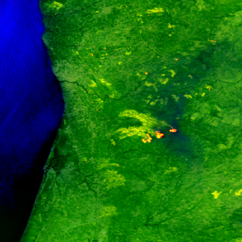
The FireBIRD mission consists of two small satellites, TET-1 and BIROS. Together, the two satellites are on an Earth observation mission that aims to detect forest fires, or high-temperature events, from space. The new infrared system provides high-quality data that is capable of measuring the spread of the fire and the amount of heat generated with great accuracy very early on - almost in real time - meaning that FireBIRD can serve as an early warning system. The data acquired from this Earth observation mission can also be used as a basis for scientific climate research. In addition to the main payload of the cameras, further experiments have been planned for developing the technology on board the small satellites. Further information can be found on the following website: http://www.dlr.de/firebird/en/ and in the FireBIRD brochure available at: http://www.dlr.de/firebird/en/Portaldata/79/Resources/dokumente/FireBIRD_Broschuere_HighRes_v3_english.pdf