 My GeoNetwork catalogue
sgd_Bohrungen
Provided by
Type of resources
Available actions
Topics
Keywords
Contact for the resource
Update frequencies
Service types
-

Die Bohrdatenbank (ADB) enthält alle dem LGRB bekannten Bohrpunkte in BW. Auch Bohrpunkte deren Fachdaten Sperrfristen unterliegen sind enthalten. Die wichtigsten Nachweisdaten wie Angaben zur Identifizierung, Lage, Art und Herstellung einer Bohrung können abgefragt werden. Im LGRB-Bohrarchiv sind Dokumente zu Bohrungen, die auf Grund des Geologiedatengesetztes dem LGRB übergeben werden, enthalten. Die Unterlagen des LGRB-Bohrarchivs liegen zum Großteil digital vor und werden über die Bohrpunkte erschlossen. Weitere Informationen liegen unter https://lgrb-bw.de/bohrungen/aufschlussdaten vor. Bohrdaten, wie Bohrprofile und Schichtenverzeichnisse, können über LGRBbohrungen heruntergeladen werden (https://bohrungen.lgrb-bw.de/).
-

Das <a href='https://www.gesetze-im-internet.de/geoldg/' target='_blank'>Geologiedatengesetz</a> (GeolDG) ist am 30.06.2020 in Kraft getreten und löst das bis dahin gültige Lagerstättengesetz ab. Das GeolDG schafft grundlegende Voraussetzungen für die geowissenschaftliche Landesaufnahme und regelt den Umgang mit geologischen Daten, wie z. B. die <a href='https://geoldg.lgb-rlp.de/' target='_blank'>Anzeige geologischer Untersuchungen</a>, die Übermittlung und Sicherung erhobener geologischer Daten sowie die öffentliche Bereitstellung der geologischen Daten. Ziel des GeolDG ist es, Geogefahren erkennen und bewerten zu können sowie einen nachhaltigen Umgang mit dem geologischen Untergrund zu gewährleisten. <a href='https://www.lgb-rlp.de/de/fachthemen-des-amtes/geologiedatengesetz.html' target='_blank'>Weitere Informationen</a> <a href='https://www.lgb-rlp.de/fachthemen/geologiedatengesetz/faq-geoldg.html' target='_blank'>Häufige Fragen</a> <a href='https://www.lgb-rlp.de/service/lgb-downloads/geoldg-downloads.html' target='_blank'>Downloads</a>:Nachweisdaten i.S.d. Geologiedatengesetzes sind Daten, die geologische Untersuchungen persönlich, örtlich, zeitlich und allgemein inhaltlich einordnen. Dargestellt sind die beim Landesamt für Geologie und Bergbau Rheinland-Pfalz eingegangenen Anzeigedaten geologischer Untersuchungen und Bohrungen, klassifiziert nach dem Untersuchungszweck. <a href='https://www.lgb-rlp.de/fachthemen-des-amtes/geologiedatengesetz/nachweisdaten-geoldg.html' target='_blank'>Weiterführende Informationen</a>
-
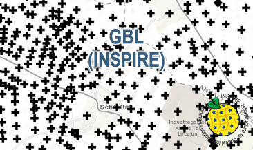
The WMS GBL (INSPIRE) represents mechanically drilled boreholes approved by the State Geological Surveys of Germany (SGS). Most of the drilling data were not collected by the SGS, but were transmitted to the SGS by third parties in accordance with legal requirements. Therefore, the SGS can accept no responsibility for the accuracy of the information. According to the Data Specification on Geology (D2.8.II.4_v3.0) the map provides INSPIRE-compliant data. The WMS GBL (INSPIRE) contains a layer of the boreholes (GE.borehole) displayed correspondingly to the INSPIRE portrayal rules. The boreholes are represented graphically by the borehole purpose. Via the getFeatureInfo request the user obtains detailed information on the boreholes.
-
The GBL (INSPIRE) represents mechanically drilled boreholes approved by the State Geological Surveys of Germany (SGS). Most of the drilling data were not collected by the SGS, but were transmitted to SGS by third parties in accordance with legal requirements. Therefore, the SGS can accept no responsibility for the accuracy of the information. According to the Data Specification on Geology (D2.8.II.4_v3.0) the boreholes of each federal state are stored in one INSPIRE-compliant GML file. The GML file together with a Readme.txt file is provided in ZIP format (e.g. GBL-INSPIRE_Lower_Saxony.zip). The Readme.txt file (German/English) contains detailed information on the GML file content. Data transformation was proceeded by using the INSPIRE Solution Pack for FME according to the INSPIRE requirements.