 My GeoNetwork catalogue
daily
Provided by
Type of resources
Available actions
Topics
Keywords
Contact for the resource
Update frequencies
Service types
-

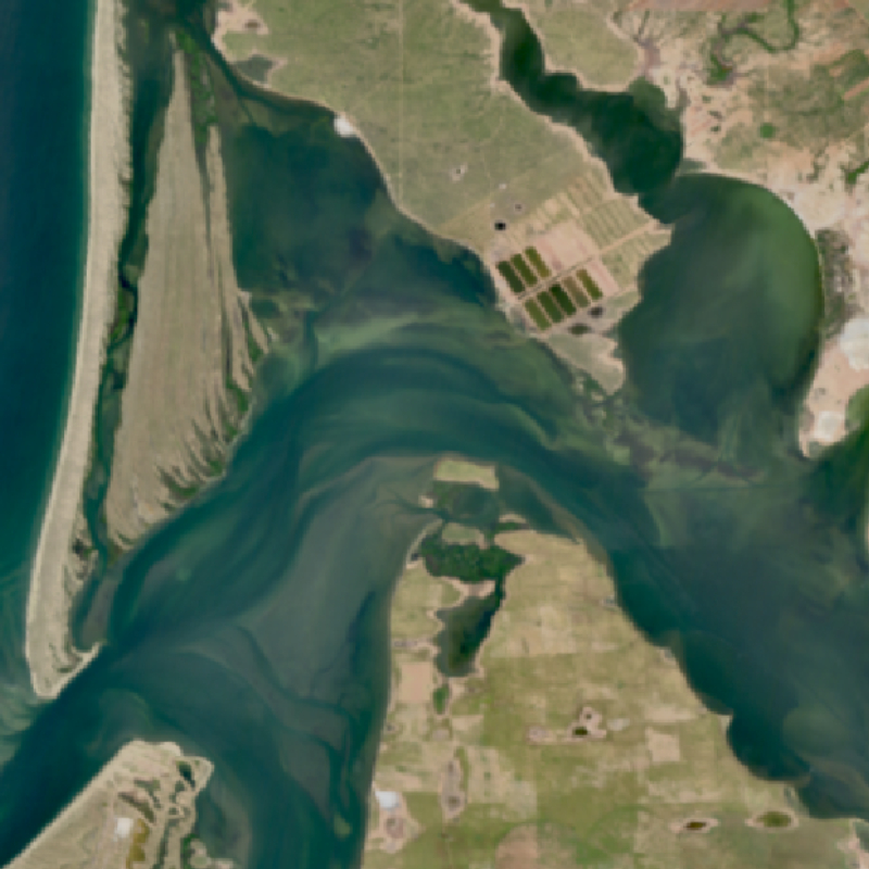
Daily updated and quality-controlled daily means of sea surface temperatures of the North Sea and Baltic Sea, derived from measurements of the Advanced Very High Resolution Radiometer Sensor (AVHRR sensor) during flyovers of different polar-orbiting satellites on the corresponding day.
-
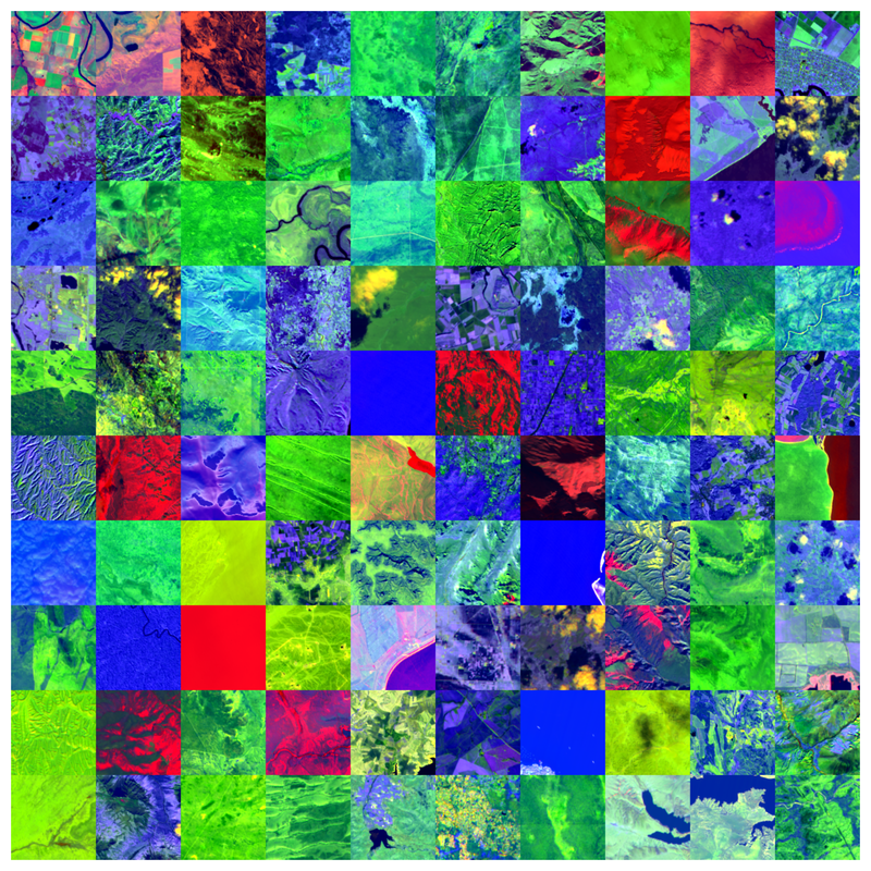
The EnMAP HSI L2A dataset collection comprises a standardized, consistent, systematically processed, and cloud-native level-2A dataset series for the entire mission. It is especially useful for big data or time series analyses. The dataset is processed with the atmospheric correction over land processor and is provided in cloud-optimized GeoTIFF format for direct access and download. The metadata follows the CEOS Analysis Ready Data (CEOS-ARD) framework. The database is constantly updated with newly acquired data. The Environmental Mapping and Analysis Program (EnMAP) is a German hyperspectral satellite mission that monitors and characterizes Earth’s environment on a global scale. EnMAP delivers accurate data that provides information on the status and evolution of terrestrial and aquatic ecosystems, supporting environmental monitoring, management, and decision-making. For more information, please see the mission website: https://www.enmap.org/mission/
-
-

This product shows globally the daily snow cover extent (SCE). The snow cover extent is the result of the Global SnowPack processor's interpolation steps and all data gaps have been filled. Snow cover extent is updated daily and processed in near real time (3 days lag). In addition to the near real-time product (NRT_SCE), the entire annual data set is processed again after the end of a calendar year in order to close data gaps etc. and the result is made available as a quality-tested SCE product. There is also a quality layer for each day (SCE_Accuracy), which reflects the quality of the snow determination based on the time interval to the next "cloud-free" day, the time of year and the topographical/geographical location. The “Global SnowPack” is derived from daily, operational MODIS snow cover product for each day since February 2000. Data gaps due to polar night and cloud cover are filled in several processing steps, which provides a unique global data set characterized by its high accuracy, spatial resolution of 500 meters and continuous future expansion. It consists of the two main elements daily snow cover extent (SCE) and seasonal snow cover duration (SCD; full and for early and late season). Both parameters have been designated by the WMO as essential climate variables, the accurate determination of which is important in order to be able to record the effects of climate change. Changes in the largest part of the cryosphere in terms of area have drastic effects on people and the environment. For more information please also refer to: Dietz, A.J., Kuenzer, C., Conrad, C., 2013. Snow-cover variability in central Asia between 2000 and 2011 derived from improved MODIS daily snow-cover products. International Journal of Remote Sensing 34, 3879–3902. https://doi.org/10.1080/01431161.2013.767480 Dietz, A.J., Kuenzer, C., Dech, S., 2015. Global SnowPack: a new set of snow cover parameters for studying status and dynamics of the planetary snow cover extent. Remote Sensing Letters 6, 844–853. https://doi.org/10.1080/2150704X.2015.1084551 Dietz, A.J., Wohner, C., Kuenzer, C., 2012. European Snow Cover Characteristics between 2000 and 2011 Derived from Improved MODIS Daily Snow Cover Products. Remote Sensing 4. https://doi.org/10.3390/rs4082432 Dietz, J.A., Conrad, C., Kuenzer, C., Gesell, G., Dech, S., 2014. Identifying Changing Snow Cover Characteristics in Central Asia between 1986 and 2014 from Remote Sensing Data. Remote Sensing 6. https://doi.org/10.3390/rs61212752 Rößler, S., Witt, M.S., Ikonen, J., Brown, I.A., Dietz, A.J., 2021. Remote Sensing of Snow Cover Variability and Its Influence on the Runoff of Sápmi’s Rivers. Geosciences 11, 130. https://doi.org/10.3390/geosciences11030130
-
-
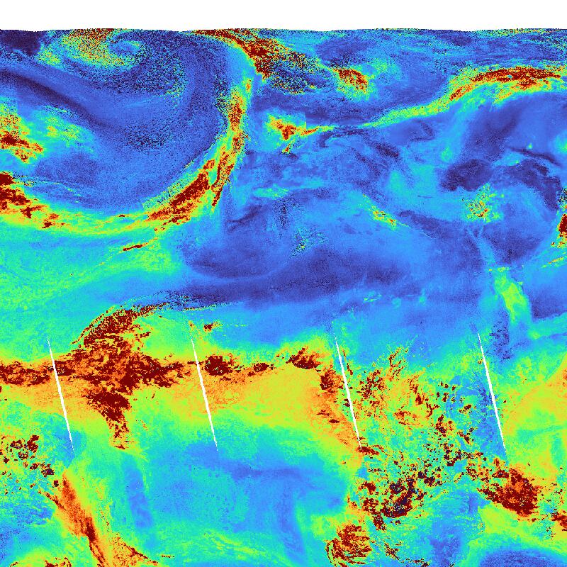
Water Vapour (H2O) concentration (globally) as derived from Sentinel-5P/TROPOMI observations. H2O is the most abundant greenhouse gas in the atmosphere. In addition it is one of the most powerful drivers for weather phenomena in the troposphere. Daily observations are binned onto a regular latitude-longitude grid. The TROPOMI instrument aboard the SENTINEL-5P space craft is a nadir-viewing, imaging spectrometer covering wavelength bands between the ultraviolet and the shortwave infra-red. TROPOMI's purpose is to measure atmospheric properties and constituents. It is contributing to monitoring air quality and providing critical information to services and decision makers. The instrument uses passive remote sensing techniques by measuring the Top Of Atmosphere (TOA) solar radiation reflected by and radiated from the earth and its atmosphere. The four spectrometers of TROPOMI cover the ultraviolet (UV), visible (VIS), Near Infra-Red (NIR) and Short Wavelength Infra-Red (SWIR) domains of the electromagnetic spectrum, allowing operational retrieval of the following trace gas constituents: Ozone (O3), Nitrogen Dioxide (NO2), Sulfur Dioxide (SO2), Water Vapour (H2O), Carbon Monoxide (CO) and Methane (CH4). Within the INPULS project, innovative algorithms and processors for the generation of Level 3 and Level 4 products, improved data discovery and access technologies as well as server-side analytics for the users are developed.
-
-
-

UV Index (UVI) as derived from TROPOMI observations. The UVI describes the intensity of the solar ultraviolet radiation. Values around zero indicate low, values greater than 10 indicate very high UV exposure on the ground. The TROPOMI instrument onboard the Copernicus SENTINEL-5 Precursor satellite is a nadir-viewing, imaging spectrometer that provides global measurements of atmospheric properties and constituents on a daily basis. It is contributing to monitoring air quality and climate, providing critical information to services and decision makers. The instrument uses passive remote sensing techniques by measuring the top of atmosphere solar radiation reflected by and radiated from the earth and its atmosphere. The four spectrometers of TROPOMI cover the ultraviolet (UV), visible (VIS), Near Infra-Red (NIR) and Short Wavelength Infra-Red (SWIR) domains of the electromagnetic spectrum. The operational trace gas products generated at DLR on behave ESA are: Ozone (O3), Nitrogen Dioxide (NO2), Sulfur Dioxide (SO2), Formaldehyde (HCHO), Carbon Monoxide (CO) and Methane (CH4), together with clouds and aerosol properties. This product is created in the scope of the project INPULS. It develops (a) innovative retrieval algorithms and processors for the generation of value-added products from the atmospheric Copernicus missions Sentinel-5 Precursor, Sentinel-4, and Sentinel-5, (b) cloud-based (re)processing systems, (c) improved data discovery and access technologies as well as server-side analytics for the users, and (d) data visualization services.
-
The Environmental Mapping and Analysis Program (EnMAP) is a German hyperspectral satellite mission to monitoring and characterise Earth’s environment on a global scale. EnMAP measures and models key dynamic processes of Earth’s ecosystems by extracting geochemical, biochemical and biophysical parameters that provide information on the status and evolution of various terrestrial and aquatic ecosystems. The mission’s main objective is to study and decipher coupled environmental processes and to assist and promote the sustainable management of Earth’s resources. This collection includes Level 0 quicklook images of the mission. For more information, please see the mission website: https://www.enmap.org/mission/