 www.geodatenkatalog.de (S1L)
Keyword
urn:eop:DLR:EOWEB:SWACI.GROUNDBASED.REC.GB.L2
1 record(s)
Provided by
Type of resources
Topics
Keywords
Contact for the resource
Update frequencies
-
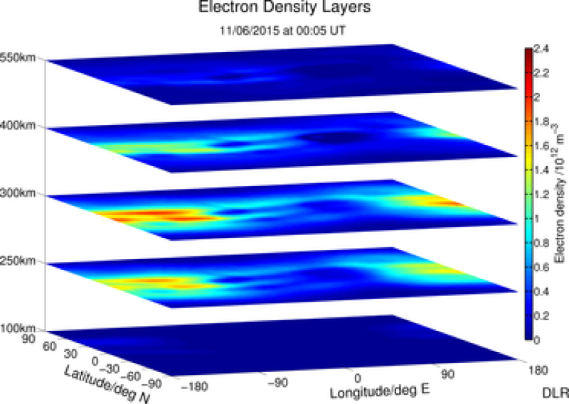
SWACI is a research project of DLR supported by the State Government of Mecklenburg-Vorpommern. Radio signals, transmitted by modern communication and navigation systems may be heavily disturbed by space weather hazards. Thus, severe temporal and spatial changes of the electron density in the ionosphere may significantly degrade the signal quality of various radio systems which even may lead to a complete loss of the signal. By providing specific space weather information, in particular now- and forecast of the ionospheric state, the accuracy and reliability of impacted communication and navigation systems shall be improved. According to the pioneer work of Sir E. Appleton the vertical structure of the terrestrial ionosphere may be divided into different layers (D, E, F1, F2) with different physical characteristics. The layers are primarily characterized by its height and peak electron density. The spatial plasma distribution is generated from actual TEC maps by applying a first version of the empirical electron density model NEDM-v1. In correspondence with the update rate of TEC maps the time resolution of the 3 D images is 5 minutes. For details see http://swaciweb.dlr.de/index.php?id=303&L=1 and http://presentations.copernicus.org/EGU2011-7324_presentation.pdf.