Keyword
Israel
118 record(s)
Provided by
Type of resources
Available actions
Topics
Keywords
Contact for the resource
Update frequencies
Service types
-
The SPIS31 TTAAii Data Designators decode as: T1 (S): Surface data T1T2 (SP): Special aviation weather reports A1A2 (IS): Israel (Remarks from Volume-C: NilReason)
-
The SPIS31 TTAAii Data Designators decode as: T1 (S): Surface data T1T2 (SP): Special aviation weather reports A1A2 (IS): Israel (Remarks from Volume-C: NilReason)
-
DWD’s fully automatic MOSMIX product optimizes and interprets the forecast calculations of the NWP models ICON (DWD) and IFS (ECMWF), combines these and calculates statistically optimized weather forecasts in terms of point forecasts (PFCs). Thus, statistically corrected, updated forecasts for the next ten days are calculated for about 5400 locations around the world. Most forecasting locations are spread over Germany and Europe. MOSMIX forecasts (PFCs) include nearly all common meteorological parameters measured by weather stations. For further information please refer to: [in German: https://www.dwd.de/DE/leistungen/met_verfahren_mosmix/met_verfahren_mosmix.html ] [in English: https://www.dwd.de/EN/ourservices/met_application_mosmix/met_application_mosmix.html ]
-

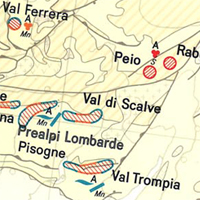
The International Map of the Iron Ore Deposits of Europe 1 : 2.500.000 completed in 1977 is published by the Federal Institute for Geosciences and Natural Resources (BGR) About 70 geoscientists from Europe, North Africa, Eastern Europe and Middle East collaborated with the Editorial Staff in the compilation of the map and the Editorial Notes. More than 800 iron ore deposits are represented on the map which covers 42 countries in 16 map sheets. All deposits of importance, either actually being mined or recently abandoned, are included. Deposits of only genetic or historic interest are also shown. Detailed information on the Map of Iron Ore Deposits of Europe - to its structure, arrangement and background data - can be found in the Explanatory Notes to the Map
-

Ankünfte, Übernachtungen, durchschnittliche Aufenthaltsdauerin Beherbergungsbetrieben: Deutschland, Jahre, ausgewählteHerkunftsländer der Gäste
-

Deutsche Studierende im Ausland: Deutschland, Jahre,Studienland
-

Deutsche Studierende im Ausland: Deutschland, Jahre,Studienland
-

Deutsche Studienanfänger im Ausland: Deutschland, Jahre,Studienland
-

Ankünfte, Übernachtungen, durchschnittliche Aufenthaltsdauerin Beherbergungsbetrieben: Deutschland, Jahre, ausgewählteHerkunftsländer der Gäste
 www.geodatenkatalog.de (S1L)