Service type
view
211383 record(s)
Provided by
Type of resources
Available actions
Keywords
Contact for the resource
Update frequencies
Service types
-
The European Marine Observation and Data Network (EMODnet) consists of more than 100 organisations assembling marine data, products and metadata to make these fragmented data resources more available to public and private users relying on quality-assured, standardised and harmonised marine data which are interoperable and free of restrictions on use. EMODnet is currently in its fourth phase. BGR participates in the EMODnet Geology theme and is coordinating the “seafloor geology” work package from the beginning. In cooperation with the project partners BGR compiles and harmonises GIS data layers on the topics geomorphology, pre-Quaternary and Quaternary geology and provides those, based on INSPIRE principles, via the EMODnet Geology portal https://www. emodnet-geology.eu/map-viewer/. These map layers present the pre-Quaternary and Quaternary sea-floor geology and Geomorphology of the European Seas, semantically harmonized based on the INSPIRE data specifications including the terms for lithology, age, event environment, event process and geomorphology. The data are compiled from the project partners, the national geological survey organizations of the participating countries. The data set represents the most detailed available data compilation of the European Seas using a multiresolution approach. Data completeness depending on the availability of data and actual mapping campaigns. This open and freely accessible product was made available by the EMODnet Geology project (https://www.emodnet-geology.eu/), implemented by EMODnet Geology Phase IV partners, and funded by the European Commission Directorate General for Maritime Affairs and Fisheries. These data were compiled by BGR from the EMODnet IV Geology partners. All ownership rights of the original data remain with the data originators, who are acknowledged within the attribute values of each map feature.
-
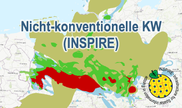
The WMS Nicht-konventionelle KW (INSPIRE) presents the results of the NiKo project according to data specifications Energy Resources (D2.8.III.20) und Geology (D2.8.II.4_v3.0). NiKo stands for „unconventional hydrocarbons“, „Nicht-konventionelle Kohlenwasserstoffe“ in German. In the NiKo project the Federal Institute for Geosciences and Natural Resources (BGR) has investigated the potential resources for shale oil and shale gas in Germany. The study was published in 2016 as a report titled „Schieferöl und Schiefergas in Deutschland – Ressourcen und Umweltaspekte“ (available in German only). The colloquial terms shale oil and shale gas refer to oil and natural gas resources in sedimentary shale rock formations, with high organic matter content. In the study, seven formations were identified to have a shale oil and/or gas potential in Germany and their distribution has been mapped in small scale. For each of the formations the organic-rich facies distribution is provided as layer and, if appropriate, the regional potential resource distribution: Fischschiefer (Oligocene), Blättertone (Barremium - Lower-Aptian), Wealden (Berriasium), Posidonienschiefer (Lower-Toarcium), Middel-Rhaetium (Oberkeuper), Permokarbon (Stefanium - Rotliegend) und Lower Carboniferous (Upper Alaunschiefer (Kulm-Facies) + Kohlenkalk-Facies). According to the overview maps in the report the following layers are provided, omitting however the sub-category “possible potential regions”. Bituminous facies distribution (0-5000 m depth) – data specification Geology: GE.GeologicUnit.Fischschiefer_distribution, GE.GeologicUnit.Blaettertone_distribution, GE.GeologicUnit.Wealden_distribution, GE.GeologicUnit.Posidonienschiefer_distribution, GE.GeologicUnit.Mittelrhaetium_black_shale_thicker_20m_distribution, GE.GeologicUnit.Permokarbon_black_shale_distribution, GE.GeologicUnit.Unterkarbon_Hangende_Alaunschiefer_distribution und GE.GeologicUnit.Unterkarbon_Kohlenkalk Facies layers are coloured according to the corresponding oldest formation age (olderNamedAge). Distribution shale oil and shale gas – potential resources (1000 - 5000 m depth) – data specification Energy Resources: ER.FossilFuelRessource.Blaettertone, ER.FossilFuelRessource.Wealden, ER.FossilFuelRessource.Posidonienschiefer, ER.FossilFuelRessource.Mittelrhaetschiefer, ER.FossilFuelRessource.Permokarbon und ER.FossilFuelRessource.Unterkarbon The shale oil and shale gas distribution layers are not coloured according to INSPIRE guidelines, but rather as common international practice in green and red, respectively. The distribution maps of the potential resources for shale oil and gas are based on geoscientific criteria. Further non-geoscientific limiting criteria, e.g. exclusion areas, have not been taken into account for the assessment. These assessments are based on appraisements of input parameters naturally with large uncertainties for the potential resources and their distribution in the deep underground. Based on the incipient exploration status of unconventionals in Germany, these resources are considered as undiscovered. The assessed shale oil and gas resources for Germany, represent the order of magnitude of potential resources. Source: BGR 2016 - Schieferöl und Schieferöl in Deutschland in 2016: - Potenziale und Umweltaspekte https://www.bgr.bund.de/DE/Themen/Energie/Downloads/Abschlussbericht_13MB_Schieferoelgaspotenzial_Deutschland_2016.html
-
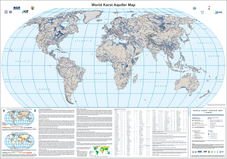
The World-wide Hydrogeological Mapping and Assessment Programme (WHYMAP) provides data and information about the earth´s major groundwater resources. The World Karst Aquifer Map (WOKAM) allows a more precise global quantification of karst systems. The map will help to increase awareness of karst groundwater resources in the context of global water issues and will serve as a basis for other karst-related research questions at global scales: for example those related to climate change, biodiversity, food production, geochemical cycles and urbanisation.
-
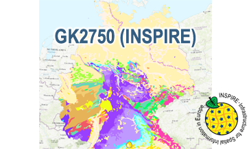
The WMS GK2750 Geology (INSPIRE) represents the surface geology of Germany on a scale of 1:2,750,000. According to the Data Specification on Geology (D2.8.II.4_v3.0) the geological map provides INSPIRE-compliant data. The WMS GK2750 Geology (INSPIRE) contains layers of the geologic units (GE.GeologicUnit), faults (GE.GeologicFault) and marginal position of the ice shield and the impact crater Nördlinger Ries (GE. GeomorphologicFeature) displayed correspondingly to the INSPIRE portrayal rules. The geologic units are represented graphically by stratigraphy (GE.GeologicUnit.AgeOfRocks) and lithology (GE.GeologicUnit.Lithology). For different geochronologic minimum and maximum ages, e.g. Upper Devonian - Permian, the portrayal is defined by the colour of the geochronologic minimum age (olderNamedAge). In case of the geologic units the user obtains detailed information via the getFeatureInfo request on the lithology, stratigraphy (age) and genesis (event environment and event process).
-
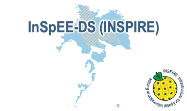
Which salt formations are suitable for storing hydrogen or compressed air? In the InSpEE-DS research project, scientists developed requirements and criteria for the assessment of suitable sites even if their exploration is still at an early stage and there is little knowledge of the salinaries’ structures. Scientists at DEEP.KBB GmbH in Hanover, worked together with their project partners at BGR and the Leibniz University Hanover, Institute for Geotechnics, to develop the planning basis for the site selection and for the construction of storage caverns in flat layered salt and multiple or double saliniferous formations. Such caverns could store renewable energy in the form of hydrogen or compressed air. While the previous project InSpEE was limited to salt formations of great thickness in Northern Germany, salt horizons of different ages have now been examined all over Germany. To estimate the potential, depth contour maps of the top and the base as well as thickness maps of the respective stratigraphic units were developed. Due to the present INSPIRE geological data model, it was necessary, in contrast to the original dataset, to classify the boundary lines of the potential storage areas in the Zechstein base and thickness layers, whereby the classification of these lines was taken from the top Zechstein layer. Consequently, the boundary element Depth criterion 2000 m (Teufe-Kriterium 2000 m) corresponds on each level to the 2000 m depth of Top Zechstein. However, the boundary of national borders and the boundary of the data basis could not be implemented in the data model and are therefore not included in the dataset. Information on compressed air and hydrogen storage potential is given for the identified areas and for the individual federal states. According to the Data Specification on Geology (D2.8.II.4_v3.0) the content of InSpEE-DS (INSPIRE) is stored in 18 INSPIRE-compliant GML files: InSpEE_DS_GeologicUnit_Isopachs_Zechstein.gml contains the Zechstein isopachs. InSpEE_DS_GeologicUnit_Isobaths_Top_Zechstein.gml and InSpEE_DS_GeologicUnit_Isobaths_Basis_Zechstein.gml contain the isobaths of the top and basis of Zechstein. The three files InSpEE_DS_GeologicStructure_ThicknessMap_Zechstein, InSpEE_DS_GeologicStructure_Top_Zechstein and InSpEE_DS_GeologicStructure_Basis_Zechstein represent the faults of the Zechstein body as well as at the top and at the basis of the Zechstein body. InSpEE_DS_GeologicUnit_Boundary_element_Potential_areas_Zechstein.gml contains the boundary elments of the potential areas at the top and the basis of Zechstein as well as of the Zechstein body. The three files InSpEE_DS_GeologicUnit_Uncertainty_areas_ThicknessMap_Zechstein.gml, InSpEE_DS_GeologicUnit_Uncertainty_areas_Top_Zechstein.gml, InSpEE_DS_GeologicUnit_Uncertainty_areas_Basis_Zechstein.gml represent the uncertainty areas of the Zechstein body as well as at the top and at the basis of the Zechstein body. InSpEE_DS_GeologicUnit_Potentially_usable_storage_areas_Storage_potential_in_the_federal_states.gml comprises the areas with storage potential for renewable energy in the form of hydrogen and compressed air. The six files InSpEE_DS_GeologicUnit_Salt_distribution_in_Germany_Malm.gml, InSpEE_DS_GeologicUnit_Salt_distribution_in_Germany_Keuper.gml, InSpEE_DS_GeologicUnit_Salt_distribution_in_Germany_Muschelkalk.gml, InSpEE_DS_GeologicUnit_Salt_distribution_in_Germany_Roet.gml, InSpEE_DS_GeologicUnit_Salt_distribution_in_Germany_Zechstein.gml and InSpEE_DS_GeologicUnit_Salt_distribution_in_Germany_Rotliegend.gml represent the salt distribution of the respective stratigraphic unit. InSpEE_DS_GeologicUnit_General_salt_distribution.gml represents the general salt distribution in Germany. This geographic information is product of a BMWi-funded research project "InSpEE-DS" running from the year 2015 to 2019. The acronym stands for "Information system salt: planning basis, selection criteria and estimation of the potential for the construction of salt caverns for the storage of renewable energies (hydrogen and compressed air) - double saline and flat salt layers".
-
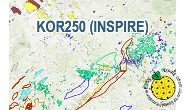
The WMS KOR250 (INSPIRE) in the scale of 1:250,000 shows occurrences and deposits of mineral resources in Germany, which lie close to the Earth’s surface, i.e. can be mined in open-pits, quarries or near-surface mines. These mineral resources include industrial minerals, aggregates, peat, lignite, oil shales, and natural brines. The map is derived from the KOR250, the digital successor of the map series KOR200 „Map of Near-Surface Deposits of the Federal Republic of Germany 1:200,000”, which has been published since 1984. The KOR200 and KOR250 have been published by the Federal Institute for Geosciences and Natural Resources together with the State Geological Surveys of the federal states on behalf of the Federal Ministry for Economic Affairs and Energy. Primary purpose of the KOR250 is to display Germany’s potential of domestic raw materials in a comparable way. The explanations given in the printed booklets accompanying the KOR200 are not available in the digital KOR250. In the KOR250 besides the defined deposits and differently coloured areas of raw materials, "active mines" (= operations) at time of publication or "focal points of several active mines" are marked with one symbol each. These mines are not included in the KOR250 (INSPIRE) as often the headquarters of the mining company and not the mining site itself is displayed as well as in many regions the dataset is outdated. As the map sheets of the KOR200 have been generated over more than three decades the timeliness of data is extremely different. For more detail, the current large-scale raw material maps of the Federal State Geological Surveys should always be consulted. The point data displayed in KOR250 (INSPIRE) indicate very small, but worth mentioning prospects of certain raw materials. The WMS KOR250 (INSPIRE) contains the two layers MR.MineralOccurence.Commodity.Polygon (mineral resources as polygons) and MR.MineralOccurence.Commodity.Point (mineral resources as points). Via the getFeatureInfo request the user obtains additional information on the mineral resources. Notes: The colouring of the raw material occurrences in the KOR250 (INSPIRE) largely corresponds to the colouring of the original KOR250. In the INSPIRE Data Specification on Mineral Resources (D2.8.III.21) there are no portrayal rules for building raw materials and dimension stones, which constitute a large part of the raw material occurrences. It should be noted that according to the INSPIRE commodity code list, most magmatites and metamorphites were assigned to the two values "granite" and "basalt". From a geological point of view and with regard to its origin, this assignment is often misleading. For more information on the outcropping rock of a specific raw material occurrence, the German name from the original KOR250 was mapped to the attribute name of the class GeologicFeature. Link KOR200: https://www.bgr.bund.de/EN/Themen/Min_rohstoffe/Projekte/Rohstoffverfuegbarkeit_laufend_en/KOR_200_en.html
-
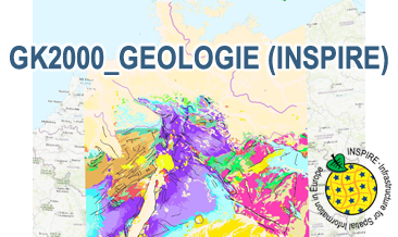
The WMS GK2000 Geologie (INSPIRE) represents the surface geology of Germany and adjacent areas on a scale of 1:2,000,000. According to the Data Specification on Geology (D2.8.II.4_v3.0) the geological map provides INSPIRE-compliant data. The WMS GK2000 Geologie (INSPIRE) contains layers of the geologic units (GE.GeologicUnit), faults (GE.GeologicFault) and marginal position of the ice shield as well as the impact craters Nördlinger Ries and Steinheimer Becken (GE. GeomorphologicFeature) displayed correspondingly to the INSPIRE portrayal rules. The geologic units are represented graphically by stratigraphy (GE.GeologicUnit.AgeOfRocks) and lithology (GE.GeologicUnit.Lithology). For different geochronologic minimum and maximum ages, Upper Devonian - Permian, the portrayal is defined by the colour of the geochronologic minimum age (olderNamedAge). In case of the geologic units the user obtains detailed information via the getFeatureInfo request on the lithology, stratigraphy (age) and genesis (event environment and event process).
-
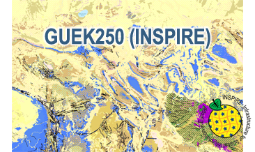
The WMS GÜK250 (INSPIRE) represents the surface geology of Germany on a scale of 1:250,000. In general, the term “surface geology” refers to geologic formations up to a depth of two meters. However, particularly in the south of Germany, considerable deviations of this concept exist and thicknesses of a couple of hundred meters may be displayed. According to the Data Specification on Geology (D2.8.II.4_v3.0) the geological map provides INSPIRE-compliant data. The GÜK250 (INSPIRE) contains a base layer and an overlay layer which usually represents thin Quaternary deposits. The WMS GÜK250 (INSPIRE) contains correspondingly two layers for the geologic units (GE.GeologicUnit.BaseLayer and GE.GeologicUnit.OverlayLayer). Additionally the WMS comprises layers representing the faults (GE.GeologicFault), marginal position of the ice shield (GE. NaturalGeomorphologicFeature) and quartz veins (GE.GeologicUnit.QuartzVein). The layers are mostly displayed according to the INSPIRE portrayal rules. The geologic units are represented graphically by stratigraphy (GE.GeologicUnit.BaseLayer.AgeOfRocks and GE.GeologicUnit.OverlayLayer.AgeOfRocks, stored in group layer GE.AgeOfRocks) and lithology (GE.GeologicUnit.BaseLayer.Lithology and GE.GeologicUnit.OverlayLayer.Lithology, stored in group layer GE.Lithology). Because INSPIRE doesn’t provide portrayal rules for the genesis (event process und event environment), this display mode is not available compared to the original WMS GÜK250. In case of different geochronologic minimum and maximum ages, e.g. Pleistocene - Holocene, the portrayal is defined by the colour of the geochronologic minimum age (olderNamedAge). The portrayal of the lithology is defined by the rock or rock group representing the main part of the petrographic composition of the geologic unit. For the portrayal of different petrographic main components the corresponding colours are superimposed in a dot pattern. Analogous to the original WMS GÜK250 the petrographic content is represented graphically according to the generic terms of the main components, e.g. clastic sedimentary rock, pure carbonate sedimentary rock or metamorphic rock. In case of the geologic units the user obtains detailed information on the stratigraphy, lithology and genesis via the getFeatureInfo request.
-
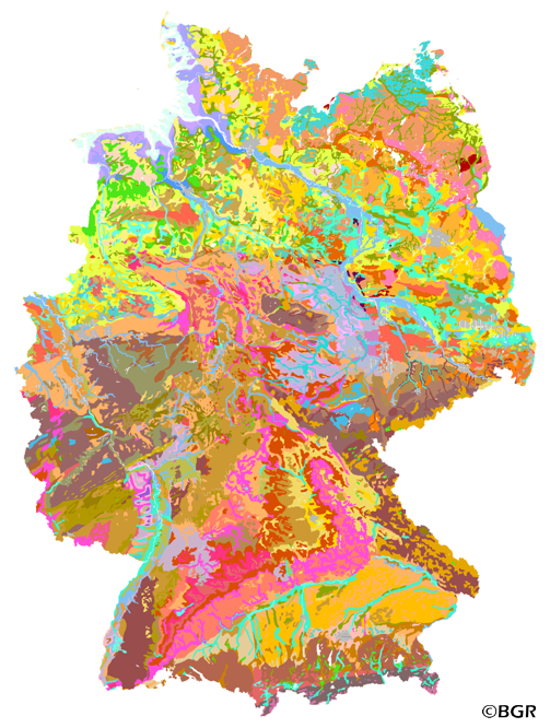
Web Map Service (WMS) of the BUEK1000. The first country wide soil map at a scale of 1:1,000,000 (BUEK1000) has been compiled on the basis of published soil maps of the former German Democratic Republic and the pre 1990 federal states of Germany. To do this, it was necessary to match the soil systems used in East and West Germany and to develop standardized descriptions of soil units. A relatively homogeneous map has resulted, which permits uniform assessment of the soils throughout Germany. The map shows 71 soil mapping units, described in the legend on the basis of the German and FAO soil systems. Each soil unit has been assigned a characteristic soil profile (Leitprofil) as an aid to map interpretation. For the first time the subdivision of the country into 12 soil regions has been represented on the map. This subdivision was coordinated with the state Geological Surveys. These soil regions will represent the highest hierarchic level of nation wide soil maps in future. The colours of soil units correspond to the standards of the 'Bodenkundliche Kartieranleitung' (KA 3; Guidelines for Soil Mapping). The various hues characterize differences in relief or soil humidity. The BUEK1000 was produced digitally. It is an important part of the spatial database integrated in the Soil Information System currently being established at the Federal Institute for Geosciences and Natural Resources (FISBo BGR). It can be used together with the characteristic soil profiles to derive thematic maps related to nation wide soil protection. The scale of the BUEK1000 makes it especially suitable for small scale evaluations at federal or EU level.
-
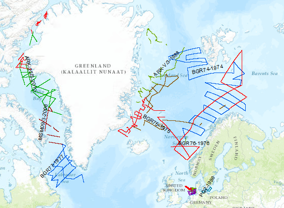
During the period from 1974 to 2018 various cruises from BGR acquired seismic lines worldwide. The aim of these marine expeditions was a detailed survey of the geological structure.
 www.geodatenkatalog.de (S3L)