 My GeoNetwork catalogue
Deutschland
Provided by
Type of resources
Available actions
Topics
Keywords
Contact for the resource
Update frequencies
Service types
-
Die Katalogschnittstelle (CSW) beschreibt den Datenbestand von GENESIS-Online (Bund) des Statistischen Bundesamtes. Diese Katalogschnittstelle beinhaltet sämtliche Daten für Deutschland. Es gibt noch 16 weitere Katalogschnittstellen dieser Reihe, die die Daten der 16 Bundesländer bereitstellen.
-

Accumulated radar data (RADOLAN SF product) added up to 30 days. Data only within Germany. Refresh interval: daily
-
Radarkomposit RX des des operationellen DWD-Radarverbundes
-
Radarbilder RX (Radardaten ohne Korrektur) des operationellen DWD-Radarverbundes - Radar images RX (Radardata without scaling)from the operational DWD radar composite
-
Radarbilder PM des operationellen DWD-Radarverbundes - Radar images PM from the operational DWD radar composite
-
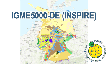
The IGME5000-DE (INSPIRE) represents the pre-quaternary bedrock geology (section of Germany) of the European map on a scale of 1:5,000,000. According to the Data Specification on Geology (D2.8.II.4_v3.0) the geological map provides INSPIRE-compliant data. The WMS IGME5000-DE contains layers of the geologic units (GE.GeologicUnit) and faults (GE.GeologicFault) mostly displayed according to the INSPIRE portrayal rules. The geologic units are represented graphically by stratigraphy (GE.GeologicUnit.AgeOfRocks) and lithology (GE.GeologicUnit.Lithology). For different geochronologic minimum and maximum ages, e.g. Ordovician - Silurian, the portrayal is defined by the color of the geochronologic minimum age (olderNamedAge). The portrayal of the lithology is defined by the first named rock or rock group. In case of the geologic units the user obtains detailed information via the getFeatureInfo request on the lithology and stratigraphy (age).
-
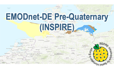
Compilation of the European Pre-Quaternary marine geology (section of Germany). Project partners are the national geological services of the participating countries. The map consists of data at highest available spatial resolution, map scale („multi-resolution“-concept) and data completeness vary depending on the project partner (as of 2016 September). According to the Data Specification on Geology (D2.8.II.4_v3.0) the geological map provides INSPIRE-compliant data. The WMS EMODnet-DE Pre-Quaternary (INSPIRE) contains layers of the geologic units (GE.GeologicUnit) displayed correspondingly to the INSPIRE portrayal rules. The geologic units are represented graphically by stratigraphy (GE.GeologicUnit.AgeOfRocks) and lithology (GE.GeologicUnit.Lithology). The portrayal of the lithology is defined by the first named rock or rock group. Via the getFeatureInfo request the user obtains detailed information on the lithology, stratigraphy (age) and genesis (event environment and event process).
-
Horizontale Echoverteilung
-
Radarbilder PM des operationellen DWD-Radarverbundes - Radar images PM from the operational DWD radar composite
-
Radarbilder RX (Radardaten ohne Korrektur) des operationellen DWD-Radarverbundes - Radar images RX (Radardata without scaling)from the operational DWD radar composite