 My GeoNetwork catalogue
biannually
Provided by
Type of resources
Available actions
Topics
Keywords
Contact for the resource
Update frequencies
Service types
-

-
-

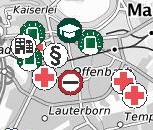
Standorte von Wärmeinseln und Leuchttürmen im Landkreis Mecklenburgische Seenplatte Als Wärmeinseln werden in diesem Zusammenhang Orte bezeichnet, an denen Bürger*Innen im Falle eines länger andauernden Ausfalls der Wärmeversorgung zeitlich begrenzt Zuflucht in einer beheizten Unterkunft finden können. Als Leuchttürme werden in diesem Zusammenhang Orte bezeichnet, an denen Bürger*Innen im Falle des Ausfalls des Fest- und Mobilfunknetzes, Notrufe absetzen können.
-

-
Since 1999, the Geologic Survey of Baden-Württemberg publishes a statewide geological map series 1 : 50 000 "Karte der mineralischen Rohstoffe 1 : 50 000 (KMR 50)". On it, the distribution of near-surface mineral raw material prospects and occurrences (mainly) and deposits (subordinate) is shown. This continuously completed and updated map currently covers around 60% of the federal state. It is the base for the regional associations in the task of mineral planning. The prospects and occurrences are classified according to different raw material groups (e.g. raw material for crushed stone (limestone, igneous rocks, metamorphic rocks, sand and gravel), raw materials for cement, dimension stone, high purity limestone, gypsum ...). Their spatial delineation is based on various group-specific criteria such as minimum workable thickness, minimum resources, ratio overburden/workable thickness, and so on. It is assumed that they contain deposits as a whole or in parts. In the vast majority of cases, the data is not sufficient for the immediate planning of mining projects, but it does facilitate the selection of exploration areas. The name of each area (e.g. L 6926-3) consists of three parts. L = roman rnumeral fo 50, 6926 = sheet number of the topographic map 1 : 50 000, 3 = number of the area/mineral occurrence shown on this sheet. Co-occurring land-use conflicts, e.g. water protection areas and nature conservation areas, forestry and agriculture, are not taken into account in the processing of KMR 50. Their assessment is the task of land use planning, the licensing authorities and the companies interested in mining. The data is stored in the statewide raw material area database "olan-db" of the LGRB.
-

-

-
-

-

Transport Networks of Germany, derived from the german digital landscape model at scale 1:250000. Mapped via EuroRegionalMap to satisfy INSPIRE and European Location Framework conformance. The dataset contains the road, railway, water and air network and is available as Open Data.