 My GeoNetwork catalogue
application
Provided by
Type of resources
Available actions
Topics
Keywords
Contact for the resource
Update frequencies
Service types
-

-
-

-

-
-
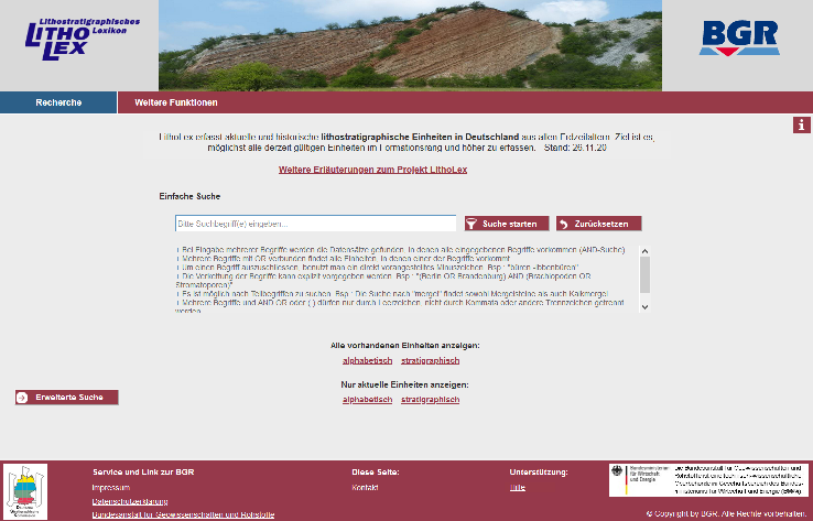
The lithostratigraphic lexicon "LithoLex" is a dynamic database that comprises all defined lithostratigraphic units of Germany and makes them accessible to the public via a web interface. LithoLex is a joint-venture of the German Stratigraphic Commission (Deutsche Stratigraphische Kommission - DSK) and the Federal Institute of Geosciences and Natural Resources (BGR). The DSK and its subcommissions are providing the content, i.e. definitions and descriptions of the lithostratigraphic units, whereas the BGR is in charge of maintaining the database and providing these geoinformation to the public.
-
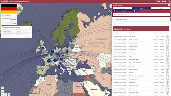
ROSYS enables you to better understand the raw material markets in the world and with a specific focus on Germany. With the help of interactive maps and diagrams, current developments on the raw material markets can be tracked, analyzed and evaluated. ROSYS contains data on around 80 raw materials. These include raw materials that are important for future technologies, such as lithium, cobalt and rare earths, as well as conventional energy raw materials.
-

The Online Public Access Catalogue includes the holdings of the library and archive: geoscientific monographs, journals, articles, maps and unpublished archival documents. Literature from the time before 1990 is not yet fully listed and can only be searched using formal criteria (e.g. title, author, or year).
-
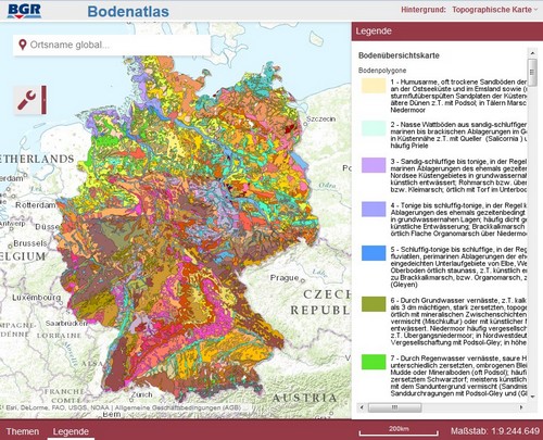
The Soil Atlas Germany published by the BGR provides a broad spectrum of soil science information for the interested public on 144 pages and in 48 thematic maps. The thematic maps are based on the profile and area data as well as evaluation methods in the Soil Science Information System of the BGR (FISBo BGR). With the digital soil atlas Germany, BGR is presenting a part of this comprehensive map series.
-
