Catalog

355169 record(s)
Provided by
Type of resources
Available actions
Topics
Keywords
Contact for the resource
Update frequencies
Service types
-

BW Map mobile ist eine App für iOS (iPhone / iPad) und Android (Smartphone / Tablet). Enthalten sind Amtliche Topographische Karten von Baden – Württemberg 1:10.000, 1:50.000, 1:200.000, 1:500.000 und 1:1 Million. Die App "BW Map mobile" ist im AppStore kostenlos erhältlich. Diese kann mit dem Kartendienst "Maps4BW" genutzt werden. Über einen In-App-Kauf (IAK) der "Jahres-Flatrate" aus der kostenlosen App heraus, werden erweiterten Funktionen aktiviert, inklusive den Zugriff auf die Topographischen Karten. Die Darstellungen 1:1 Million und 1:500.000 sind aus dem DLM1000 und die Topographische Übersichtskarte 1:200.000 aus dem DLM250. Die Darstellung 1:50.000 basiert auf dem DLM50. Die kartographische Darstellung 1:10.000 basiert auf dem Basis-DLM und der Gebäudedaten des Amtlichen Liegenschaftskatasterinformationssystems (ALKIS). Die Höheninformationen innerhalb Baden-Württembergs bestehen aus dem Digitalen Geländemodell (DGM25). Das DGM basiert auf dem Höhenbezugssystem „Höhen im Neuen System“ des Deutschen Haupthöhennetzes 1912 (DHHN 12 – HST 130) mit dem Pegel von Amsterdam. Zur Höhendarstellung außerhalb Baden-Württembergs wurden SRTM-3 Höhendaten des United States Geological Survay genutzt. Bezugssystem ist das Europäische Terrestrische Referenzsystem 1989 (ETRS89) und die Kartenprojektion die Universale Transversale Mercatorabbildung (UTM), Zone 32. Weitere Funktionen der App: GPS-Position, Moving Map (IAK), Trackaufzeichnung, Sprachführung entlang von Tracks, Suche (Orte, Straßen, Berge, Gewässer ...), Haltestelleninformationen, Meldefunktion, Messen von Strecken und Flächen. Sprachen DE,EN,FR,IT Erweiterte Funktionen für iOS sind: Panorama-Ansicht (3D-Karte), Augmented Reality. Weitere Angaben unter: http://www.lgl-bw.de/lgl-internet/opencms/de/07_Produkte_und_Dienstleistungen/Karten/BW-Map-mobile/Grundlegendes/
-

Since 1999, the Geologic Survey of Baden-Württemberg publishes a statewide geological map series 1 : 50 000 "Karte der mineralischen Rohstoffe 1 : 50 000 (KMR 50)". On it, the distribution of near-surface mineral raw material prospects and occurrences (mainly) and deposits (subordinate) is shown. This continuously completed and updated map currently covers around 60% of the federal state. It is the base for the regional associations in the task of mineral planning. The prospects and occurrences are classified according to different raw material groups (e.g. raw material for crushed stone (limestone, igneous rocks, metamorphic rocks, sand and gravel), raw materials for cement, dimension stone, high purity limestone, gypsum ...). Their spatial delineation is based on various group-specific criteria such as minimum workable thickness, minimum resources, ratio overburden/workable thickness, and so on. It is assumed that they contain deposits as a whole or in parts. In the vast majority of cases, the data is not sufficient for the immediate planning of mining projects, but it does facilitate the selection of exploration areas. The name of each area (e.g. L 6926-3) consists of three parts. L = roman rnumeral fo 50, 6926 = sheet number of the topographic map 1 : 50 000, 3 = number of the area/mineral occurrence shown on this sheet. Co-occurring land-use conflicts, e.g. water protection areas and nature conservation areas, forestry and agriculture, are not taken into account in the processing of KMR 50. Their assessment is the task of land use planning, the licensing authorities and the companies interested in mining. The data is stored in the statewide raw material area database "olan-db" of the LGRB.
-

Dieser Dienst stellt die Blattschnitteinteilung sowie -nummerierung der Topographischen Kartenwerke 1:25000, 1:50000 sowie 1:100000 in je einer Ebene dar. Die Blattschnitte beziehen sich dabei auf das Printprodukt der Topographische Karte, nicht auf die Rasterdaten der Digitalen Topographischen Karte.
-
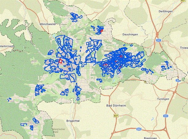
Dieser Dienst stellt die Daten der Bodennutzung von landwirtschaftlich genutzten Flächen in Baden-Württemberg bereit. Die Polygone zeigen die Grenzen einer im Rahmen des Gemeinsamen Antrages gemeldeten Nutzung. Die Daten werden im Rahmen der Gemeinsamen Agrarpolitik der EU erhoben und sind Bestandteil des Verwaltungs- und Kontrollsystems (InVeKoS) von Baden-Württemberg. Ein Polygon liegt nur dann vor, wenn die landwirtschaftliche Fläche im Gemeinsamen Antrag beantragt worden ist. Die Polygone wurden anonymisiert.
-
Der WFS-Dienst liefert aktuelle, vektorbasierte ALKIS Daten zu Verwaltungsgrenzen in der NOrA Datenstruktur. Der WFS-Dienst stellt keinen amtlichen Nachweis dar. Der Dienst liefert Flurgrenzen, Gemarkungsgrenzen, Gemeindegrenzen, Kreisgrenzen, Regierungsbezirksgrenzen, Regionsgrenzen sowie Landesgrenze jeweils als FeatureType.
-

Der Download-Dienst bietet eine Zugriffsmöglichkeit auf die Geltungsbereiche der rechtskräftigen Bebauungspläne der Stadt Villingen-Schwenningen. Als Attribute sind neben den Informationen zum Namen, Nummer, Inkrafttretungsdatum, … auch der WMS-Dienst Link etc. hinterlegt. Zusätzliche Informationen findet man in der Bebauungsplan-App der Stadt
-

This Downloadservice contains point locations of near-surface mineral raw material occurrences and mining sites in Baden-Württemberg (BW), which is one of 16 states of the Federal Republic of Germany. The information is harmonized according to the specifications of the MIN4EU database model as part of the Mintell4EU project. BW is rich in near-surface mineral raw materials. The most important are 1) Quaternary sands and gravels (Upper Rhine Graben Valley and glacial sediments of Upper Swabia), 2) Paleozoic rocks (mainly metamorphic rocks and granites, minor Permian volcanic rocks) in the Black Forest and the Odenwald, and 3) Middle Triassic (Southwest German scarplands) and Upper Jurassic (Swabian Alb) limestones. The deep-lying raw materials (various gangue ores, barite, fluorite, uranium ores), which were mined mainly in the Black Forest, are currently of no importance, with the exception of the still ongoing extraction of barite and fluorite in the Clara mine. In the future, some deposits could regain importance as raw material prices rise. Almost 100 million tons of mostly near-surface mineral raw materials are extracted annually in BW in currently about 500 mining sites (survey year: 2017). The annual raw material consumption is approx. 9 tons/inhabitant. At the beginning of the 2000s, there were still around 630 mining sites. This decline is due to both concentration processes and depletion of deposits. Since the end of the 1980ies the geological, areal and production data of operating mining sites have been collected systematically by LGRB. They are the basis for the periodic raw material report edited by LGRB and for the calculation of the need of mineral raw materials. Manly these pits, beside some important historic mines, are shown in the layer "MIN4EU LGRB-BW: mining sites - harmonized dataset". Another important task of the LGRB is to advise the regional planning authorities on securing mineral raw material supply. Beside the calculation of the need of mineral raw materials supply for the two planning periods (2 x 15 or 2x 20 years), the knowledge of mineral occurrences of proven or estimated economic value is important. After some preliminary stages, the LGRB is producing the Map of Mineral Resources in Baden-Württemberg 1 : 50,000 (KMR 50) as a basis and planning map for this purpose. On it, the distribution of near-surface mineral raw material prospects and occurrences (mainly) and deposits (subordinate) is shown. This continuously completed and updated map currently covers actually around 60% of the federal state. These occurrences are the topic of the second layer theme "MIN4EU LGRB-BW: near-surface mineral raw material occurrences - harmonized dataset".
-
Die landesweite Erstfassung der Daten für die Berechnung des Digitalen Geländemodells (DGM) / Digitalen Oberflächenmodells (DOM) erfolgte in den Jahren 2000 bis 2005 über Laserscanbefliegung. Die Fortführung der Daten des DGM erfolgt seither partiell auf Datengrundlagen unterschiedlicher Erfassungmethoden. Dieser Dienst setzt sich aus fünf Ebenen zusammen. Die Ebene "ATKIS DGM Laserflüge ALS 1 (2000-2005)" zeigt die Laserfluggebiete der Erstfassung. Get FeatureInfo gibt Auskunft über Flugdatum, Punktdichte, Scanner, Scanwinkel und Flughöhe. Die Ebene "ATKIS DGM Fortführung aus Laserscanning-Daten (2009-2015)" zeigt die Fortführungsgebiete, die über Laserflüge erfasst wurden, die Ebene "ATKIS DGM Fortführung über sonstige Methoden (2011-2015)" Fortführungsgebiete, die mittels Terrestrisches Laserscanning, Bildflügen oder UAV durchgeführt wurden. Get FeatureInfo gibt jeweils Auskunft über Name des Erfassungsgebietes, -,datum, -methode, Losnummer sowie Fortführungsdatum des DGMs. Die Ebene "ATKIS DGM Bearbeitungsübersicht ALS 2 (2016-2021)" zeigt die Darstellung der verfügbaren DGM km² Kacheln aus der Laserscanbefliegung (Punktdichte 8 Punkte\m²) von 2016-2021 mit Flugdatum und die Ebene "ATKIS DGM Laserflüge ALS 2 (2016-2021)" zeigt die Darstellung der Losabgrenzungen der Laserbefliegung für die flächenhafte Aktualisierung von DGM und DOM aus durchgeführten Laserscanbefliegungen (Punktdichte 8 Punkte\m²) von 2016 bis 2021. Get FeatureInfo gibt jeweils Auskunft über Los, Flugdatum, Punktdichte, Scanner, Scanwinkel und Flughöhe. Es wird darauf hingewiesen, dass keine Rechtsverbindlichkeit für die gelieferten Daten besteht.
-
Dieser Dienst liefert die Blattschnitteinteilung des (historischen) Topographischen Atlas 1:50000 für das Großherzogtum Baden und das Königreich Württemberg mit den Attributen Blattnummer, Blattnamen sowie Ausgabejahr.
-
Dieser Dienst stellt die Geodaten bereit, welche aus dem System zur Identifizierung landw. Parzellen (LPIS) stammen und somit das Referenzsystem für die flächenbezogenen Agrarzahlungen abbilden. In Baden-Württemberg wird das Katasterflurstück als Referenzparzelle genutzt. Das System zur Identifizierung landwirtschaftlicher Parzellen ist ein Teilsystem des Integrierten Verwaltungs- und Kontrollsystems (InVeKoS) im Sinne von Artikel 68 der Verordnung (EG) Nr. 1306/2013. Die Daten werden für die gesamte landwirtschaftliche Fläche Baden-Württembergs aufgrund § 3 Abs. 1 der InVeKoS-Verordnung erhoben und laufend auf Basis aktueller Luftbilder (Orthophotos) und Fernerkundungsdaten weiter gepflegt. Weitere Informationen zur Agrarpolitik und Förderung in Baden-Württemberg finden Sie unter: https://foerderung.landwirtschaft-bw.de/pb/,Lde/Startseite. Der Erfassungsmaßstab der Daten beträgt ca. 1:5.000. Die Bodenbedeckung, auch Nutzungsart, ist auf den einzelnen Referenzparzellen abgegrenzt und kann folgende Eigenschaften haben, siehe folgende Liste. Je Referenzparzelle sind mehrere Nutzungsarten möglich: Ackerland, Grünland, Dauerkultur, Landschaftselement, Nicht landwirtschaftliche Fläche. Neben der Bodenbedeckung/Nutzungsart hat jede Geometrie einen eindeutigen Identen, die FLIK der Referenzparzelle, die für Direktzahlungen förderfähige Höchstfläche in ha und eine Angabe zur Aktualität des Datenstandes. Der Erfassungsmaßstab der Daten beträgt ca. 1:5.000.
 www.geodatenkatalog.de (S2L)