 My GeoNetwork catalogue
Regional
Provided by
Type of resources
Available actions
Topics
Keywords
Contact for the resource
Update frequencies
Service types
-
-- Customize this sample record to describe the Catalogue Service Web (CSW) service of your catalogue --. See https://docs.geonetwork-opensource.org/4.4/administrator-guide/configuring-the-catalog/csw-configuration/ Access datasets, maps and services from my organisation using the OGC CSW standards. This catalogue contains descriptions of GIS resources on the ... region produced and/or maintained by ....
-
Verlauf aller Straßen und Wege, die einen Namen haben innerhalb und teilweise auch außerhalb der Stadt Göttingen. Die Information wird in einer Linie gespeichert. Namenlose Wege und kleine Verbindungswege sind nicht enthalten.
-
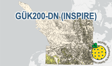
The General Geological Map of the Federal Republic of Germany 1:200,000 (GÜK200) provides detailed information on the stratigraphy, petrography and genesis of the geological units shown. In this revised GÜK200-DN, the onshore surface geology is shown in up to two overlays. The thin overlying soil is not shown. In the marine environment, only the petrography of the recent seabed is shown, which comprises the uppermost 20 cm of the seabed. In accordance with the original GÜK200 map sheets, the seabed is referred to stratigraphically as the recent seabed. According to the Data Specification on Geology (D2.8.II.4_v3.0) the geological map provides INSPIRE-compliant data. A base layer and two overlay layers are displayed correspondingly to the INSPIRE portrayal rules. The geologic units are represented graphically by stratigraphy (GE.GeologicUnit.BaseLayer.AgeOfRocks, GE.GeologicUnit.OverlayLayer1.AgeOfRocks, and GE.GeologicUnit.OverlayLayer2.AgeOfRocks) and lithology (GE.GeologicUnit.BaseLayer.Lithology, GE.GeologicUnit.OverlayLayer1.Lithology, and GE.GeologicUnit.OverlayLayer2.Lithology). The user obtains detailed information via the getFeatureInfo request on the lithology, stratigraphy (age) and genesis (event environment and event process).
-
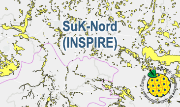
The WMS SuK-Nord (INSPIRE) shows the geological distribution of aggregates (sand and gravel) in Northern Germany, especially north of the southernmost maximum of the Scandinavian inland ice sheet (Saalian and Elsterian glaciation). According to the Data Specification on Mineral Resources (D2.8.III.21) and Geology (D2.8.II.4_v3.0) the map provides INSPIRE-compliant data. The WMS GK2000 Lagerstätten (INSPIRE) contains the following layers: MR.MineralOccurence.Commodity represents the distribution of sand and gravel. GE.GeomorphologicFeature shows the southernmost maximum of the Scandinavian inland ice sheet (Saalian and Elsterian glaciation).
-

The digital terrain model of waterways for the estuary of river Elbe (DGM-W 2016) in high resolution based on airborne laser scanning and echo sounder data is produced and published by the German Federal Waterways and Shipping Administration (Wasserstraßen- und Schifffahrtsverwaltung des Bundes, WSV). The data includes the Outer Elbe and the tidally influenced side branches of the Elbe estuary upstream to the town Geesthacht. The data is available in a raster resolution of 1 meter. Coordinate reference system: EPSG 25852, ETRS89 / UTM Zone 32N Elevation reference system: DHHN92, NHN Survey methods: Airborne laser scanning (ALS) 02. - 04.2016 Multibeam echo sounder, single beam echo sounder 2015-2017 It is strongly recommended to use the data source map for quality assessment.
-

The TROPOMI instrument onboard the Copernicus SENTINEL-5 Precursor satellite is a nadir-viewing, imaging spectrometer that provides global measurements of atmospheric properties and constituents on a daily basis. It is contributing to monitoring air quality and climate, providing critical information to services and decision makers. The instrument uses passive remote sensing techniques by measuring the top of atmosphere solar radiation reflected by and radiated from the earth and its atmosphere. The four spectrometers of TROPOMI cover the ultraviolet (UV), visible (VIS), Near Infra-Red (NIR) and Short Wavelength Infra-Red (SWIR) domains of the electromagnetic spectrum. The operational trace gas products generated at DLR on behave ESA are: Ozone (O3), Nitrogen Dioxide (NO2), Sulfur Dioxide (SO2), Formaldehyde (HCHO), Carbon Monoxide (CO) and Methane (CH4), together with clouds and aerosol properties. This product displays the Nitrogen Dioxide (NO2) near surface concentration for Germany and neighboring countries as derived from the POLYPHEMUS/DLR air quality model. Surface NO2 is mainly generated by anthropogenic sources, e.g. transport and industry. POLYPHEMUS/DLR is a state-of-the-art air quality model taking into consideration - meteorological conditions, - photochemistry, - anthropogenic and natural (biogenic) emissions, - TROPOMI NO2 observations for data assimilation. This Level 4 air quality product (surface NO2 at 15:00 UTC) is based on innovative algorithms, processors, data assimilation schemes and operational processing and dissemination chain developed in the framework of the INPULS project. The DLR project INPULS develops (a) innovative retrieval algorithms and processors for the generation of value-added products from the atmospheric Copernicus missions Sentinel-5 Precursor, Sentinel-4, and Sentinel-5, (b) cloud-based (re)processing systems, (c) improved data discovery and access technologies as well as server-side analytics for the users, and (d) data visualization services.
-

Hedgerows play an important role in maintaining biodiversity, carbon sequestration, soil stability and the ecological integrity of agricultural landscapes. In this dataset, hedgerows are mapped for the whole of Bavaria. Orthophotos with a spatial resolution of 20 cm, taken in the period from 2019 to 2021, were used in a deep learning approach. Hedgerow polygons of the Bavarian in-situ biotope mapping from 5 districts (Miltenberg, Hassberge, Dillingen a.d. Donau, Freyung-Grafenau, Weilheim-Schongau) as well as other manually digitized polygons were used for training and testing as input into a DeepLabV3 Convolutional Neural Network (CNN). The CNN has a Resnet50 backbone and was optimized with the Dice loss as a cost function. The generated hedgerow probability tiles were post-processed by merging and averaging the overlapping tile boundaries, shape simplification and filtering. For more details, see Huber Garcia et al. (2025). The dataset has been created within the project FPCUP (https://www.copernicus-user-uptake.eu/) in close cooperation with Bayerisches Landesamt für Umwelt (LfU).
-

The digital terrain model of waterways for the estuary of river Elbe (DGM-W 2022) in high resolution based on airborne laser scanning and echo sounder data is produced and published by the German Federal Waterways and Shipping Administration (Wasserstraßen- und Schifffahrtsverwaltung des Bundes, WSV). The data includes the Outer Elbe and the tidally influenced tributaries and branches of the Elbe estuary upstream to the town Geesthacht. The data is available in a raster resolution of 1 meter. Coordinate reference system: EPSG 25852, ETRS89 / UTM Zone 32N Elevation reference system: DHHN2016, NHN Survey methods: Airborne laser scanning (ALS) 02.04.2022 - 19.04.2022 Multibeam echo sounder, single beam echo sounder 09.02.2017 - 09.04.2023 It is strongly recommended to use the data source map for quality assessment.
-
The General Geological Map of the Federal Republic of Germany 1:200,000 (GÜK200) provides detailed information on the stratigraphy, petrography and genesis of the geological units shown. In this revised GÜK200-DN, the onshore surface geology is shown in up to two overlayers. The thin overlying soil is not shown. In the marine environment, only the petrography of the recent seabed is shown, which comprises the uppermost 20 cm of the seabed. In accordance with the original GÜK200 map sheets, the seabed is referred to stratigraphically as the recent seabed. According to the Data Specification on Geology (D2.8.II.4_v3.0) the content of the geological map is stored in three INSPIRE-compliant GML files: GUEK200_DN_GeologicUnit_BaseLayer.gml, GUEK200_DN_GeologicUnit_OverlayLayer1.gml, and GUEK200_DN_GeologicUnit_OverlayLayer2.gml contain the geologic units. The GML files together with a Readme.txt file are provided in ZIP format (GUEK200_DN-INSPIRE.zip). The Readme.text file (German/English) contains detailed information on the GML files content. Data transformation was proceeded by using the INSPIRE Solution Pack for FME according to the INSPIRE requirements.
-
The SuK-Nord (INSPIRE) shows the geological distribution of aggregates (sand and gravel) in Northern Germany, especially north of the southernmost maximum of the Scandinavian inland ice sheet (Saalian and Elsterian glaciation). According to the Data Specifications on Mineral Resources (D2.8.III.21) and Geology (D2.8.II.4_v3.0) the content of the map is stored in two INSPIRE-compliant GML files: SuK_Nord_EarthResource_polygon.gml contains the distribution of aggreagtes (sand and gravel) as polygons. SuK_Nord_GeomorphologicFeature.gml contains the southernmost maximum of the Scandinavian inland ice sheet (Saalian and Elsterian glaciation) as lines. The GML files together with a Readme.txt file are provided in ZIP format (SuK_Nord-INSPIRE.zip). The Readme.text file (German/English) contains detailed information on the GML files content. Data transformation was proceeded by using the INSPIRE Solution Pack for FME according to the INSPIRE requirements.