 My GeoNetwork catalogue
National
Provided by
Type of resources
Available actions
Topics
Keywords
Contact for the resource
Update frequencies
Service types
-
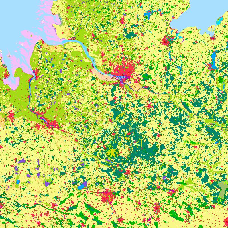
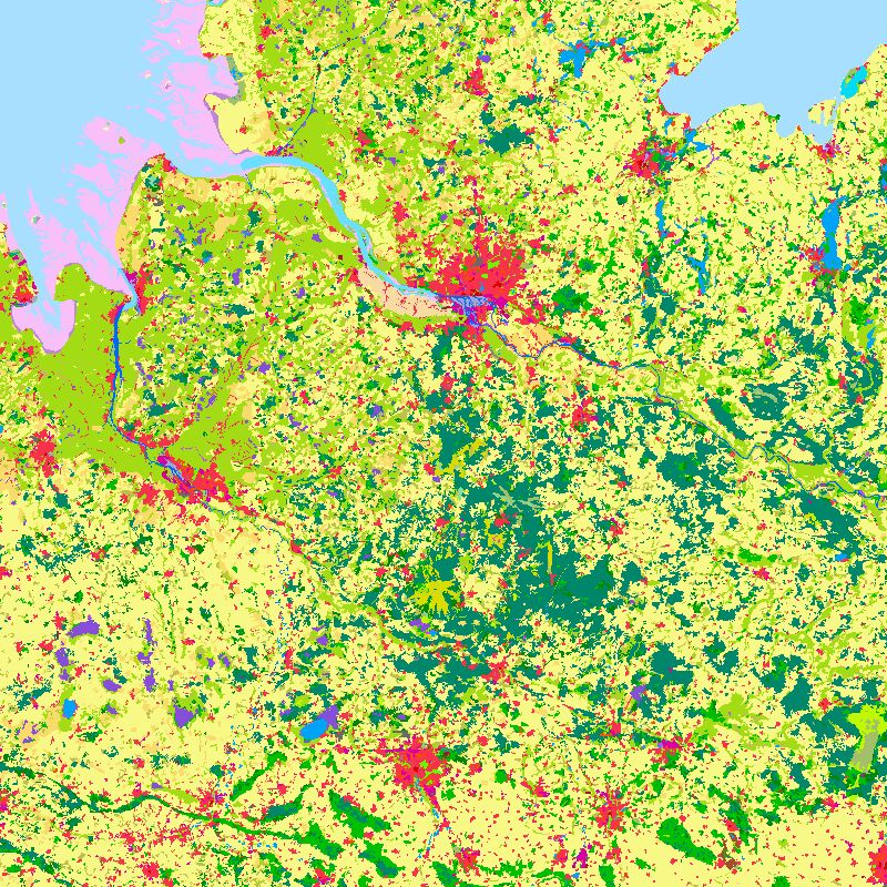
The objective of the pan-European project CORINE Land Cover (CLC) is the provision of a unique and comparable data set of land cover for Europe and the delivery of regular updates to register also the land cover and land use changes over time. It is part of the European Union programme CORINE (Coordination of Information on the Environment). The mapping of the land cover and land use was performed on the basis of satellite remote sensing images. The first CLC data base CLC1990, which was finalized in the 1990s, consistently provided land use information comprising 44 classes, out of which 37 classes are relevant in Germany. The first two updates for Europe were based on the reference years 2000 and 2006. For Germany, DLR-DFD was responsible for the creation of CLC2000 and CLC2006 on behalf of the Federal Environment Agency. In addition to the updated land cover, change datasets were also parts of the project. For deriving a meaningful CLC2000 change product, it became necessary to re-interprete parts of the satellite data of 1990 and to create a revised product, called CLC1990 (rev). Further details: https://www.dlr.de/en/eoc/research-transfer/projects-missions/corine-land-cover
-
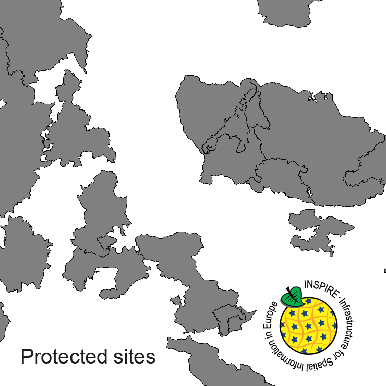
Protected Sites of Germany, derived from the german digital landscape model at scale 1:250000. Mapped via EuroRegionalMap to satisfy INSPIRE and European Location Framework conformance. The dataset is available as Open Data.
-

The RV composite is a Germany composite of the amount of precipitation accumulated over a period of 5 minutes in mm. For graphical visualisation it was converted to mm/h. Horizontal resolution is 1 km x 1 km. The horizontal range of the DWD radar network is 1200 x 1100 with a class number of 4095 and an availability of 5 min.
-

These grids are a product derived from HYRAS-DE-PRE. HYRAS-DE-PRE is a precipitation product for Germany in a 1 km x 1 km grid for the period 1931 to the previous day and is based on daily measured values of precipitation height. The data set can be used, for example, for the analysis of past climate, for bias adjustment of regionalized climate projection data and as input data for hydrological modeling.
-

HYRAS-DE-PRE is a precipitation product for Germany in a 1 km x 1 km grid for the period 1931 to the previous day and is based on daily measured values of precipitation height. The data set can be used, for example, for the analysis of past climate, for bias adjustment of regionalized climate projection data and as input data for hydrological modeling.
-
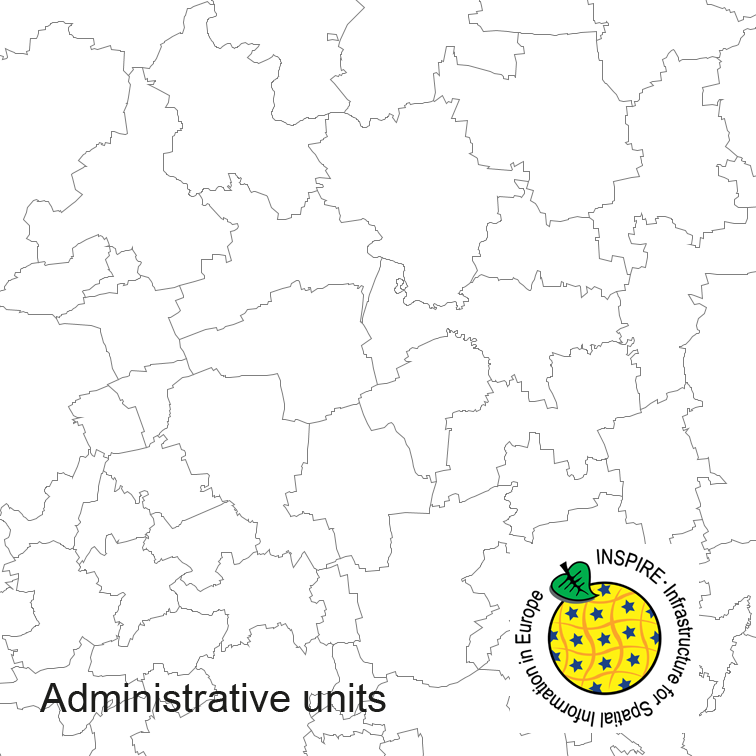
Administrative units of Germany, derived from the german digital landscape model at scale 1:250000. Mapped via EuroBoundaryMap to satisfy INSPIRE and European Location Framework conformance. The dataset is available as Open Data.