 My GeoNetwork catalogue
GeolDG
Provided by
Type of resources
Available actions
Topics
Keywords
Contact for the resource
Update frequencies
Service types
-
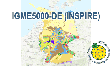
The IGME5000-DE (INSPIRE) represents the pre-quaternary bedrock geology (section of Germany) of the European map on a scale of 1:5,000,000. According to the Data Specification on Geology (D2.8.II.4_v3.0) the geological map provides INSPIRE-compliant data. The WMS IGME5000-DE contains layers of the geologic units (GE.GeologicUnit) and faults (GE.GeologicFault) mostly displayed according to the INSPIRE portrayal rules. The geologic units are represented graphically by stratigraphy (GE.GeologicUnit.AgeOfRocks) and lithology (GE.GeologicUnit.Lithology). For different geochronologic minimum and maximum ages, e.g. Ordovician - Silurian, the portrayal is defined by the color of the geochronologic minimum age (olderNamedAge). The portrayal of the lithology is defined by the first named rock or rock group. In case of the geologic units the user obtains detailed information via the getFeatureInfo request on the lithology and stratigraphy (age).
-
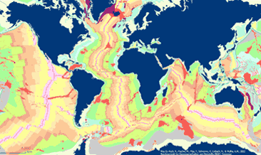
The General Global Map of Seafloor Bedrock Geology (seafloorgeol) shows the global distribution of seafloor bedrock, the boundaries of the continental shelf and continental slope, the axes of the oceanic ridges and other marine geological features. Sedimentary deposits are not shown. The map is based on extracts from Bouysse et al. (2010) © CGMW, and Bryan & Ernst (2008) using Esri Basemap, HERE, Garmin, FAO, NOAA, USGS, © OpenStreetMap contributors and the GIS User Community.
-
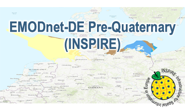
Compilation of the European Pre-Quaternary marine geology (section of Germany). Project partners are the national geological services of the participating countries. The map consists of data at highest available spatial resolution, map scale („multi-resolution“-concept) and data completeness vary depending on the project partner (as of 2016 September). According to the Data Specification on Geology (D2.8.II.4_v3.0) the geological map provides INSPIRE-compliant data. The WMS EMODnet-DE Pre-Quaternary (INSPIRE) contains layers of the geologic units (GE.GeologicUnit) displayed correspondingly to the INSPIRE portrayal rules. The geologic units are represented graphically by stratigraphy (GE.GeologicUnit.AgeOfRocks) and lithology (GE.GeologicUnit.Lithology). The portrayal of the lithology is defined by the first named rock or rock group. Via the getFeatureInfo request the user obtains detailed information on the lithology, stratigraphy (age) and genesis (event environment and event process).
-
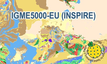
The IGME5000-EU (INSPIRE) represents the pre-quaternary bedrock geology (onshore and offshore) of the European map on a scale of 1:5,000,000. According to the Data Specification on Geology (D2.8.II.4_v3.0) the geological map provides INSPIRE-compliant data. The WMS IGME5000-EU contains layers of the geologic units (GE.GeologicUnit) and faults (GE.GeologicFault) mostly displayed according to the INSPIRE portrayal rules. The geologic units are represented graphically by stratigraphy (GE.GeologicUnit.AgeOfRocks) and lithology (GE.GeologicUnit.Lithology). For different geochronologic minimum and maximum ages, e.g. Ordovician - Silurian, the portrayal is defined by the color of the geochronologic minimum age (olderNamedAge). The portrayal of the lithology is defined by the first named rock or rock group. In case of the geologic units the user obtains detailed information via the getFeatureInfo request on the lithology and stratigraphy (age).
-
The IGME5000-DE (INSPIRE) represents the pre-quaternary bedrock geology (section of Germany) of the European map on a scale of 1:5,000,000. According to the Data Specification on Geology (D2.8.II.4_v3.0) the content of the geological map is stored in two INSPIRE-compliant GML files: IGME5000-DE_GeologicUnit.gml contains the geologic units and IGME5000-DE_GeologicStructure.gml comprises the faults. The GML files together with a Readme.txt file are provided in ZIP format (IGME5000-DE-INSPIRE.zip). The Readme.text file (German/English) contains detailed information on the GML files content. Data transformation was proceeded by using the INSPIRE Solution Pack for FME according to the INSPIRE requirements.
-
The IGME5000-EU (INSPIRE) represents the pre-quaternary bedrock geology (onshore and offshore) of the European map on a scale of 1:5,000,000. According to the Data Specification on Geology (D2.8.II.4_v3.0) the content of the geological map is stored in two INSPIRE-compliant GML files: IGME5000-EU_GeologicUnit.gml contains the geologic units and IGME5000-EU_GeologicStructure.gml comprises the faults. The GML files together with a Readme.txt file are provided in ZIP format (IGME5000-EU-INSPIRE.zip). The Readme.text file (German/English) contains detailed information on the GML files content. Data transformation was proceeded by using the INSPIRE Solution Pack for FME according to the INSPIRE requirements.
-
Compilation of the European Pre-Quaternary marine geology (section of Germany). Project partners are the national geological services of the participating countries. The map consists of data at highest available spatial resolution, map scale („multi-resolution“-concept) and data completeness vary depending on the project partner (as of 2016 September). According to the Data Specification on Geology (D2.8.II.4_v3.0) the content of the geological map is stored in a INSPIRE-compliant GML file: EMODnet-DE_Pre-Quaternary_GeologicUnit.gml contains the geologic units. The GML files together with a Readme.txt file are provided in ZIP format (EMODnet-DE_Pre-Quaternary-INSPIRE.zip). The Readme.text file (German/English) contains detailed information on the GML file content. Data transformation was proceeded by using the INSPIRE Solution Pack for FME according to the INSPIRE requirements.
-
The General Global Map of Seafloor Bedrock Geology (seafloorgeol) shows the global distribution of seafloor bedrock, the boundaries of the continental shelf and continental slope, the axes of the oceanic ridges and other marine geological features. Sedimentary deposits are not shown. The map is based on extracts from Bouysse et al. (2010) © CGMW, and Bryan & Ernst (2008) using Esri Basemap, HERE, Garmin, FAO, NOAA, USGS, © OpenStreetMap contributors and the GIS User Community.
-
Compilation of the European marine geomorphology (section of Germany). According to the Data Specification on Geology (D2.8.II.4_v3.0) the geological map provides INSPIRE-compliant data. The WMS EMODnet-DE Geomorphology (INSPIRE) contains layers of the natural geomorphologic features (GE.GeomorphologicFeature) displayed correspondingly to the INSPIRE portrayal rules. Via the getFeatureInfo request the user obtains detailed information on the natural geomorphologic features.
-
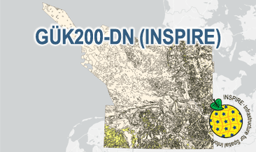
The General Geological Map of the Federal Republic of Germany 1:200,000 (GÜK200) provides detailed information on the stratigraphy, petrography and genesis of the geological units shown. In this revised GÜK200-DN, the onshore surface geology is shown in up to two overlays. The thin overlying soil is not shown. In the marine environment, only the petrography of the recent seabed is shown, which comprises the uppermost 20 cm of the seabed. In accordance with the original GÜK200 map sheets, the seabed is referred to stratigraphically as the recent seabed. According to the Data Specification on Geology (D2.8.II.4_v3.0) the geological map provides INSPIRE-compliant data. A base layer and two overlay layers are displayed correspondingly to the INSPIRE portrayal rules. The geologic units are represented graphically by stratigraphy (GE.GeologicUnit.BaseLayer.AgeOfRocks, GE.GeologicUnit.OverlayLayer1.AgeOfRocks, and GE.GeologicUnit.OverlayLayer2.AgeOfRocks) and lithology (GE.GeologicUnit.BaseLayer.Lithology, GE.GeologicUnit.OverlayLayer1.Lithology, and GE.GeologicUnit.OverlayLayer2.Lithology). The user obtains detailed information via the getFeatureInfo request on the lithology, stratigraphy (age) and genesis (event environment and event process).