From 1 - 10 / 2701
  • Results of side-scan sonar mapping within the framework of the German Coastal Engineering Research Council project AufMod (¿Aufbau integrierter Modellsysteme zur Analyse der langfristigen Morphodynamik in der Deutschen Bucht¿ [¿Development of integrated model systems for the analysis of long-term morphodynamics in the German Bight¿], 01.11.2009-31.12.2012): -survey lines of side-scan sonar surveys -grab stations for ground truthing -sediment maps For more information, please visit: https://gdi.bsh.de/en/data/Marine-Geology-Study-Areas-Project-AufMod_Information_Meeresgeologische_Fokusgebiete_-Projekt_AufMod-_DE.pdf

  • INSPIRE theme Production and Industrial Facilities

  • INSPIRE theme Geology. Provision of the sediment distribution of the seabed in the North and Baltic Sea.
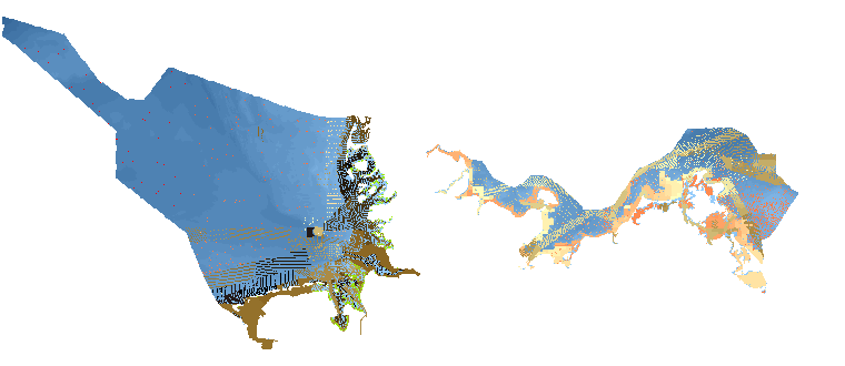
  • In this service, information on underwater obstacles is presented, which is stored in the "Deutsches Unterwasserhindernisauskunftssystem" (DUWHAS) of the BSH. The data are displayed according to the symbolisation of CONTIS.

  • DTM of the German Bight (yearly, 1982 - 2012). Classified isosurfaces of spatiotemporally interpolated bathymetries from the years 1982 to 2012, with two parameters for the purposes of reliability: Confidence and Minimum dt. The parameter Confidence [m] indicates the reliability of the modelled bathymetry. Data were generated within the framework of the German Coastal Engineering Research Council project AufMod ("Aufbau integrierter Modellsysteme zur Analyse der langfristigen Morphodynamik in der Deutschen Bucht" ["Development of integrated model systems for the analysis of long-term morphodynamics in the German Bight"], 01.11.2009-31.12.2012). For more information, please visit: https://gdi.bsh.de/en/data/Bathymetries-German-Bight-1982-2012-Classified-Isosurfaces-Project-AufMod_Information_Bathymetrie_Deutsche_Bucht_1982-2012_klassifizierte_Isoflaechen_-Projekt_AufMod-_DE.pdf

  • INSPIRE theme Water Transport Network (shipping routes). The maritime data of the BSH for INSPIRE Transport Networks describe the water transport network for maritime navigation in the area of responsibility of the Federal Maritime and Hydrographic Agency (BSH) as well as its associated infrastructure facilities.

  • Shipping areas and navigational rules applicable for passenger ships

  • INSPIRE theme Maritime Units. These are condensed coordinates of the sea border maps 2920 (North Sea) and 2921 (Baltic Sea). They are (interpolated) coordinates compressed to geodetic lines. The distance between the nodes on the geodetic lines connecting the defined border points is less than or equal to 100 m. The sea borders of Germany were proclaimed in the coordinate system European Datum 1950 (ED50), which is no longer used today. The basis for this determination is in particular the promulgation of the proclamation of the Federal Government on the expansion of the German territorial sea of 19 October 1994 (Federal Law Gazette I p. 3428) and the proclamation of the Federal Republic of Germany on the establishment of an exclusive economic zone of 25 November 1994 (Federal Law Gazette II p. 3769), which are decisive with regard to the delimitation of the German territorial sea and the German exclusive economic zone. In order to make better use of these boundaries in today's geoinformation systems and to avoid conversion errors, the BSH has derived the present utility coordinates in WGS 84. In this respect they are not official maritime borders of Germany.

  • DTM of the German Bight (yearly, 1982 - 2012). Classified isosurfaces of spatiotemporally interpolated bathymetries from the years 1982 to 2012, with two parameters for the purposes of reliability: Confidence and Minimum dt. The parameter Confidence [m] indicates the reliability of the modelled bathymetry. Data were generated within the framework of the German Coastal Engineering Research Council project AufMod ("Aufbau integrierter Modellsysteme zur Analyse der langfristigen Morphodynamik in der Deutschen Bucht" ["Development of integrated model systems for the analysis of long-term morphodynamics in the German Bight"], 01.11.2009-31.12.2012). For more information, please visit: https://gdi.bsh.de/en/data/Bathymetries-German-Bight-1982-2012-Classified-Isosurfaces-Project-AufMod_Information_Bathymetrie_Deutsche_Bucht_1982-2012_klassifizierte_Isoflaechen_-Projekt_AufMod-_DE.pdf

  • Obstruction data for nautical products. For more information, please visit: https://gdi.bsh.de/en/data/Underwater-Obstructions-for-Nautical-Products_Information_Schifffahrtshindernisse_fuer_nautische_Produkte_DE.pdf

Barrierefreiheit | Datenschutz | Impressum