 My GeoNetwork catalogue
Mineral Resources
Provided by
Type of resources
Available actions
Update frequencies
Service types
-
Dieser Dienst stellt für das INSPIRE-Thema Mineralische Bodenschätze aus dem Geofachdaten umgesetzte Daten bereit.:Diese Layerzusammenstellung visualisiert die saarländischen mineralischen Bodenschätze der Geofachdaten. Die Datengrundlage erfüllt die INSPIRE Datenspezifikation.
-
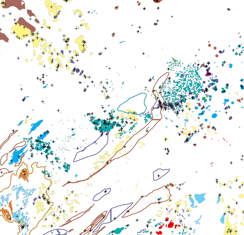
The KOR250 in the scale of 1:250,000 shows occurrences and deposits of mineral resources in Germany, which lie close to the Earth’s surface, i.e. can be mined in open-pits, quarries or near-surface mines. These mineral resources include industrial minerals, aggregates, peat, lignite, oil shales, and natural brines. The map is the digital successor of the map series KOR200 „Map of Near-Surface Deposits of the Federal Republic of Germany 1:200,000”, which has been published since 1984. The KOR200 and KOR250 have been published by the Federal Institute for Geosciences and Natural Resources together with the State Geological Surveys of the federal states on behalf of the Federal Ministry for Economic Affairs and Energy. Primary purpose of the KOR250 is to display Germany’s potential of domestic raw materials in a comparable way. The explanations given in the printed booklets accompanying the KOR200 are not available in the digital KOR250. In the KOR250 besides the defined deposits and differently coloured areas of raw materials, "active mines" (= operations) at time of publication or "focal points of several active mines" are marked with one symbol each. These symbols often display the headquarters of the mining company and not the mining site itself. As the map sheets of the KOR200 have been generated over more than three decades the timeliness of data is extremely different. For more detail, the current large-scale raw material maps of the Federal State Geological Surveys should always be consulted.
-
Dieser Dienst stellt für das INSPIRE-Thema Mineralische Bodenschätze aus dem Geofachdaten umgesetzte Daten bereit.:Der Prozess des Abbaus metallischer oder nichtmetallischer Minerallagerstätten oder Industriegesteine aus der Erde.
-
Beschreibung des INSPIRE Download Service (predefined Atom): Dieser Datensatz enthält ins INSPIRE-Datenmodell "Mineral Ressource " (Mineralische Bodenschätze) transformierte Daten des Oberbergamtes des Saarlandes. Die Transformation erfolgte gemäß den INSPIRE Richtlinien Mineral Ressource der Version 4.0. - Der/die Link(s) für das Herunterladen der Datensätze wird/werden dynamisch aus GetFeature Anfragen an einen WFS 1.1.0+ generiert
-
Dieser Dienst stellt für das INSPIRE-Thema Mineralische Bodenschätze aus dem Geofachdaten umgesetzte Daten bereit.:Ein Abbau zur Gewinnung von mineralischen Rohstoffen.
-
Dieser Dienst stellt für das INSPIRE-Thema Mineralische Bodenschätze aus dem Geofachdaten umgesetzte Daten bereit.:Das in der EarthResource enthaltene wirtschaftlich bedeutsame Material.
-
Dieser Dienst stellt für das INSPIRE-Thema Mineralische Bodenschätze aus dem Geofachdaten umgesetzte Daten bereit.:Der Prozess des Abbaus metallischer oder nichtmetallischer Minerallagerstätten oder Industriegesteine aus der Erde.
-
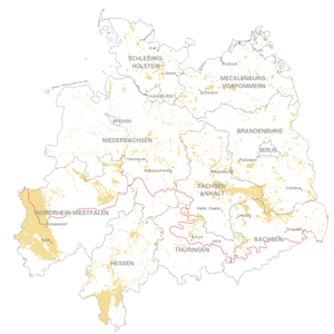
Geological distribution of aggregates (sand and gravel) in Northern Germany, especially north of the southernmost maximum of the Scandinavian inland ice sheet (Saalian and Elsterian glaciation).
-
Dieser Dienst stellt für das INSPIRE-Thema Mineralische Bodenschätze aus dem Geofachdaten umgesetzte Daten bereit.:Das in der EarthResource enthaltene wirtschaftlich bedeutsame Material.
-
Dieser Dienst stellt für das INSPIRE-Thema Mineralische Bodenschätze aus dem Geofachdaten umgesetzte Daten bereit.:Eine räumliche Darstellung eines MiningFeature.