 My GeoNetwork catalogue
coastline
Provided by
Type of resources
Available actions
Topics
Keywords
Contact for the resource
Update frequencies
Service types
-

It is about an automated derived coastline of the North Sea and Baltic Sea from different scale ranges of the Electronic Navigational Chart (ENC) corresponding to the relative coverage area – see nautical product catalogue. The ENCs are produced in accordance with the valid international standard S-57. It consists of generalised lines in the different ENC scale ranges Approach, Harbour and Berthing. None of these scale ranges provides a continuous coastline. The derived coastline consists of natural and man-made (e. g. piers) elements. As an alternative, there is a further coastline available. Information on this high-precision coastline is available via customer@bsh.de.
-

The global TanDEM-X High-Resolution Coastline Product was developed by the German Remote Sensing Data Center (DFD) at the German Aerospace Center (DLR) as part of the TanDEM-X Mission and the HydroSHEDS v2.0 project. It is a global vector dataset that outlines the boundary between terrestrial and marine environments at a resolution of 10 meters. Between 2010 and 2015, the TanDEM-X mission acquired a complete coverage of the Earth's landmass, resulting in a global digital elevation model (DEM). Since the TanDEM-X coastline is derived from the TanDEM-X dataset, it provides an optimal fit for improving the DEM. Additionally, the TanDEM-X coastline is a key component in the derivation of hydrographic data within the HydroSHEDS v2.0 project, where it defines the outer boundary of watersheds and river networks. To meet hydrological requirements and to ensure global consistency, the TanDEM-X coastline was extracted automatically in a first step and subsequently manually verified and refined. Since the coastline is a mapping feature located in the coastal zone, its position is a function of the source data, the method used to identify the coastline, the time of acquisition, and the purpose of mapping.
-
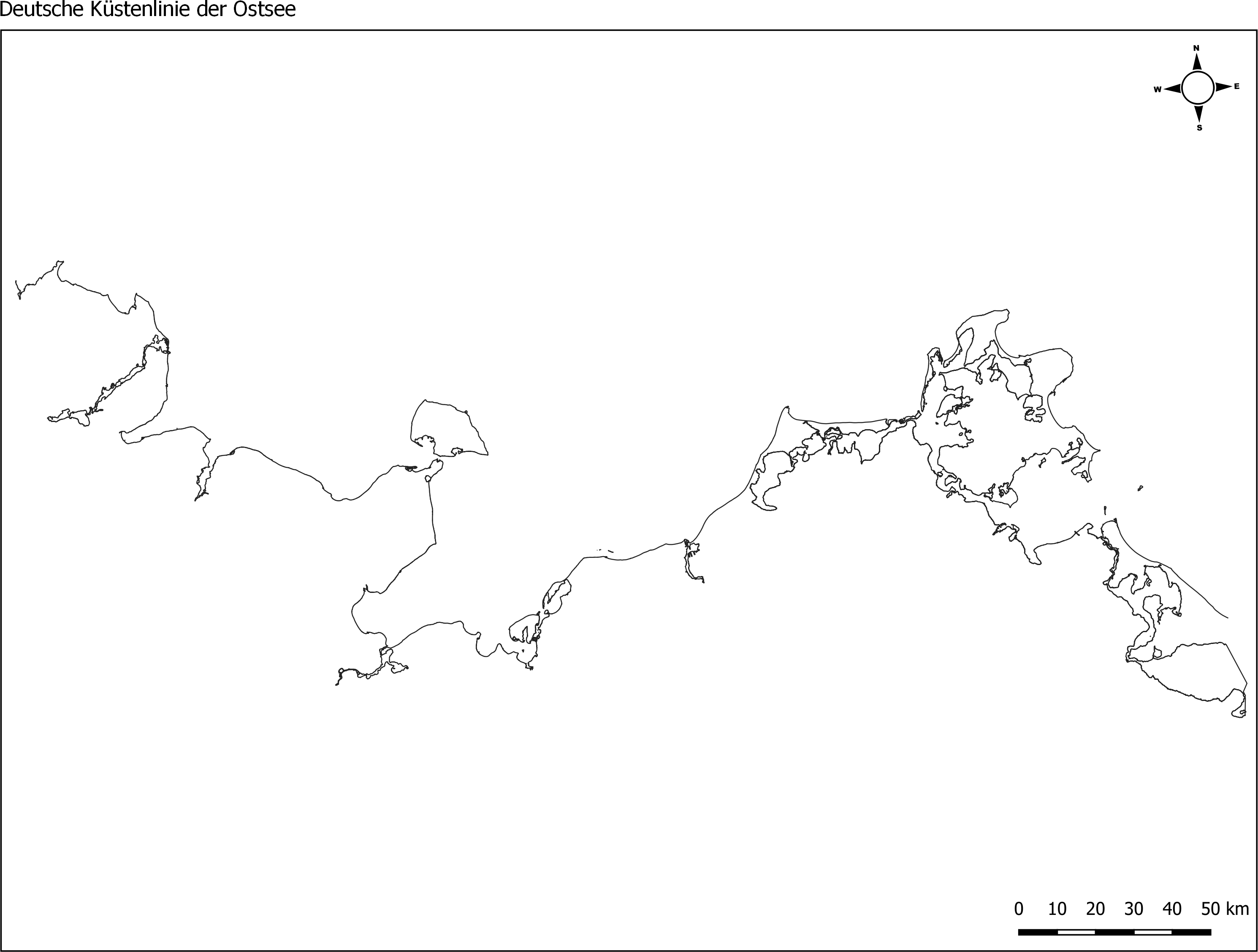
Die Küstenlinie der deutschen Ostseeküste, erstellt vom Landesamt für Umwelt (LfU) von Schleswig Holstein. Grundlage dafür waren MSRL- und WRRL-Shapefiles der Küsten- Übergangsgewässer. Der Dienst stellt Shapefiles der Küstenlinien für die Nordsee (ANS-DE) und die Ostsee (BAL-DE) aus den abgestimmten und an die EU gemeldeten Berichtsgeometrien für die gesamte deutsche Küste bereit. Hierfür wurden Shapes der MSRL und der WRRL (Küsten- und Übergangsgewässer) genutzt. Die Daten wurden im Dezember 2017 (Ostsee) / bzw. im Januar 2018 (Nordsee) erstellt.
-
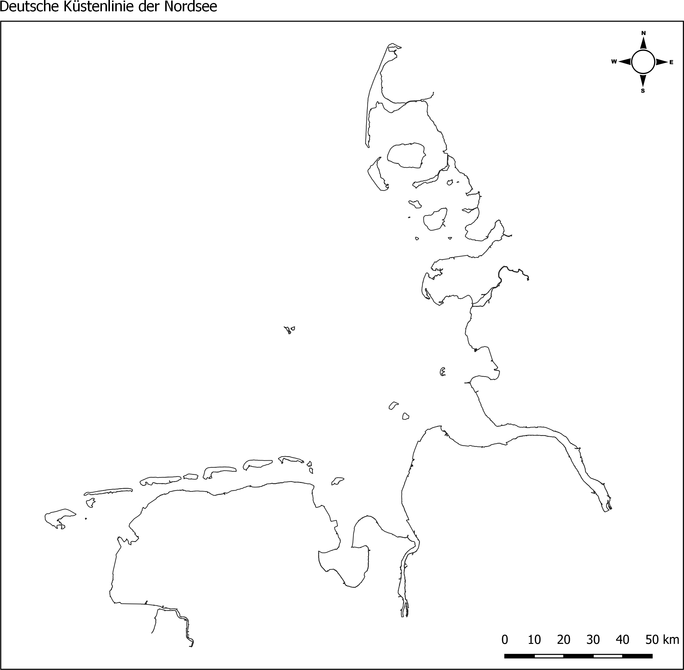
Die Küstenlinie der deutschen Nordseeküste, erstellt vom Landesamt für Umwelt (LfU) von Schleswig Holstein. Grundlage dafür waren MSRL- und WRRL-Shapefiles der Küsten- Übergangsgewässer. Der Dienst stellt Shapefiles der Küstenlinien für die Nordsee (ANS-DE) und die Ostsee (BAL-DE) aus den abgestimmten und an die EU gemeldeten Berichtsgeometrien für die gesamte deutsche Küste bereit. Hierfür wurden Shapes der MSRL und der WRRL (Küsten- und Übergangsgewässer) genutzt. Die Daten wurden im Dezember 2017 (Ostsee) / bzw. im Januar 2018 (Nordsee) erstellt.
-
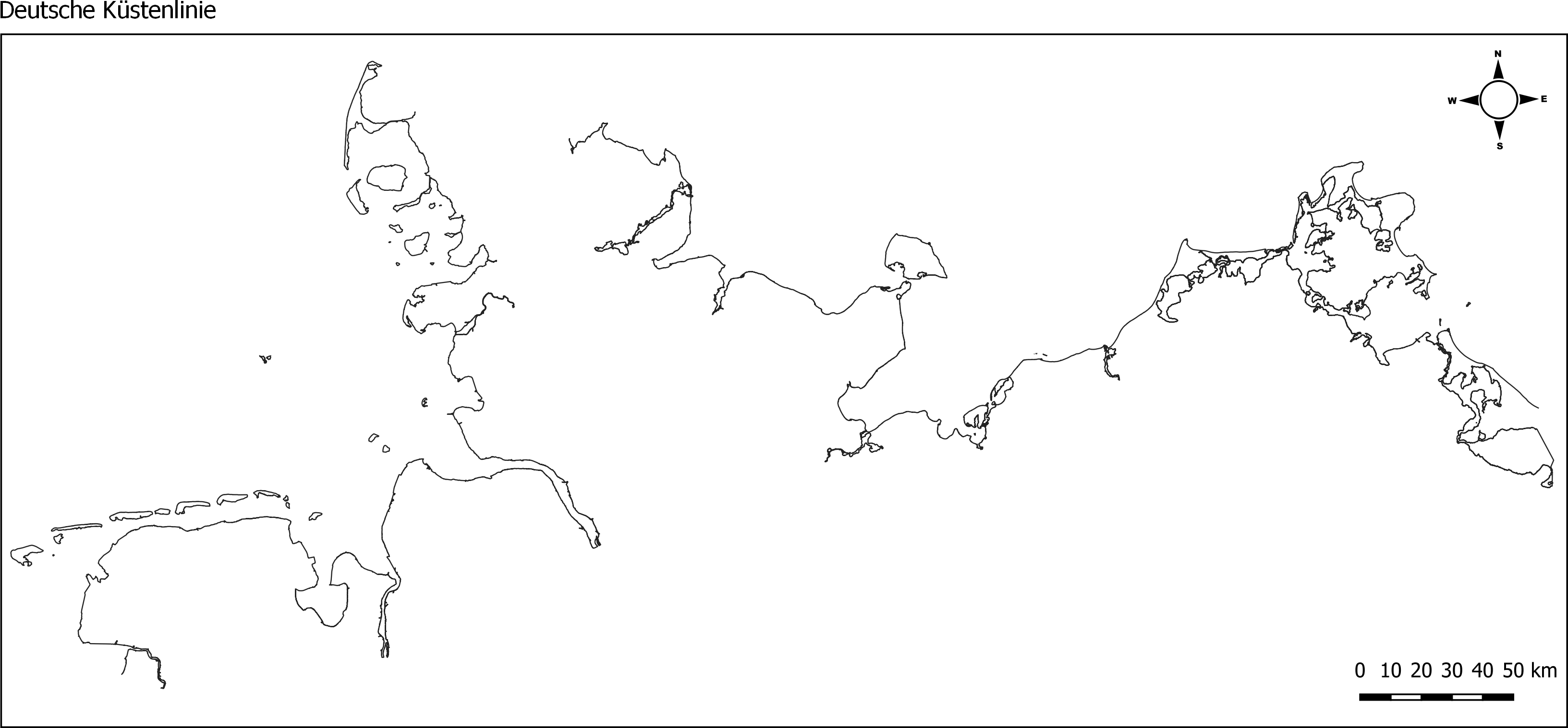
Web Map Service (WMS) vom Geoserver der Marinen Dateninfrastruktur Deutschland (MDI-DE), der die Küstenlinie der Nord- und Ostsee in Form von Layern für die MDI-DE publiziert. Der Dienst stellt Shapefiles der Küstenlinien für die Nordsee (ANS-DE) und die Ostsee (BAL-DE) aus den abgestimmten und an die EU gemeldeten Berichtsgeometrien für die gesamte deutsche Küste bereit. Hierfür wurden Shapes der MSRL und der WRRL (Küsten- und Übergangsgewässer) genutzt. Die Daten wurden im Dezember 2017 (Ostsee) / bzw. im Januar 2018 (Nordsee) erstellt.
-
Web Feature Service (WFS) vom Geoserver der Marinen Dateninfrastruktur Deutschland (MDI-DE), der die Küstenlinie der Nord- und Ostsee in Form von Layern für die MDI-DE publiziert. Der Dienst stellt Shapefiles der Küstenlinien für die Nordsee (ANS-DE) und die Ostsee (BAL-DE) aus den abgestimmten und an die EU gemeldeten Berichtsgeometrien für die gesamte deutsche Küste bereit. Hierfür wurden Shapes der MSRL und der WRRL (Küsten- und Übergangsgewässer) genutzt. Die Daten wurden im Dezember 2017 (Ostsee) / bzw. im Januar 2018 (Nordsee) erstellt.