 www.geodatenkatalog.de (S3L)
Keyword
EEZ
24 record(s)
Provided by
Type of resources
Available actions
Topics
Keywords
Contact for the resource
Update frequencies
Service types
-

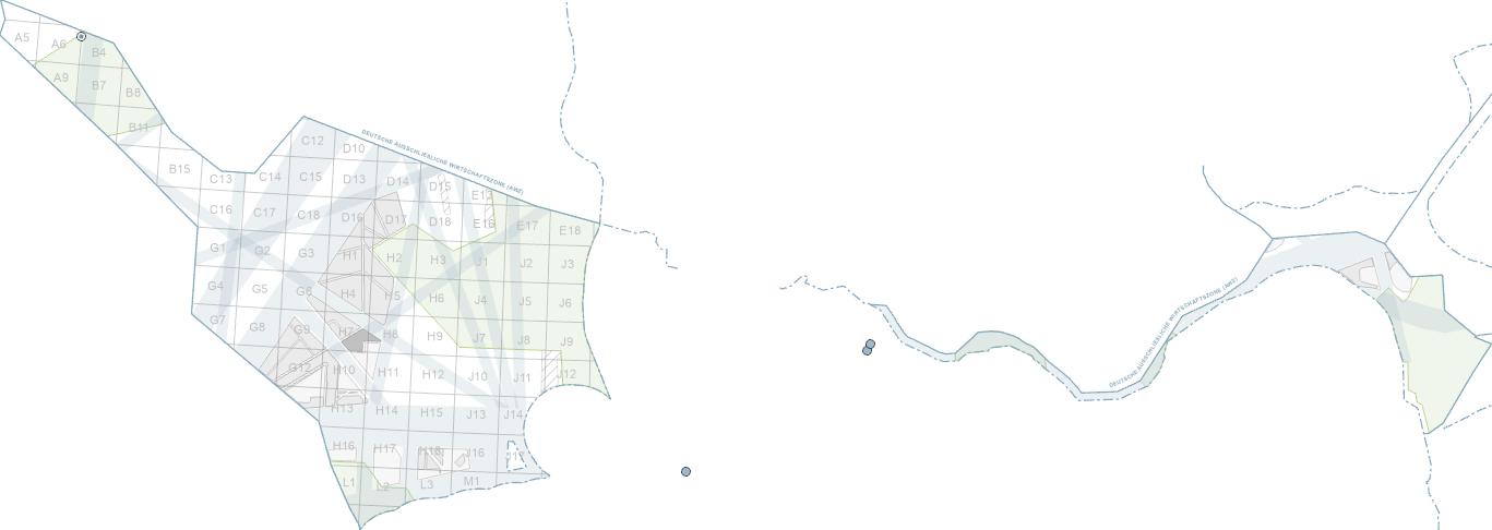
A large number of offshore projects are planned and implemented in the German Exclusive Economic Zone or on the continental shelf. These include wind farm projects, the connection of wind farms to the power grid by means of so-called grid connection systems, the construction and laying of other submarine cables and pipelines, the installation of measuring points and finally the performance of research activities.
-

The maritime borders dataset contains the seaward boundaries of the Exclusive Economic Zone (EEZ), the territorial sea and the baselines. They are condensed coordinates of the maritime border maps 2920 (North Sea) and 2921 (Baltic Sea). They are coordinates compressed (interpolated) to geodetic lines. The distance of the nodes on the geodetic connecting lines of the defined boundary points is less than or equal to 100 m. The maritime borders of Germany were proclaimed in the today no more usual coordinate system "European date 1950 (ED50)". This definition is based in particular on the announcement of the Federal Government's proclamation of 19 October 1994 on the extension of the German territorial sea (BGBl. I p. 3428) and the Federal Republic of Germany's proclamation of 25 November 1994 on the establishment of an exclusive economic zone (BGBl. II p. 3769), which are decisive with regard to the demarcation of the German territorial sea and the German exclusive economic zone. In order to be able to better use these boundaries in today's GIS systems and to avoid conversion errors, the Federal Maritime and Hydrographic Agency has derived the present usage coordinates in WGS 84. In this respect, they are not official maritime borders of Germany.
-
A large number of offshore projects are planned and implemented in the German Exclusive Economic Zone or on the continental shelf. These include wind farm projects, the connection of wind farms to the power grid by means of so-called grid connection systems, the construction and laying of other submarine cables and pipelines, the installation of measuring points and finally the performance of research activities.
-
The maritime borders dataset contains the seaward boundaries of the Exclusive Economic Zone (EEZ), the territorial sea and the baselines. They are condensed coordinates of the maritime border maps 2920 (North Sea) and 2921 (Baltic Sea). They are coordinates compressed (interpolated) to geodetic lines. The distance of the nodes on the geodetic connecting lines of the defined boundary points is less than or equal to 100 m. The maritime borders of Germany were proclaimed in the today no more usual coordinate system "European date 1950 (ED50)". This definition is based in particular on the announcement of the Federal Government's proclamation of 19 October 1994 on the extension of the German territorial sea (BGBl. I p. 3428) and the Federal Republic of Germany's proclamation of 25 November 1994 on the establishment of an exclusive economic zone (BGBl. II p. 3769), which are decisive with regard to the demarcation of the German territorial sea and the German exclusive economic zone. In order to be able to better use these boundaries in today's GIS systems and to avoid conversion errors, the Federal Maritime and Hydrographic Agency has derived the present usage coordinates in WGS 84. In this respect, they are not official maritime borders of Germany.
-
The WMS service “Site Development Plan in the German Maritime Area 2025 - WMS” of the BSH is used by the BGR geoportal for a better overview of the EEZ. The metadata of the service can be found at the following URL: https://www.geoportal.de/Metadata/6156b1d2-c44c-421c-9855-b2e77e4b21e5
-
The WMS service “Maritime Spatial Plan in the German Maritime Area - WMS” of the BSH is used by the BGR geoportal for a better overview of the EEZ. The metadata of the service can be found at the following URL: https://www.geoportal.de/Metadata/054fbaab-7f59-456d-81a5-7c27195070e8
-
This dataset contains sea-borders based on Maritime Boundaries Geodatabase from Flanders Marine Institute. It contains borderlines of the Exclusive Economic Zone (EEZ) and the 12 nautical mile limit (SMZ) of Germany and neighbouring countries of North Sea and Baltic Sea. This data is compiled and prepared for displaying background information for metadata of geological surveys, according to Geological Data Act (GeolDG).