 www.geodatenkatalog.de (S1L)
Keyword
Oberflächengeologie
25 record(s)
Provided by
Type of resources
Available actions
Topics
Keywords
Contact for the resource
Update frequencies
Service types
-
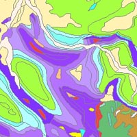
The “Geological Map of Germany 1:1,000,000 OneGeology-Europe (GK1000-1GE)” shows Germany’s surface geology: All geological units are described by their age (stratigraphy) and composition (lithology). The geological units and terms used in this map were semantically harmonized within the OneGeology-Europe project and have been - in a number of regions - geometrically and semantically made consistent with the neighbouring OneGeology-Europe participants.
-

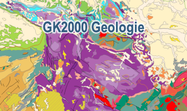
The digital GK2000 Geology represents the surface geology of Germany and adjacent regions at a scale of 1:2,000,000. The map includes 30 units differentiated according to their age of formation. It also contains information on the distribution of volcanic, plutonic and metamorphic rocks. Furthermore, the map shows tectonic line elements, marginal positions of the ice shield of the last glacial periods as well as the impact craters Nördlinger Ries and Steinheimer Becken.
-
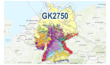
The digital GK2750 Geology represents the surface geology of Germany at a scale of 1:2,750,000. The map comprises 28 units differentiated according to their age of formation. It also contains information on the distribution of volcanic and plutonic rocks. Furthermore, the map shows tectonic line elements, marginal positions of the ice shield of the last glacial periods and the impact formation Nördlinger Ries.
-
The digital GK2000 Geology represents the surface geology of Germany and adjacent regions at a scale of 1:2,000,000. The map includes 30 units differentiated according to their age of formation. It also contains information on the distribution of volcanic, plutonic and metamorphic rocks. Furthermore, the map shows tectonic line elements, marginal positions of the ice shield of the last glacial periods as well as the impact craters Nördlinger Ries and Steinheimer Becken.
-
Der interoperable INSPIRE-Downloaddienst (WFS) Geology (Geologische Übersichtskarte 1 : 300 000 des Landes Brandenburg) gibt einen Überblick über die an der Oberfläche bzw. oberflächennah anstehenden geologischen Bildungen Brandenburgs im Maßstab 1 : 300 000. Gemäß der INSPIRE-Datenspezifikation Geology (D2.8.II.4_v3.0) liegen die Inhalte der geologischen Karte INSPIRE-konform vor. Der WFS beinhaltet die folgenden FeatureTypes: - geologische Einheiten (ge:GeologicUnit) mit Angaben zur petrographischen Bezeichnung (ge:GeologicUnit.Lithology) und Art der geologischen Einheit (ge:GeologicUnit.geologicUnitType) - geologische Ereignisse (ge:GeologicEvent) mit Angaben zur Stratigraphie (ge:GeologicEvent.GeochronologicEra) und Genese, u.a. Bildungsraum (ge:GeologicEvent.EventEnvironment) und Bildungsprozess (ge:GeologicEvent.EventProcess) - anthropogene geomorphologische Merkmale (ge:AnthropogenicGeomorphologicFeature) - Art der geologische Sammlung (ge:GeologicCollection) - Geometrieobjekte (ge:MappedFeature). --- The compliant INSPIRE download service (WFS) Geology (Geologische Übersichtskarte 1 : 300,000 des Landes Brandenburg) provides an overview of the geological structure near the surface for the state of Brandenburg at a scale of 1 : 300,000. The content of the geological map is compliant to the INSPIRE data specification for the annex theme Geology (D2.8.II.4_v3.0). The WFS includes the following FeatureTypes: - geological units (ge:GeologicUnit) with information on the petrographic name (ge:GeologicUnit.Lithology) and type of geological unit (ge:GeologicUnit.GeologicUnitType) - geological events (ge:GeologicEvent) with information on the stratigraphy (ge:GeologicEvent.GeochronologicEra) and genesis, including the geologic environment (ge:GeologicEvent.EventEnvironment) and geologic process (ge:GeologicEvent.EventProcess) - anthropogenic geomorphological characteristics (ge:AnthropogenicGeomorphologicFeature) - type of the geological collection (ge:GeologicCollection) - spatial objects (ge:MappedFeature).
-

Der interoperable INSPIRE-Darstellungsdienst (WMS) Geology (Umweltgeologische Karte 1 : 300 000 des Landes Brandenburg) gibt einen Überblick über das Rückhaltevermögen in den tieferen Bereichen der Grundwasserüberdeckung, das auch durch die Lagerung der Schichten mitbestimmt wird. Intensive Lagerungsstörungen treten besonders in glazigenen Stauchungsgebieten auf. Gemäß der INSPIRE-Datenspezifikation Geology (D2.8.II.4_v3.0) liegen die Inhalte der geologischen Karte INSPIRE-konform vor. Der WMS beinhaltet den folgenden Layer: - GE.GeomorphologicFeature.Natural: natürliches geomorphologisches Merkmal (glazial geprägt) mit gemindertem Rückhaltevermögen (Stauchungsgebiete). --- The compliant INSPIRE view service (WMS) Geology (Gemindertes Rückhaltevermögen (Stauchungsgebiete) der Umweltgeologischen Karte 1 : 300 000 des Landes Brandenburg) provides an overview of the retention capacity in the deeper areas of the groundwater cover, which is also determined by the storage of the layers. Intense storage disorders occur particularly in glacial compression areas. The contents of the geological map are INSPIRE compliant according to the INSPIRE data specification Geology (D2.8.II.4_v3.0). The WMS includes the following layer: - GE.GeomorphologicFeature.Natural: natural geomorphological characteristics (glacial imprint) with reduced retention capacity (compression areas).
-
Der interoperable INSPIRE-Downloaddienst (WFS) Geology (Geologische Übersichtskarte 1 : 100 000 des Landes Brandenburg) gibt einen Überblick über die an der Oberfläche bzw. oberflächennah anstehenden geologischen Bildungen Brandenburgs im Maßstab 1 : 100 000. Gemäß der INSPIRE-Datenspezifikation Geology (D2.8.II.4_v3.0) liegen die Inhalte der geologischen Karte INSPIRE-konform vor. Der WFS beinhaltet die folgenden FeatureTypes: - geologische Einheiten (ge:GeologicUnit) mit Angaben zur petrographischen Bezeichnung (ge:GeologicUnit.Lithology) und Art der geologischen Einheit (ge:GeologicUnit.geologicUnitType) - geologische Ereignisse (ge:GeologicEvent) mit Angaben zur Stratigraphie (ge:GeologicEvent.GeochronologicEra) und Genese, u.a. Bildungsraum (ge:GeologicEvent.EventEnvironment) und Bildungsprozess (ge:GeologicEvent.EventProcess) - anthropogene geomorphologische Merkmale (ge:AnthropogenicGeomorphologicFeature) - Art der geologische Sammlung (ge:GeologicCollection) - Geometrieobjekte (ge:MappedFeature). --- The compliant INSPIRE download service (WFS) Geology (Geologische Übersichtskarte 1 : 100,000 des Landes Brandenburg) provides an overview of the geological structure near the surface for the state of Brandenburg at a scale of 1 : 100,000. The content of the geological map is compliant to the INSPIRE data specification for the annex theme Geology (D2.8.II.4_v3.0). The WFS includes the following FeatureTypes: - geological units (ge:GeologicUnit) with information on the petrographic name (ge:GeologicUnit.Lithology) and type of geological unit (ge:GeologicUnit.GeologicUnitType) - geological events (ge:GeologicEvent) with information on the stratigraphy (ge:GeologicEvent.GeochronologicEra) and genesis, including the geologic environment (ge:GeologicEvent.EventEnvironment) and geologic process (ge:GeologicEvent.EventProcess) - anthropogenic geomorphological characteristics (ge:AnthropogenicGeomorphologicFeature) - type of the geological collection (ge:GeologicCollection) - spatial objects (ge:MappedFeature).
-
Der interoperable INSPIRE-Downloaddienst (WFS) Geology (Tiefenlage der Quartärbasisfläche des Landes Brandenburg) skizziert die Basisfläche quartärer Sedimente im Raum Brandenburg im Maßstab 1 : 500 000. Um dem Übersichtscharakter der Karte Rechnung zu tragen, wurden Äquidistanzen von 100 m gewählt. Gemäß der INSPIRE-Datenspezifikation Geology (D2.8.II.4_v3.0) liegen die Inhalte der geologischen Karte INSPIRE-konform vor. Der WFS beinhaltet die folgenden FeatureTypes: - Geologische Einheiten (GeologicUnits) mit Angaben zur petrographischen Bezeichnung (ge:GeologicUnit.Lithology), Art der geologischen Einheit (ge:GeologicUnit.geologicUnitType), - geologische Ereignisse (ge:GeologicEvent) mit Angaben zur Stratigraphie (ge:GeologicEvent.GeochronologicEra) und Genese, u.a. Bildungsraum (ge:GeologicEvent.EventEnvironment) und Bildungsprozess (ge:GeologicEvent.EventProcess), - Geomorphologische Merkmale (ge:GeomorphologicFeatures) mit Angaben zu natürlichen geomorphologischen Erscheinungen (ge:NaturalGeomorphologicFeature), wie quartäre Rinnenstrukturen, - Art der geologische Sammlung (ge:GeologicCollection), - Geometrieobjekte (ge:MappedFeature). --- The compliant INSPIRE download service (WFS) Geology (Tiefenlage der Quartärbasisfläche des Landes Brandenburg 1 : 500,000) outlines the base area of quaternary sediments in the state of Brandenburg at a scale of 1 : 500,000. To take the overview character of the map into account, equidistances of 100 m were chosen. The contents of the geological map are INSPIRE compliant according to the INSPIRE data specification Geology (D2.8.II.4_v3.0). The WFS includes the following FeatureTypes: - geological features (GeologicUnits) with information on the petrographic name (ge:GeologicUnit.Lithology), type of geological unit (ge:GeologicUnit.GeologicUnitType), - geological events (ge:GeologicEvent) with information on the stratigraphy (ge:GeologicEvent.GeochronologicEra) and genesis, including the geologic environment (ge: GeologicEvent.EventEnvironment) and geologic process (ge:GeologicEvent.EventProcess), - geomorphologic Features (ge:GeomorphologicFeatures) with details on natural geomorphological characteristics (ge:NaturalGeomorphologicFeature), as quaternary channels, - type of the geological collection (ge:GeologicCollection), - spatial objects (ge:MappedFeature).