 My GeoNetwork catalogue
uranium
Provided by
Type of resources
Available actions
Topics
Keywords
Contact for the resource
Service types
-
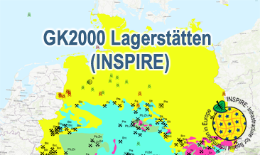
The WMS GK2000 Lagerstätten (INSPIRE) shows deposits and mines of energy resources, metal resources, industrial minerals and salt on a greatly simplified geology within Germany on a scale of 1:2,000,000. According to the Data Specification on Mineral Resources (D2.8.III.21) and Geology (D2.8.II.4_v3.0) the map provides INSPIRE-compliant data. The WMS GK2000 Lagerstätten (INSPIRE) contains the following layers: MR.Mine displays mines. MR.MineralOccurence.Commodity.Polygon.EnergyResources displays energy resources as polygons. GE.GeologicUnits provides the greatly simplified geology of Germany. For different geochronologic minimum and maximum ages, e.g. Precambrian - Cenozoic, the portrayal is defined by the colour of the geochronologic minimum age (olderNamedAge). The user obtains detailed information on the deposits, mines and geology via the getFeatureInfo request. Notes regarding the portrayal: The gas and oil provinces as well as the corresponding mines are coloured in green and red according to common international practice. The black coal fields are displayed in their original colour grey. The colouring of the brown coal fields correspond to the KOR250 respectively KOR250 (INSPIRE) colouring. All mine symbols and commodity abbrevations are BGR symbols and abbrevations.
-
The GK2000 Lagerstätten (INSPIRE) shows deposits and mines of energy resources, metal resources, industrial minerals and salt on a greatly simplified geology within Germany on a scale of 1:2,000,000. According to the Data Specifications on Mineral Resources (D2.8.III.21) and Geology (D2.8.II.4_v3.0) the content of the map is stored in three INSPIRE-compliant GML files: GK2000_Lagerstaetten_Mine.gml contains mines as points. GK2000_ Lagerstaetten _EarthResource_polygon_Energy_resources.gml contains energy resources as polygons. GK2000_ Lagerstaetten _GeologicUnit.gml contains the greatly simplified geology of Germany. The GML files together with a Readme.txt file are provided in ZIP format (GK2000_ Lagerstaetten -INSPIRE.zip). The Readme.text file (German/English) contains detailed information on the GML files content. Data transformation was proceeded by using the INSPIRE Solution Pack for FME according to the INSPIRE requirements.
-
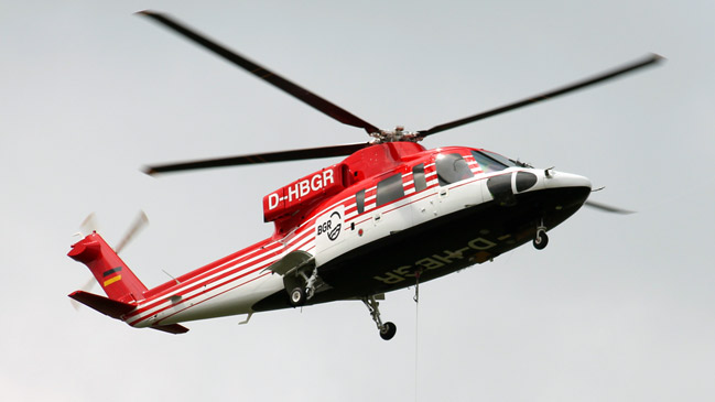
The BGR helicopter (Sikorsky S-76B) is used for airborne geophysical surveying of the Earth’s subsurface. The standard equipment comprises the methods electromagnetics, magnetics and radiometrics. The passive helicopter-borne radiometric (HRD) measuring system is a gamma-ray spectrometer, which is installed into the helicopter. The detector of the spectrometer consists of five Sodium-iodide crystals (volume: 4 l per NaI crystal). The spectral range of gamma radiation recorded ranges from 0 to 3 MeV. The results are displayed as total count rate and the (equivalent) concentrations of Thorium, Uranium and Sodium as well as the exposure rate at ground level.
-
BGR conducted an airborne survey in the region of the Hadelner Marsch in cooperation with the GGA Institute (now LIAG) as well as with the water suppliers of Land Hadeln and Wingst. The survey area Hadelner Marsch (2004) is bounded by the river Elbe to the north and by the settlements Bederkesa and Lamstedt to the south. The size of the area is about 700 km². The area was surveyed with 20 flights totalling to 2970 line-km (75,822 survey points). The nominal separation of the 117 ESE-WNW lines and 13 NNE-SSW tie lines was 250 m and 2000 m, respectively. The maps display the total count, the (equivalent) content of potassium, uranium and thorium as well as the exposure rate at ground.
-
The BGR helicopter (Sikorsky S-76B) is used for airborne geophysical surveying of the Earth’s subsurface. The standard equipment comprises the methods electromagnetics, magnetics and radiometrics. The passive radiometric (HRD) system is installed into the helicopter and consists of a gamma-ray spectrometer with five Sodiumiodid detectors to measure the gamma radiation. Besides the total counts, the (equivalent) concentrations of potassium, thorium and uranium at ground level as well as the exposure rate are derived.
-
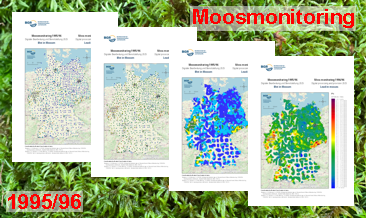
In the Federal Republic of Germany, analyses to determine the constituents of mosses were carried out at five-year intervals from 1990 to 2005 and in 2015/16 and 2020/21. The focus was on analysing heavy metals, and from 2005/06 also nitrogen. Since 2015/16, the range of substances has been expanded to include persistent organic pollutants (POPs) and microplastics. This moss monitoring is the German contribution to the European moss monitoring programme, which is coordinated by the ‘International Cooperative Programme on Effects of Air Pollution on Natural Vegetation and Crops’ (ICP Vegetation) of the Geneva Convention on Long-range Transboundary Air Pollution (CLRTAP). The German Environment Agency (Umweltbundesamt - UBA) has commissioned various institutions to carry out the individual sampling campaigns and analyse the results of the investigations, including the Federal Institute for Geosciences and Natural Resources (BGR) for moss monitoring in 1995/96. The UBA has published the results of subsequent monitoring years. They are available at https://www.umweltbundesamt.de/daten/luft/bioindikation-von-luftverunreinigungen. With 1026 sites, the 1995/96 moss monitoring is, alongside the 2000 moss monitoring, the one with the greatest sample density and, with 40 analysed elements, the one with the widest range of investigations. Although the research reports completed in 1998 and 1999 (Siewers & Herpin, 1998; Siewers, Herpin & Straßburg, 1999) contained an evaluation (brief description, statistical measures, distribution maps) of all 40 elements analysed, only the data of 12 of the analysed elements have been published to date. In addition, the raw data from the laboratories available as a result of the analyses were re-evaluated in 2007. This resulted in a series of error corrections and the analysable element spectrum was extended to 42 elements. The results of this re-evaluation have also not yet been published. The additional processing of the data using modern methods has further enhanced their value. The downloads show the distribution of uranium concentrations in four different coloured dot and colour shaded contour maps. The legends of the maps can be called up either in the unit of measurement µg/g or in a unit of measurement adapted to the content range of the element shown.
-
BGR conducted an airborne survey in the region of the Hadelner Marsch in cooperation with the GGA Institute (now LIAG) as well as with the water suppliers of Land Hadeln and Wingst. The survey area Hadelner Marsch (2004) is bounded by the river Elbe to the north and by the settlements Bederkesa and Lamstedt to the south. The size of the area is about 700 km². The area was surveyed with 20 flights totalling to 2970 line-km (75,822 survey points). The nominal separation of the 117 ESE-WNW lines and 13 NNE-SSW tie lines was 250 m and 2000 m, respectively. The ASCII datafile contains the raw data as well as the processed HRD data.
-
The data series “Aerogeophysics” contains the data of aerogeophysical measurements provided by the BGR, divided into flight areas. It contains raw data and processed data as well as results in the form of maps, profiles and models.