 www.geodatenkatalog.de (S3L)
Keyword
soil parameters
41 record(s)
Provided by
Type of resources
Available actions
Topics
Keywords
Update frequencies
Service types
-
The daily grids of soil moisture are calculated for 10 cm layers up to a depth of 2 meters for selected agricultural crops with the AMBAV 2.0 model. The meteorological input fields required for the calculation must be available in hourly resolution and derived from interpolated weather station data. Furthermore, the model is parameterized with soil information from the soil guide profiles of the Bodenübersichtskarte (BÜK 1000) of the Federal Institute for Geosciences and Natural Resources (Geowissenschaftenund Rohstoffe, BGR). The data have a spatial resolution of 1 x 1 km and cover the whole of Germany. Data outside of Germany are considered as missing values.
-
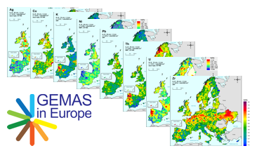
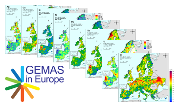
GEMAS (Geochemical Mapping of Agricultural and Grazing Land Soil in Europe) is a cooperative project between the Geochemistry Expert Group of EuroGeoSurveys and Eurometeaux. In total, more than 60 international organisations and institutions worldwide were involved in the implementation of the project. During 2008 and 2009, a total of 2219 samples of agricultural (arable land soils, 0 – 20 cm, Ap samples) and 2127 samples of grazing land (pasture land soils, 0 – 10 cm, Gr samples) soil were collected at a density of 1 site/2 500 km² each from 33 European countries, covering an area of 5,600,000 km². All samples were analysed for 52 chemical elements after an aqua regia extraction, 41 by XRF (total), TC and TOC. In the agricultural soil samples, 57 elements in a mobile metal ion (MMI®) extraction and Pb isotopes ratios were also analysed. In addition to the chemical element contents, soil properties and soil parameters such as pH, particle size distribution, effective cation exchange capacity (CEC), MIR spectra and magnetic susceptibility were investigated and some coefficients were calculated. All analytical results were subject to tight external quality control procedures. The GEMAS project thus provides for the first time fully harmonised data for element concentrations and bioavailability of the elements at the continental (European) scale. The geochemical maps provided in the WMS “GEMAS - Single element maps” and “GEMAS - Parameters and indices” show an unbiased representation of the distribution patterns of the investigated elements and parameters. The WMS “GEMAS - Supporting information” provides additional information to support the interpretation of these geochemical maps.
-
GEMAS (Geochemical Mapping of Agricultural and Grazing Land Soil in Europe) is a cooperative project between the Geochemistry Expert Group of EuroGeoSurveys and Eurometeaux. In total, more than 60 international organisations and institutions worldwide were involved in the implementation of the project. During 2008 and 2009, a total of 2219 samples of agricultural (arable land soils, 0 – 20 cm, Ap samples) and 2127 samples of grazing land (pasture land soils, 0 – 10 cm, Gr samples) soil were collected at a density of 1 site/2 500 km² each from 33 European countries, covering an area of 5,600,000 km². In addition to the chemical element contents, soil properties and soil parameters such as pH, particle size distribution, effective cation exchange capacity (CEC), MIR spectra and magnetic susceptibility were investigated in the samples and some coefficients were calculated. The downloadable files present the areal distribution of the determined Kd values (soil-solution partitioning values) for Molybdenum (Mo) in the shape of colour shaded contour maps.
-
GEMAS (Geochemical Mapping of Agricultural and Grazing Land Soil in Europe) is a cooperative project between the Geochemistry Expert Group of EuroGeoSurveys and Eurometeaux. In total, more than 60 international organisations and institutions worldwide were involved in the implementation of the project. During 2008 and 2009, a total of 2219 samples of agricultural (arable land soils, 0 – 20 cm, Ap samples) and 2127 samples of grazing land (pasture land soils, 0 – 10 cm, Gr samples) soil were collected at a density of 1 site/2 500 km² each from 33 European countries, covering an area of 5,600,000 km². All samples were analysed for 52 chemical elements after an aqua regia extraction, 41 by XRF (total), TC and TOC. In the agricultural soil samples, 57 elements in a mobile metal ion (MMI®) extraction and Pb isotopes ratios were also analysed. In addition to the chemical element contents, soil properties and soil parameters such as pH, particle size distribution, effective cation exchange capacity (CEC), MIR spectra and magnetic susceptibility were investigated and some coefficients were calculated. All analytical results were subject to tight external quality control procedures. The GEMAS project thus provides for the first time fully harmonised data for element concentrations and bioavailability of the elements at the continental (European) scale. The geochemical maps provided in the data series “GEMAS - Single element maps” and “GEMAS - Parameters and indices” show an unbiased representation of the distribution patterns of the investigated elements and parameters. The data series “GEMAS - Supporting information” provides additional information to support the interpretation of these geochemical maps. The data set “Ecological regions” belonging to this data series provides a map of ecological regions distributed in the project survey area (data source: EEA, 2003).
-
GEMAS (Geochemical Mapping of Agricultural and Grazing Land Soil in Europe) is a cooperative project between the Geochemistry Expert Group of EuroGeoSurveys and Eurometeaux. In total, more than 60 international organisations and institutions worldwide were involved in the implementation of the project. During 2008 and 2009, a total of 2219 samples of agricultural (arable land soils, 0 – 20 cm, Ap samples) and 2127 samples of grazing land (pasture land soils, 0 – 10 cm, Gr samples) soil were collected at a density of 1 site/2 500 km² each from 33 European countries, covering an area of 5,600,000 km². In addition to the chemical element contents, soil properties and soil parameters such as pH, particle size distribution, effective cation exchange capacity (CEC), MIR spectra and magnetic susceptibility were investigated in the samples and some coefficients were calculated. The downloadable files present the areal distribution of the determined PNEC (predicted no effect concentration) for Copper (Cu) in the shape of colour shaded contour maps.
-
GEMAS (Geochemical Mapping of Agricultural and Grazing Land Soil in Europe) is a cooperative project between the Geochemistry Expert Group of EuroGeoSurveys and Eurometeaux. In total, more than 60 international organisations and institutions worldwide were involved in the implementation of the project. During 2008 and 2009, a total of 2219 samples of agricultural (arable land soils, 0 – 20 cm, Ap samples) and 2127 samples of grazing land (pasture land soils, 0 – 10 cm, Gr samples) soil were collected at a density of 1 site/2 500 km² each from 33 European countries, covering an area of 5,600,000 km². All samples were analysed for 52 chemical elements after an aqua regia extraction, 41 by XRF (total), TC and TOC. In the agricultural soil samples, 57 elements in a mobile metal ion (MMI®) extraction and Pb isotopes ratios were also analysed. In addition to the chemical element contents, soil properties and soil parameters such as pH, particle size distribution, effective cation exchange capacity (CEC), MIR spectra and magnetic susceptibility were investigated and some coefficients were calculated. All analytical results were subject to tight external quality control procedures. The GEMAS project thus provides for the first time fully harmonised data for element concentrations and bioavailability of the elements at the continental (European) scale. The geochemical maps provided in the data series “GEMAS - Single element maps” and “GEMAS - Parameters and indices” show an unbiased representation of the distribution patterns of the investigated elements and parameters. The data series “GEMAS - Supporting information” provides additional information to support the interpretation of these geochemical maps. The data set “Soil classes” belonging to this data series provides maps of the distribution of soil classes in the project survey area. The information on soil classes is based on the results of the investigation of the particle size distribution in the samples.
-
GEMAS (Geochemical Mapping of Agricultural and Grazing Land Soil in Europe) is a cooperative project between the Geochemistry Expert Group of EuroGeoSurveys and Eurometeaux. In total, more than 60 international organisations and institutions worldwide were involved in the implementation of the project. During 2008 and 2009, a total of 2219 samples of agricultural (arable land soils, 0 – 20 cm, Ap samples) and 2127 samples of grazing land (pasture land soils, 0 – 10 cm, Gr samples) soil were collected at a density of 1 site/2 500 km² each from 33 European countries, covering an area of 5,600,000 km². All samples were analysed for 52 chemical elements after an aqua regia extraction, 41 by XRF (total), TC and TOC. In the agricultural soil samples, 57 elements in a mobile metal ion (MMI®) extraction and Pb isotopes ratios were also analysed. In addition to the chemical element contents, soil properties and soil parameters such as pH, particle size distribution, effective cation exchange capacity (CEC), MIR spectra and magnetic susceptibility were investigated and some coefficients were calculated. All analytical results were subject to tight external quality control procedures. The GEMAS project thus provides for the first time fully harmonised data for element concentrations and bioavailability of the elements at the continental (European) scale. The geochemical maps provided in the data series “GEMAS - Single element maps” and “GEMAS - Parameters and indices” show an unbiased representation of the distribution patterns of the investigated elements and parameters. The data series “GEMAS - Supporting information” provides additional information to support the interpretation of these geochemical maps. The data set “Annual mean temperature” belonging to this data series provides maps of the annual mean temperature in the project survey area in the years 1960-1990 and 1970-2000 (data sources: UCDAVIS, worldclim.org).
-
GEMAS (Geochemical Mapping of Agricultural and Grazing Land Soil in Europe) is a cooperative project between the Geochemistry Expert Group of EuroGeoSurveys and Eurometeaux. In total, more than 60 international organisations and institutions worldwide were involved in the implementation of the project. During 2008 and 2009, a total of 2219 samples of agricultural (arable land soils, 0 – 20 cm, Ap samples) and 2127 samples of grazing land (pasture land soils, 0 – 10 cm, Gr samples) soil were collected at a density of 1 site/2 500 km² each from 33 European countries, covering an area of 5,600,000 km². All samples were analysed for 52 chemical elements after an aqua regia extraction, 41 by XRF (total), TC and TOC. In the agricultural soil samples, 57 elements in a mobile metal ion (MMI®) extraction and Pb isotopes ratios were also analysed. In addition to the chemical element contents, soil properties and soil parameters such as pH, particle size distribution, effective cation exchange capacity (CEC), MIR spectra and magnetic susceptibility were investigated and some coefficients were calculated. All analytical results were subject to tight external quality control procedures. The GEMAS project thus provides for the first time fully harmonised data for element concentrations and bioavailability of the elements at the continental (European) scale. The geochemical maps provided in the data series “GEMAS - Single element maps” and “GEMAS - Parameters and indices” show an unbiased representation of the distribution patterns of the investigated elements and parameters. The data series “GEMAS - Supporting information” provides additional information to support the interpretation of these geochemical maps. The data set “Chemical and Geological Soil Groups” belonging to this data series provides a map of the distribution of the geological and chemical soil groups in the project survey area. The chemical and geological soil groups were generated by combining the information from lithological maps and parent material maps with the geochemical signal from the GEMAS project samples.
-
GEMAS (Geochemical Mapping of Agricultural and Grazing Land Soil in Europe) is a cooperative project between the Geochemistry Expert Group of EuroGeoSurveys and Eurometeaux. In total, more than 60 international organisations and institutions worldwide were involved in the implementation of the project. During 2008 and 2009, a total of 2219 samples of agricultural (arable land soils, 0 – 20 cm, Ap samples) and 2127 samples of grazing land (pasture land soils, 0 – 10 cm, Gr samples) soil were collected at a density of 1 site/2 500 km² each from 33 European countries, covering an area of 5,600,000 km². In addition to the chemical element contents, soil properties and soil parameters such as pH, particle size distribution, effective cation exchange capacity (CEC), MIR spectra and magnetic susceptibility were investigated in the samples and some coefficients were calculated. The downloadable files present the areal distribution of the determined Kd values (soil-solution partitioning values) for Tin (Sn) in the shape of colour shaded contour maps.
-
GEMAS (Geochemical Mapping of Agricultural and Grazing Land Soil in Europe) is a cooperative project between the Geochemistry Expert Group of EuroGeoSurveys and Eurometeaux. In total, more than 60 international organisations and institutions worldwide were involved in the implementation of the project. During 2008 and 2009, a total of 2219 samples of agricultural (arable land soils, 0 – 20 cm, Ap samples) and 2127 samples of grazing land (pasture land soils, 0 – 10 cm, Gr samples) soil were collected at a density of 1 site/2 500 km² each from 33 European countries, covering an area of 5,600,000 km². In addition to the chemical element contents, soil properties and soil parameters such as pH, particle size distribution, effective cation exchange capacity (CEC), MIR spectra and magnetic susceptibility were investigated in the samples and some coefficients were calculated. The WMS presents the areal distribution of the determined parameters and coefficients in the shape of colour shaded contour maps.